Country:
 USA
USARegion:
City:
Latitude and Longitude:
Time Zone:
Postal Code:
IP information under different IP Channel
ip-api
Country
Region
City
ASN
Time Zone
ISP
Blacklist
Proxy
Latitude
Longitude
Postal
Route
IPinfo
Country
Region
City
ASN
Time Zone
ISP
Blacklist
Proxy
Latitude
Longitude
Postal
Route
MaxMind
Country
Region
City
ASN
Time Zone
ISP
Blacklist
Proxy
Latitude
Longitude
Postal
Route
Luminati
Country
USRegion
ia
City
peosta
ASN
Time Zone
America/Chicago
ISP
MVLINK
Latitude
Longitude
Postal
db-ip
Country
Region
City
ASN
Time Zone
ISP
Blacklist
Proxy
Latitude
Longitude
Postal
Route
ipdata
Country
Region
City
ASN
Time Zone
ISP
Blacklist
Proxy
Latitude
Longitude
Postal
Route
Popular places and events near this IP address

Dubuque County, Iowa
County in Iowa, United States
Distance: Approx. 6236 meters
Latitude and longitude: 42.47083333,-90.87833333
Dubuque County is a county located in the U.S. state of Iowa. As of the 2020 census, the population was 99,266, making it the eighth-most populous county in Iowa. The county seat is Dubuque.
Asbury, Iowa
City in Iowa, United States
Distance: Approx. 8464 meters
Latitude and longitude: 42.51555556,-90.76333333
Asbury is a city in Dubuque County, Iowa, United States, and adjacent to the westside of the city of Dubuque. It is part of the Dubuque, Iowa Metropolitan Statistical Area. The population was 5,943 at the 2020 census.

Centralia, Iowa
City in Iowa, United States
Distance: Approx. 3525 meters
Latitude and longitude: 42.47222222,-90.83611111
Centralia is a city in Dubuque County, Iowa, United States. It is part of the Dubuque, Iowa Metropolitan Statistical Area. The population was 116 at the 2020 census, up 15 persons since the 2000 census and down 18 from the 2010.
Graf, Iowa
City in Iowa, United States
Distance: Approx. 7377 meters
Latitude and longitude: 42.495,-90.87194444
Graf is a city in Dubuque County, Iowa, United States. It is part of the 'Dubuque, Iowa Metropolitan Statistical Area'. The population was 76 at the time of the 2020 census, up from 73 in 2000.

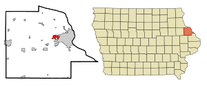
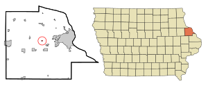
Peosta, Iowa
City in Iowa, United States
Distance: Approx. 3052 meters
Latitude and longitude: 42.44916667,-90.84638889
Peosta is a city in Dubuque County, Iowa, United States, and an exurb of the city of Dubuque. It is part of the Dubuque, Iowa Metropolitan Statistical Area. The population was 1,908 in the 2020 census, an increase of 193% from 651 in 2000.

New Melleray Abbey
Trappist monastery near Dubuque, Iowa
Distance: Approx. 6178 meters
Latitude and longitude: 42.392,-90.809
New Melleray Abbey (Abbey of Our Lady of New Melleray) is a Trappist monastery located near Dubuque, Iowa. The abbey is located about 15 miles southwest of Dubuque and is in the Archdiocese of Dubuque. Currently the Abbey is home to about 16 monks.
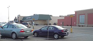
Kennedy Mall
Shopping mall in Iowa, United States
Distance: Approx. 8776 meters
Latitude and longitude: 42.494,-90.723
Kennedy Mall is a shopping mall located in Dubuque, Iowa. It is owned by the Cafaro Company. The mall's anchor stores are Edward Jones, Shoe Carnival, Planet Fitness, Vertical Jump Park, JCPenney, Dick's Sporting Goods, Ulta Beauty, and Books-A-Million.

Hempstead High School (Iowa)
Public secondary school in Dubuque, Iowa, United States
Distance: Approx. 8662 meters
Latitude and longitude: 42.502,-90.734
Stephen Hempstead High School (commonly Hempstead or HHS) is a four-year public high school located in Dubuque, Iowa. It is one of two high schools in the Dubuque Community School District and enrolls around 1,800 students in grades 9–12. The school is named in honor of Stephen Hempstead, the second governor of Iowa, and it competes in class 4A of the Iowa High School Athletic Association as part of the Mississippi Valley Conference.
KGRR
Radio station in Iowa, United States
Distance: Approx. 2833 meters
Latitude and longitude: 42.45805556,-90.77791667
KGRR (97.3 FM) is a radio station broadcasting an active rock format to the Dubuque, Iowa, United States, area. The station is licensed to Radio Dubuque, Inc. Its transmitter is located alongside U.S. Highway 20 between Dubuque and Peosta on top of the U.S. 20 Bluff.
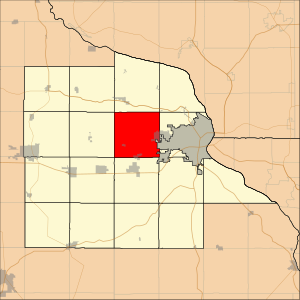
Center Township, Dubuque County, Iowa
Township in Iowa, United States
Distance: Approx. 7970 meters
Latitude and longitude: 42.515,-90.84166667
Center Township is one of seventeen townships in Dubuque County, Iowa, United States. As of the 2000 census, its population was 1,726.
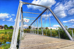
Dunleith and Dubuque Bridge
United States historic place
Distance: Approx. 5390 meters
Latitude and longitude: 42.48916667,-90.77586111
The Dunleith and Dubuque Bridge, also known as the White Water Creek Bridge and the Bergfeld Recreation Area Bridge, is a historic structure located in Dubuque, Iowa, United States. This span was part of a seven-span approach to one of the first bridges constructed over the Mississippi River. It was part of a railroad bridge that connected Dubuque with Dunleith, Illinois, now known as East Dubuque.
Ballyclough, Iowa
Unincorporated community in Iowa, United States
Distance: Approx. 7865 meters
Latitude and longitude: 42.42583333,-90.71818333
Ballyclough is an unincorporated community in Dubuque County, in the U.S. state of Iowa.
Weather in this IP's area
clear sky
27 Celsius
28 Celsius
25 Celsius
29 Celsius
1010 hPa
55 %
1010 hPa
973 hPa
10000 meters
1.54 m/s
330 degree
06:48:59
19:04:03