Country:
 Canada
Region:
City:
Latitude and Longitude:
Time Zone:
Postal Code:
IP information under different IP Channel
ip-api
Country
Region
City
ASN
Time Zone
ISP
Blacklist
Proxy
Latitude
Longitude
Postal
Route
IPinfo
Country
Region
City
ASN
Time Zone
ISP
Blacklist
Proxy
Latitude
Longitude
Postal
Route
MaxMind
Country
Region
City
ASN
Time Zone
ISP
Blacklist
Proxy
Latitude
Longitude
Postal
Route
Luminati
Country
CARegion
ab
City
calgary
ASN
Time Zone
America/Edmonton
ISP
ASN-WIBAND-1
Latitude
Longitude
Postal
db-ip
Country
Region
City
ASN
Time Zone
ISP
Blacklist
Proxy
Latitude
Longitude
Postal
Route
ipdata
Country
Region
City
ASN
Time Zone
ISP
Blacklist
Proxy
Latitude
Longitude
Postal
Route
Popular places and events near this IP address
Big Rock Brewery
Brewery based in Calgary, Alberta, Canada
Distance: Approx. 926 meters
Latitude and longitude: 50.9847,-113.9544
Big Rock Brewery is a Canadian public company and the largest brewery that is based in Calgary, Alberta, Canada. As of March 2020, it was also Canada's largest craft brewery. Additional brewing operations are located in Vancouver, British Columbia; Etobicoke, Ontario; and Liberty Village in Toronto, Ontario.

Calgary Metropolitan Region
Metropolitan area in Alberta, Canada
Distance: Approx. 2770 meters
Latitude and longitude: 51,-114
The Calgary Metropolitan Region (CMR), also commonly referred to as the Calgary Region, is a conglomeration of municipalities centred on Calgary, the largest city in Alberta. With the Government of Alberta's establishment of the Calgary Metropolitan Region Board (CMRB) in 2017, the CMR's boundaries were legislated to include the City of Calgary, Foothills County to the south, Rocky View County to the west, north, and east, and a western portion of Wheatland County further to the east. Also within these boundaries are the cities of Airdrie and Chestermere, seven towns: Cochrane, Crossfield, Diamond Valley, High River, Irricana, Okotoks, and Strathmore, two villages: Beiseker and Longview, and two First Nations communities: Tsuu T'ina 145 and Eden Valley 216.
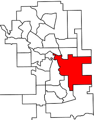
Calgary-Fort
Defunct provincial electoral district in Alberta, Canada
Distance: Approx. 1047 meters
Latitude and longitude: 51,-113.967
Calgary-Fort was a provincial electoral district in Alberta, Canada, mandated to return a single member to the Legislative Assembly of Alberta using the first past the post method of voting from 1997 to 2019.
Calgary-Millican
Defunct provincial electoral district in Alberta, Canada
Distance: Approx. 4106 meters
Latitude and longitude: 51,-114.02
Calgary-Millican was a provincial electoral district in Calgary, Alberta, Canada, mandated to return a single member to the Legislative Assembly of Alberta using the first past the post method of voting from 1971 to 1993.
Ogden, Calgary
Neighbourhood in Calgary, Alberta, Canada
Distance: Approx. 3475 meters
Latitude and longitude: 50.9875,-114.0125
Ogden is a residential neighbourhood in the southeast quadrant of Calgary, Alberta. It includes the districts of Lynnwood and Millican Estates. It is bounded by Glenmore Trail to the south, Deerfoot Trail and the Bow River to the west, and the CPR tracks and the industrial areas of Ogden Shops to the north and east.
Dover, Calgary
Neighbourhood in Calgary, Alberta, Canada
Distance: Approx. 3741 meters
Latitude and longitude: 51.01944444,-113.99138889
Dover is a residential neighbourhood in the southeast quadrant of Calgary, Alberta. It is bounded by 26 Avenue SE to the north, Peigan Trail to the south, 24 Street SE and Deerfoot Trail to the west and 36 Street SE to the east. The Inglewood golf course, developed in the Bow River valley, borders the community to the west.
Erin Woods, Calgary
Place in Alberta, Canada
Distance: Approx. 3342 meters
Latitude and longitude: 51.02027778,-113.97305556
Erin Woods is a residential neighbourhood in the southeast quadrant of Calgary, Alberta. It is located at the eastern edge of the city and is bounded to the east by 52 Street E, to the south by Peigan Trail and to the north and west by the Canadian National Railway tracks. The area was annexed by the City of Calgary in 1961, and Erin Woods was established in 1981.
Shepard Industrial, Calgary
Neighbourhood in Calgary, Alberta, Canada
Distance: Approx. 3198 meters
Latitude and longitude: 50.97277778,-113.99861111
Shepard Industrial is a neighbourhood in the southeast quadrant of Calgary, Alberta. Although predominantly industrial, it contains a pocket of residential area in the northwest corner, including a mobile home park. It is represented in the Calgary City Council by Ward 9 and 12 councillors.
Calgary Soccer Centre
Indoor soccer facility in Alberta, Canada
Distance: Approx. 208 meters
Latitude and longitude: 50.99242,-113.96147
The Calgary Soccer Centre is an indoor soccer facility located in Calgary, Alberta. The soccer centre is owned and operated by the City of Calgary. The centre is a prime venue for many minor soccer teams in Calgary.
Lynnwood/Millican station
Future light rail station in Calgary, Alberta
Distance: Approx. 3380 meters
Latitude and longitude: 50.99895,-114.009718
Lynnwood/Millican station is a planned and approved CTrain light rail station in Calgary, Alberta, part of the Green Line. Construction will begin in 2022 and complete in 2027 as part of construction stage one, segment one. The station is located in the districts of Lynnwood and Millican Estates in the community of Ogden, at the junction of Ogden Road SE and Millican Road SE, adjacent to the Pop Davies Athletic Park.
South Hill station
Future light rail station in Calgary, Alberta
Distance: Approx. 2702 meters
Latitude and longitude: 50.976724,-113.994501
South Hill station is a planned and approved CTrain light rail station in Calgary, Alberta, part of the Green Line. Construction will begin in 2022 and complete in 2027 as part of construction stage one, segment one. The station planned to be located in the community of Shepard next to the South Hill Trailer Park.
Quarry Park station
Future light rail station in Calgary, Alberta
Distance: Approx. 4069 meters
Latitude and longitude: 50.963421,-114.001478
Quarry Park station is a planned and approved CTrain light rail station in Calgary, Alberta, part of the Green Line. Construction will begin in 2022 and complete in 2027 as part of construction stage one, segment one. The station is located in the largely commercial community of Quarry Park and will also serve the suburban communities of Douglas Glen and Riverbend.
Weather in this IP's area
scattered clouds
14 Celsius
13 Celsius
12 Celsius
16 Celsius
1008 hPa
68 %
1008 hPa
892 hPa
10000 meters
1.03 m/s
40 %
07:18:19
19:40:39