72.10.98.247 - IP Lookup: Free IP Address Lookup, Postal Code Lookup, IP Location Lookup, IP ASN, Public IP
Country:
Region:
City:
Location:
Time Zone:
Postal Code:
ISP:
ASN:
language:
User-Agent:
Proxy IP:
Blacklist:
IP information under different IP Channel
ip-api
Country
Region
City
ASN
Time Zone
ISP
Blacklist
Proxy
Latitude
Longitude
Postal
Route
db-ip
Country
Region
City
ASN
Time Zone
ISP
Blacklist
Proxy
Latitude
Longitude
Postal
Route
IPinfo
Country
Region
City
ASN
Time Zone
ISP
Blacklist
Proxy
Latitude
Longitude
Postal
Route
IP2Location
72.10.98.247Country
Region
connecticut
City
litchfield
Time Zone
America/New_York
ISP
Language
User-Agent
Latitude
Longitude
Postal
ipdata
Country
Region
City
ASN
Time Zone
ISP
Blacklist
Proxy
Latitude
Longitude
Postal
Route
Popular places and events near this IP address

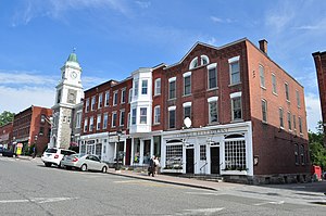
Litchfield, Connecticut
Town in Connecticut, United States
Distance: Approx. 207 meters
Latitude and longitude: 41.74722222,-73.18972222
Litchfield is a town in and former county seat of Litchfield County, Connecticut, United States. The population was 8,192 at the 2020 census. The town is part of the Northwest Hills Planning Region.

Litchfield Law School
United States historic place
Distance: Approx. 571 meters
Latitude and longitude: 41.74395,-73.18851
The Litchfield Law School was a law school in Litchfield, Connecticut, that operated from 1774 to 1833. Litchfield was the first independent law school established in America for reading law. Founded and led by lawyer Tapping Reeve, the proprietary school was unaffiliated with any college or university.
Forman School
Boarding school, day school in Litchfield, Connecticut, United States
Distance: Approx. 680 meters
Latitude and longitude: 41.7547,-73.1909
The Forman School is a co-educational boarding and day school in Litchfield, Connecticut, United States offering a college preparatory program in grades 9 to 12 and a postgraduate program (PG) exclusively for students with learning differences such as ADD/ADHD and dyslexia. Forman School offers a 4-week summer program in July for students with learning differences.

Litchfield Historic District
Historic district in Connecticut, United States
Distance: Approx. 171 meters
Latitude and longitude: 41.74738889,-73.19013889
Litchfield Historic District, in Litchfield, Connecticut, is a National Historic Landmark District designated in 1968 as a notable and well-preserved example of a typical late 18th century New England village. As a National Historic Landmark, it is listed on the National Register of Historic Places (NRHP). It is the core area of a larger NRHP-listed historic district that includes the entire borough of Litchfield and was designated a state historic district in 1959.: 72 This residential district is anchored by the Litchfield meetinghouse (1829) and is predominantly Georgian with clapboarding, gables and hipped roofs.

Oliver Wolcott House
Historic house in Connecticut, United States
Distance: Approx. 659 meters
Latitude and longitude: 41.74333333,-73.18777778
The Oliver Wolcott House is a historic colonial home at South Street near Wolcott Avenue in Litchfield, Connecticut. It was built in 1753 by Founding Father Oliver Wolcott Sr., a signer of the Declaration of Independence and the Articles of Confederation, and a state militia leader in the American Revolutionary War. It is the oldest house in the borough.
Litchfield High School (Litchfield, Connecticut)
High school in Litchfield, Connecticut, United States
Distance: Approx. 1438 meters
Latitude and longitude: 41.743,-73.207
Litchfield High School is a high school in Litchfield, Connecticut, United States. It is a part of Litchfield Public Schools. Litchfield High currently enrolls students from Bantam, Northfield, East Litchfield, and Litchfield.

Topsmead State Forest
Distance: Approx. 2614 meters
Latitude and longitude: 41.74694444,-73.16
Topsmead State Forest is a Connecticut state forest located in the town of Litchfield. It was formerly the summer residence of Edith Morton Chase, daughter of Henry Sabin Chase, first president of the Chase Brass and Copper Company. She left the house and its grounds to the state of Connecticut on her death in 1972.

First Congregational Church of Litchfield
Church in Connecticut, US
Distance: Approx. 269 meters
Latitude and longitude: 41.7479,-73.1883
The First Congregational Church of Litchfield is a congregation of the United Church of Christ in Litchfield, Connecticut, USA, occupying a historic building on the Litchfield green.

Litchfield (borough), Connecticut
Borough in Connecticut, United States
Distance: Approx. 304 meters
Latitude and longitude: 41.7475,-73.18805556
Litchfield is a borough in, and the village center of, the town of Litchfield in Litchfield County, Connecticut, United States. The population was 1,258 at the 2010 census. The entire borough was designated a Connecticut historic district in 1959 by special act of the state General Assembly and is listed on the National Register of Historic Places.

White Memorial Foundation
Distance: Approx. 3860 meters
Latitude and longitude: 41.71968889,-73.21705
The White Memorial Foundation is an organization dedicated to environmental conservation located in Litchfield, Connecticut. The Foundation owns approximately 4,000 acres of wetlands and uplands, including recreational trails, two camping areas, and a conservation center dedicated to education, research, conservation, and recreation.
White Memorial Conservation Center
Distance: Approx. 3737 meters
Latitude and longitude: 41.721,-73.217
The White Memorial Conservation Center is a natural history museum and nature center in Litchfield, Connecticut, United States, supported by the White Memorial Foundation. The museum is currently housed in Whitehall, the former residence of White Memorial Foundation founders Alain and May White.

Wamogo Regional High School
Secondary school in Litchfield, Connecticut, United States
Distance: Approx. 3659 meters
Latitude and longitude: 41.7278,-73.2255
Wamogo Regional High School was a public school in Litchfield, Connecticut. It served grades 9 through 12. It was the public high school for the surrounding towns of Morris, Warren, and Goshen.
Weather in this IP's area
broken clouds
-9 Celsius
-13 Celsius
-10 Celsius
-8 Celsius
1012 hPa
88 %
1012 hPa
973 hPa
10000 meters
1.7 m/s
8.37 m/s
299 degree
55 %
