72.10.98.186 - IP Lookup: Free IP Address Lookup, Postal Code Lookup, IP Location Lookup, IP ASN, Public IP
Country:
Region:
City:
Location:
Time Zone:
Postal Code:
ISP:
ASN:
language:
User-Agent:
Proxy IP:
Blacklist:
IP information under different IP Channel
ip-api
Country
Region
City
ASN
Time Zone
ISP
Blacklist
Proxy
Latitude
Longitude
Postal
Route
db-ip
Country
Region
City
ASN
Time Zone
ISP
Blacklist
Proxy
Latitude
Longitude
Postal
Route
IPinfo
Country
Region
City
ASN
Time Zone
ISP
Blacklist
Proxy
Latitude
Longitude
Postal
Route
IP2Location
72.10.98.186Country
Region
connecticut
City
west haven
Time Zone
America/New_York
ISP
Language
User-Agent
Latitude
Longitude
Postal
ipdata
Country
Region
City
ASN
Time Zone
ISP
Blacklist
Proxy
Latitude
Longitude
Postal
Route
Popular places and events near this IP address
West Haven, Connecticut
City in Connecticut, United States
Distance: Approx. 514 meters
Latitude and longitude: 41.27388889,-72.96777778
West Haven is a city in New Haven County, Connecticut, United States, located on the coast of Long Island Sound. The city is part of the South Central Connecticut Planning Region. At the 2020 census, the population of the city was 55,584.
WNHU
Radio station in West Haven
Distance: Approx. 2229 meters
Latitude and longitude: 41.29138889,-72.96111111
WNHU (88.7 FM) is a radio station broadcasting a variety format. Licensed to West Haven, Connecticut, United States, the station serves the New Haven area. The station is owned by the University of New Haven.
Notre Dame High School (West Haven, Connecticut)
Private boys secondary school in West Haven, Connecticut, United States
Distance: Approx. 1829 meters
Latitude and longitude: 41.28777778,-72.96083333
Notre Dame High School (NDWH) is a private, Roman Catholic, co-educational college preparatory school located in West Haven, Connecticut, a coastal suburb of New Haven, Connecticut.
West Haven High School
Public school in West Haven, Connecticut, United States
Distance: Approx. 1315 meters
Latitude and longitude: 41.26,-72.9585
West Haven High School is a secondary school located in West Haven, Connecticut, which educates students in grades 9–12. The mascot of West Haven is the Blue Devil.

West Haven station
Railroad station in Connecticut
Distance: Approx. 58 meters
Latitude and longitude: 41.271142,-72.963199
West Haven station is a commuter rail station on the Metro-North Railroad's New Haven Line, located in West Haven, Connecticut. The station was built on Sawmill Road between Hood Terrace and Railroad Avenue, in the Elm Street-Wagner Place neighborhood. West Haven has 660 parking spaces in on-site lots (with the possibility of 300–400 more in a parking garage in a refurbished industrial building north of the station if warranted by future demand) as well as bicycle facilities.

Savin Rock
Distance: Approx. 1947 meters
Latitude and longitude: 41.25972222,-72.94527778
Savin Rock is a section of West Haven, Connecticut, named after the rocky outcropping at the shorefront in Bradley Point Park. It was the site of the Savin Rock Amusement Park, which began in the late 19th century as a regionally renowned seaside resort. It evolved into a general amusement park in the 20th century and eventually closed in 1966.

West Haven Green Historic District
Historic district in Connecticut, United States
Distance: Approx. 1033 meters
Latitude and longitude: 41.27083333,-72.95027778
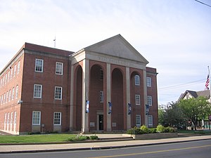
West Haven Green is the town green of the New England town of West Haven, Connecticut. The green is bordered by Church Street on the south, Savin Avenue on the west, Main Street on the north and Campbell Avenue on the east. The green and surrounding buildings are part of the West Haven Green Historic District.

Union School (West Haven, Connecticut)
United States historic place
Distance: Approx. 1361 meters
Latitude and longitude: 41.27472222,-72.94694444
The Union School is a historic school building at 174 Center Street in West Haven, Connecticut. Built in 1890, when the area was still part of Orange, it was West Haven's first brick school building, serving as a grammar school and high school for generations of local students. Now a senior living facility, it was listed on the National Register of Historic Places in 1987.

Savin Rock Amusement Park
Distance: Approx. 1919 meters
Latitude and longitude: 41.257,-72.95
Savin Rock was an American amusement park in West Haven, Connecticut. It was previously called The White City and was established in the 1870s . The park included a number of roller coasters, other rides and numerous funhouses.

Thunderbolt (Savin Rock)
Distance: Approx. 1919 meters
Latitude and longitude: 41.257,-72.95
Thunderbolt was a wooden roller coaster which operated at Savin Rock Amusement Park in West Haven, Connecticut, from 1925 until 1938 when it was destroyed by a hurricane. It was rebuilt in modified form in 1939 and it continued to operate until 1956. When it was first built, it was purported to be the fastest roller coaster in the world.

Ward-Heitman House
Historic house in Connecticut, United States
Distance: Approx. 1014 meters
Latitude and longitude: 41.27611111,-72.95222222
The Ward-Heitman House is a historic house museum at 277 Elm Street in West Haven, Connecticut. The house displays furnishings and objects that might have been used by families that lived here in more than 250 years of residential occupancy. The house was listed on the National Register of Historic Places in 2003.

Cove River
River in Connecticut, US
Distance: Approx. 2106 meters
Latitude and longitude: 41.2525971,-72.9598251
The Cove River is a stream in New Haven County in the U.S. state of Connecticut. It rises in Orange and flows through West Haven before discharging into Long Island Sound at Sea Bluff Beach by Bradley Point. Dams along the river form the Maltby Lakes, reservoirs of the South Central Connecticut Regional Water Authority, as well as Phipps Lake.
Weather in this IP's area
few clouds
-6 Celsius
-9 Celsius
-7 Celsius
-4 Celsius
1012 hPa
85 %
1012 hPa
1008 hPa
10000 meters
2.06 m/s
290 degree
20 %
