72.10.96.99 - IP Lookup: Free IP Address Lookup, Postal Code Lookup, IP Location Lookup, IP ASN, Public IP
Country:
Region:
City:
Location:
Time Zone:
Postal Code:
ISP:
ASN:
language:
User-Agent:
Proxy IP:
Blacklist:
IP information under different IP Channel
ip-api
Country
Region
City
ASN
Time Zone
ISP
Blacklist
Proxy
Latitude
Longitude
Postal
Route
db-ip
Country
Region
City
ASN
Time Zone
ISP
Blacklist
Proxy
Latitude
Longitude
Postal
Route
IPinfo
Country
Region
City
ASN
Time Zone
ISP
Blacklist
Proxy
Latitude
Longitude
Postal
Route
IP2Location
72.10.96.99Country
Region
connecticut
City
berlin
Time Zone
America/New_York
ISP
Language
User-Agent
Latitude
Longitude
Postal
ipdata
Country
Region
City
ASN
Time Zone
ISP
Blacklist
Proxy
Latitude
Longitude
Postal
Route
Popular places and events near this IP address

Berlin, Connecticut
Town in Connecticut, United States
Distance: Approx. 707 meters
Latitude and longitude: 41.61388889,-72.7725
Berlin ( BUR-lin) is a town in the Capitol Planning Region, Connecticut, United States. The population was 20,175 at the 2020 census. It was incorporated in 1785.

Kensington, Connecticut
Census-designated place in Connecticut, United States
Distance: Approx. 3061 meters
Latitude and longitude: 41.63527778,-72.76861111
Kensington is a census-designated place (CDP) and section of the town of Berlin in Hartford County, Connecticut, United States. The Berlin town offices are located in Kensington. The population was 8,459 at the 2010 census.

Berlin High School (Connecticut)
Public school in Berlin, Connecticut, United States
Distance: Approx. 2100 meters
Latitude and longitude: 41.6216,-72.7529
Berlin High School is a public high school located in Berlin, Connecticut, United States.

Berlin station (Connecticut)
Train station in Berlin, Connecticut, US
Distance: Approx. 3120 meters
Latitude and longitude: 41.6356,-72.7653
Berlin station is a train station located in the Kensington neighborhood of Berlin, Connecticut. It is on the New Haven–Springfield Line and is served by Amtrak's Northeast Regional, Hartford Line, and Valley Flyer, in addition to the Hartford Line commuter rail. Two high-level platforms, each six cars long connected by an overhead pedestrian bridge opened at the Hartford Line service launch on June 16, 2018.
Connecticut statistical areas
Distance: Approx. 3893 meters
Latitude and longitude: 41.6219,-72.7273
The U.S. State of Connecticut currently has nine statistical areas that have been delineated by the Office of Management and Budget (OMB). On July 21, 2023, the OMB delineated two combined statistical areas, five metropolitan statistical areas, and two micropolitan statistical areas in Connecticut. As of 2023, the largest of these in the state is the New Haven-Hartford-Waterbury, CT CSA, encompassing the entire state outside of the Bridgeport-Stamford-Danbury, CT MSA in the southwest.

Lamentation Mountain
Traprock mountain in the American state of Connecticut
Distance: Approx. 3797 meters
Latitude and longitude: 41.57416667,-72.7625
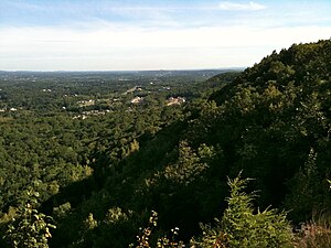
Lamentation Mountain, or Mount Lamentation, 720 feet (220 m), is a traprock mountain located 2.5 miles (4.0 km) north of Meriden, Connecticut. It is part of the narrow, linear Metacomet Ridge that extends from Long Island Sound near New Haven, Connecticut, north through the Connecticut River Valley of Massachusetts to the Vermont border. Lamentation Mountain is known for its scenic vistas, extensive cliff faces, unique microclimate ecosystems, and rare plant communities.

Catherine M. McGee Middle School
Public middle school in Berlin, Connecticut, United States
Distance: Approx. 973 meters
Latitude and longitude: 41.61444444,-72.7625
Catherine M. McGee Middle School is a public middle school located in Berlin, Connecticut. The current school building on Norton Road was opened in 1969 and serves grades 6–8. An addition was added in 1996, which included a new library media center, new science labs, and nine additional classrooms.

Worthington Ridge Historic District
Historic district in Connecticut, United States
Distance: Approx. 2256 meters
Latitude and longitude: 41.61833333,-72.74694444
The Worthington Ridge Historic District encompasses the historic town center of Berlin, Connecticut. It runs mostly along Worthington Ridge Road from the intersection of Mill Street (Route 372) to Sunset Lane. This section of road was historically part of the Boston Post Road laid out in 1673, and is now lined by a diversity of residential architecture and several of the town's civic buildings.

Berlin-Peck Memorial Library
Distance: Approx. 2227 meters
Latitude and longitude: 41.6278,-72.7705
The Berlin-Peck Memorial Library is a public library in Berlin, Connecticut. The original library was founded in 1829. The library was relocated to a new facility at 234 Kensington Road in 1989.
Lamentation Mountain State Park
State park in Connecticut, United States
Distance: Approx. 3280 meters
Latitude and longitude: 41.57888889,-72.7625
Lamentation Mountain State Park is an undeveloped public recreation area covering 47 acres (19 ha) in the town of Berlin, Connecticut. It entered the roll of state parks in the 1936 edition of the Connecticut Register and Manual. The state park extends for about 0.4 miles (0.64 km) from the Berlin Turnpike up the western flank of Lamentation Mountain to the ridgeline near the Mattabesett Trail.

Jean E. Hooker School-Berlin High School
United States historic place
Distance: Approx. 2905 meters
Latitude and longitude: 41.63388889,-72.77083333
The Jean E. Hooker School-Berlin High School, most recently the Kensington Grammar School, was a historic school complex at 462 Alling Street in Berlin, Connecticut. Built in 1910, the building served as both the town's first high school, and as a private school before being converted to an elementary school and finally closing in 1975. The building was listed on the National Register of Historic Places in 2012; it was demolished in 2014.

Kensington Soldier's Monument
United States historic place
Distance: Approx. 1986 meters
Latitude and longitude: 41.62277778,-72.78305556
The Kensington Soldiers' Monument is a historic war memorial located at 312 Percival Road, on the grounds of the Kensington Congregational Church in Berlin, Connecticut. Erected in 1863, it is one of the oldest memorials to the American Civil War in the United States, and the first to be erected in Connecticut. It is a modest brownstone obelisk, with an accompanying cannon.
Weather in this IP's area
few clouds
4 Celsius
3 Celsius
4 Celsius
4 Celsius
1009 hPa
57 %
1009 hPa
998 hPa
10000 meters
1.97 m/s
2.77 m/s
340 degree
14 %
