Country:
 Canada
Region:
City:
Latitude and Longitude:
Time Zone:
Postal Code:
IP information under different IP Channel
ip-api
Country
Region
City
ASN
Time Zone
ISP
Blacklist
Proxy
Latitude
Longitude
Postal
Route
IPinfo
Country
Region
City
ASN
Time Zone
ISP
Blacklist
Proxy
Latitude
Longitude
Postal
Route
MaxMind
Country
Region
City
ASN
Time Zone
ISP
Blacklist
Proxy
Latitude
Longitude
Postal
Route
Luminati
Country
CARegion
nl
City
newharbour
ASN
Time Zone
America/St_Johns
ISP
EASTLINK-HSI
Latitude
Longitude
Postal
db-ip
Country
Region
City
ASN
Time Zone
ISP
Blacklist
Proxy
Latitude
Longitude
Postal
Route
ipdata
Country
Region
City
ASN
Time Zone
ISP
Blacklist
Proxy
Latitude
Longitude
Postal
Route
Popular places and events near this IP address
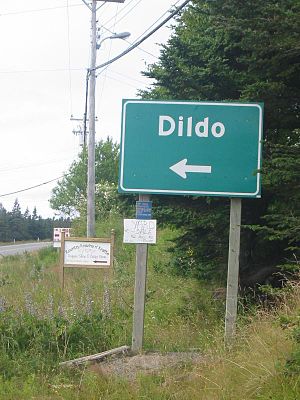
Dildo, Newfoundland and Labrador
Local service district / designated place in Newfoundland and Labrador, Canada
Distance: Approx. 1917 meters
Latitude and longitude: 47.57055556,-53.55583333
Dildo is a local service district and designated place in the Canadian province of Newfoundland and Labrador on the island of Newfoundland. It is located on the southeastern Dildo Arm of Trinity Bay about 100 kilometres (62 mi) west of St. John's.

Dildo Island
Island in Newfoundland and Labrador, Canada
Distance: Approx. 3961 meters
Latitude and longitude: 47.56643889,-53.59095
Dildo Island is a small, uninhabited island in the Canadian province of Newfoundland and Labrador. It is the largest of three islands located at the entrance to Dildo Tip in the bottom of Charlie Burgess, off the coast of the neighbouring town of Dildo. An archaeological excavation in 1995 discovered Dorset artifacts dated to between 150 CE and 750 CE. It is believed that these people camped on Dildo Island for the purpose of seal hunting.
Old Shop, Newfoundland and Labrador
Distance: Approx. 6533 meters
Latitude and longitude: 47.53333333,-53.58333333
Old Shop is a local service district and designated place in the Canadian province of Newfoundland and Labrador. It is on the western side of the Dildo Arm, at the southern end of Trinity Bay. It is northwest of South Dildo, across the Dildo Arm from Dildo proper.
Little Ridge
Distance: Approx. 8109 meters
Latitude and longitude: 47.549,-53.64
Little Ridge is a former settlement in Newfoundland and Labrador. It was located on the Avalon Peninsula near to Thornlea and Bellevue.
New Harbour, Newfoundland and Labrador
Local service district / designated place in Newfoundland and Labrador, Canada
Distance: Approx. 551 meters
Latitude and longitude: 47.58611111,-53.54055556
New Harbour is a local service district and designated place in the Canadian province of Newfoundland and Labrador. It is on the east shore of Trinity Bay, along Provincial Route 80. Route 80's intersection with Route 73 is inside New Harbour.
Knife Bay
Distance: Approx. 9551 meters
Latitude and longitude: 47.588,-53.675
Knife Bay (or Baie de Couteau, or Knife Cove) is natural bay or cove on the island of Newfoundland in the province of Newfoundland and Labrador, Canada. Cornelius Island is nearby.
Hopeall Bay
Bay in Newfoundland and Labrador, Canada
Distance: Approx. 5284 meters
Latitude and longitude: 47.633,-53.531
Hopeall Bay (also Hope-all Bay) is a natural bay off the island of Newfoundland in the province of Newfoundland and Labrador, Canada. It is an arm of Trinity Bay, which in turn opens to the Atlantic Ocean.
Spread Eagle Bay
Distance: Approx. 5658 meters
Latitude and longitude: 47.549,-53.598
Spread Eagle Bay is a natural bay off the island of Newfoundland in the province of Newfoundland and Labrador, Canada.
Green's Harbour
Local service district / designated place in Newfoundland and Labrador, Canada
Distance: Approx. 6425 meters
Latitude and longitude: 47.638,-53.508
Green's Harbour is a local service district and designated place in the Canadian province of Newfoundland and Labrador.
Hopeall
Local service district / designated place in Newfoundland and Labrador, Canada
Distance: Approx. 3197 meters
Latitude and longitude: 47.606,-53.516
Hopeall is a local service district and designated place in the Canadian province of Newfoundland and Labrador.

South Dildo
Local service district / designated place in Newfoundland and Labrador, Canada
Distance: Approx. 7120 meters
Latitude and longitude: 47.523,-53.552
South Dildo is a local service district and designated place in the Canadian province of Newfoundland and Labrador.
Weather in this IP's area
clear sky
9 Celsius
5 Celsius
8 Celsius
9 Celsius
1017 hPa
78 %
1017 hPa
1017 hPa
10000 meters
6.32 m/s
10.26 m/s
301 degree
9 %
07:27:43
18:10:27