Country:
Region:
City:
Latitude and Longitude:
Time Zone:
Postal Code:
IP information under different IP Channel
ip-api
Country
Region
City
ASN
Time Zone
ISP
Blacklist
Proxy
Latitude
Longitude
Postal
Route
Luminati
Country
Region
ns
City
yarmouth
ASN
Time Zone
America/Halifax
ISP
EASTLINK-HSI
Latitude
Longitude
Postal
IPinfo
Country
Region
City
ASN
Time Zone
ISP
Blacklist
Proxy
Latitude
Longitude
Postal
Route
db-ip
Country
Region
City
ASN
Time Zone
ISP
Blacklist
Proxy
Latitude
Longitude
Postal
Route
ipdata
Country
Region
City
ASN
Time Zone
ISP
Blacklist
Proxy
Latitude
Longitude
Postal
Route
Popular places and events near this IP address

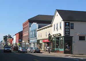
Yarmouth, Nova Scotia
Town in Nova Scotia, Canada
Distance: Approx. 944 meters
Latitude and longitude: 43.83861111,-66.11527778
Yarmouth is a port town located on the Bay of Fundy in southwestern Nova Scotia, Canada. Yarmouth is the shire town of Yarmouth County and is the largest population centre in the region.
Mariners Centre
Distance: Approx. 1633 meters
Latitude and longitude: 43.8375,-66.09916667
The Mariners Centre is a multi-purpose and double ice surface arena in Yarmouth, Nova Scotia, Canada. It officially opened on November 28, 2001 and the building size is 65,000 square feet (6,000 m2). It is home to the Yarmouth Mariners of the Maritime Junior Hockey League.
Arcadia, Nova Scotia
Distance: Approx. 3528 meters
Latitude and longitude: 43.82486667,-66.07349444
Arcadia is a small community in Nova Scotia, Canada, adjacent to the Town of Yarmouth. It was originally known as "Upper Chebogue" from its location on the upper reaches of the tidal Chebogue River. The name was changed to Arcadia in 1863.
Yarmouth 33
Distance: Approx. 2757 meters
Latitude and longitude: 43.83589444,-66.08338889
First established on June 8, 1887, Yarmouth 33 is a Mi'kmaq reserve located in Yarmouth County, Nova Scotia. As of 2021, the population was 181, a 15.3% increase from 2016. It is administratively part of the Acadia First Nation.

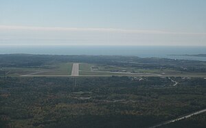
Yarmouth Airport
Aerodrome in Yarmouth, Nova Scotia
Distance: Approx. 2310 meters
Latitude and longitude: 43.82722222,-66.08833333
Yarmouth Airport (IATA: YQI, ICAO: CYQI) is a registered aerodrome located in Yarmouth County, Nova Scotia, Canada. It began as a World War II Royal Air Force training base. The airport is classified as an airport of entry by Nav Canada and is staffed by the Canada Border Services Agency (CBSA).
Yarmouth Consolidated Memorial High School
Senior high school in Yarmouth, Nova Scotia, Canada
Distance: Approx. 852 meters
Latitude and longitude: 43.8372,-66.1125
Yarmouth Consolidated Memorial High School (YCMHS) is a secondary school located in Yarmouth, Nova Scotia, Canada. It is part of the Tri-County Regional School Board and is the only high school in the town of Yarmouth. The high school serves the town of Yarmouth as well as the rest of Yarmouth County.

Cape Forchu, Nova Scotia
Community and headland in Nova Scotia, Canada
Distance: Approx. 4223 meters
Latitude and longitude: 43.80694444,-66.15833333
Cape Forchu ( for-SHOO) is a Canadian fishing community and headland of the same name in Yarmouth County, Nova Scotia.
Yarmouth County Museum & Archives
Municipal Museum & Archives in Yarmouth, Nova Scotia
Distance: Approx. 733 meters
Latitude and longitude: 43.83673611,-66.11572222
The Yarmouth County Museum & Archives is a museum located in Yarmouth, Nova Scotia, Canada. This museum explores the history of Yarmouth County. Located in the heart of Yarmouth's heritage residential district, the museum is housed in a former church as well as two historic houses.
Milton Highlands, Nova Scotia
Distance: Approx. 2903 meters
Latitude and longitude: 43.85555556,-66.12527778
Milton Highlands (2021 population: 320) is a designated place located 2 km (1.2 mi) from the town of Yarmouth within the Municipality of the District of Yarmouth in Nova Scotia, Canada.
Johns Cove, Nova Scotia
Distance: Approx. 4048 meters
Latitude and longitude: 43.8029,-66.1501
Johns Cove is a small bay located on the Cape Forchu peninsula in the Municipality of Yarmouth, Nova Scotia. The cove is located in Yarmouth Sound and until the cancellation of the service in 2009 the CAT Ferry could be seen arriving and departing Yarmouth Harbour. Johns Cove is located 4 kilometers away from the town of Yarmouth.

Bunker's Island, Nova Scotia
Peninsula in Nova Scotia, Canada
Distance: Approx. 2144 meters
Latitude and longitude: 43.81611111,-66.135
Bunker's Island is a peninsula located in Yarmouth Harbour in Yarmouth County, Nova Scotia. It contains a lighthouse which is nicknamed Bug Light by the locals and, until recently, it also contained Irving oil tanks and a wharf. The tanks were removed in 2017.
Raid on Yarmouth, Nova Scotia (1775)
1775 military operation
Distance: Approx. 4198 meters
Latitude and longitude: 43.807,-66.158
The Raid on Yarmouth took place on 5 December 1775 during the American Revolutionary War. The raid involved American Privateers from Salem, Massachusetts attacking Yarmouth, Nova Scotia at Cape Forchu. The privateers intended to stop the export of supplies being sent from Nova Scotia to the loyalists in Boston.
Weather in this IP's area
broken clouds
4 Celsius
-1 Celsius
3 Celsius
5 Celsius
1028 hPa
65 %
1028 hPa
1025 hPa
10000 meters
7.72 m/s
11.83 m/s
330 degree
75 %
07:03:45
17:12:14
