71.5.109.230 - IP Lookup: Free IP Address Lookup, Postal Code Lookup, IP Location Lookup, IP ASN, Public IP
Country:
Region:
City:
Location:
Time Zone:
Postal Code:
IP information under different IP Channel
ip-api
Country
Region
City
ASN
Time Zone
ISP
Blacklist
Proxy
Latitude
Longitude
Postal
Route
Luminati
Country
Region
mn
City
minneapolis
ASN
Time Zone
America/Chicago
ISP
ATOMIC
Latitude
Longitude
Postal
IPinfo
Country
Region
City
ASN
Time Zone
ISP
Blacklist
Proxy
Latitude
Longitude
Postal
Route
IP2Location
71.5.109.230Country
Region
minnesota
City
minneapolis
Time Zone
America/Chicago
ISP
Language
User-Agent
Latitude
Longitude
Postal
db-ip
Country
Region
City
ASN
Time Zone
ISP
Blacklist
Proxy
Latitude
Longitude
Postal
Route
ipdata
Country
Region
City
ASN
Time Zone
ISP
Blacklist
Proxy
Latitude
Longitude
Postal
Route
Popular places and events near this IP address
Beltrami, Minneapolis
Neighborhood in Hennepin, Minnesota, United States
Distance: Approx. 589 meters
Latitude and longitude: 44.9949,-93.2416
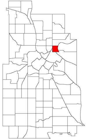
Beltrami is a neighborhood in the Northeast community in Minneapolis. Its boundaries are Broadway Street NE to the north, Interstate 35W to the east, East Hennepin Avenue to the south, and Central Avenue and Harrison Street NE to the west. Beltrami neighborhood and park are named after Giacomo Constantino Beltrami, an early 19th-century Italian jurist, scholar and explorer.
Windom Park, Minneapolis
Neighborhood in Hennepin, Minnesota, United States
Distance: Approx. 1313 meters
Latitude and longitude: 45.0091,-93.2356
Windom Park is a neighborhood in the Northeast community in Minneapolis.
St. Anthony West, Minneapolis
Neighborhood in Hennepin, Minnesota, United States
Distance: Approx. 1367 meters
Latitude and longitude: 44.9932,-93.2602
Saint Anthony West is a neighborhood in the Northeast community of Minneapolis.
Logan Park, Minneapolis
Neighborhood in Hennepin, Minnesota, United States
Distance: Approx. 592 meters
Latitude and longitude: 45.0028,-93.2512
Logan Park is a neighborhood in the Northeast community in Minneapolis. It is one of ten neighborhoods in Ward 1 of Minneapolis, currently represented by Council President Elliott Payne.
Northeast Park, Minneapolis
Neighborhood in Hennepin, Minnesota, United States
Distance: Approx. 510 meters
Latitude and longitude: 45.0031,-93.2413
Northeast Park is a neighborhood in the Northeast community in Minneapolis, Minnesota. Its boundaries are 18th Avenue NE and New Brighton Boulevard to the north, the city limits to the northeast, Interstate 35W to the southeast, Broadway Street NE to the south, and Central Avenue to the west. It is one of ten neighborhoods in Ward 1 of Minneapolis, currently represented by Council President Elliott Payne.
St. Anthony East, Minneapolis
Neighborhood in Hennepin, Minnesota, United States
Distance: Approx. 751 meters
Latitude and longitude: 44.9945,-93.2517
St. Anthony East is a neighborhood of the Northeast community in Minneapolis. It is located in Ward 3, currently represented by council member Michael Rainville.

Woodbury Fisk House
Historic house in Minnesota, United States
Distance: Approx. 1485 meters
Latitude and longitude: 44.98630556,-93.24805556
The Woodbury Fisk House is a historic house in the Marcy-Holmes neighborhood of Minneapolis, Minnesota, United States, built in 1869. It was listed on the National Register of Historic Places in 1983 for its local significance in the theme of architecture. It was nominated for being the most elaborate example of Italianate architecture—and one of the style's most intact specimens—in the city of Minneapolis.

Edison High School (Minnesota)
High school in Minneapolis, Minnesota
Distance: Approx. 1216 meters
Latitude and longitude: 45.0094077,-93.2518039
Thomas Edison High School, or simply Edison, is a public high school in the Northeast community of Minneapolis, Minnesota, United States. It was named after the American inventor Thomas Alva Edison. Located in the Holland neighborhood, the school's academic focus areas are: American Studies, Business Enterprise, Candidate International Baccalaureate Middle Years Programme, International Baccalaureate Diploma Programme, Personal Care & Therapeutic Services, and Technology & Multi Media.
Indeed Brewing Company
Distance: Approx. 659 meters
Latitude and longitude: 45.003566,-93.251381
Indeed Brewing Company is a microbrewery located in the Logan Park neighborhood of Northeast Minneapolis. It was founded in 2011 by friends Thomas Whisenand, Rachel Anderson, and Nathan Berndt. The three brought in Josh Bischoff, formerly a brewer at Town Hall Brewery in Minneapolis, as their head brewer.

St. Mary's Cathedral (Minneapolis)
Church in Minnesota, United States
Distance: Approx. 1309 meters
Latitude and longitude: 45.005,-93.26
St. Mary's Orthodox Cathedral, also known as the Cathedral of the Protection of the Holy Virgin, is a cathedral of the Orthodox Church in America and the Diocese of the Midwest, located in Minneapolis. It is one of only two Orthodox churches in Northeast Minneapolis, and of 16 local Orthodox churches in the Twin Cities.

Mid-City Industrial, Minneapolis
Neighborhood in Hennepin, Minnesota, United States
Distance: Approx. 1272 meters
Latitude and longitude: 44.99888889,-93.22916667
Mid-City Industrial is a neighborhood in the University community of Minneapolis. It is located in Minneapolis City Council Ward 1, currently represented by Minneapolis City Council member Elliott Payne.

Camden Industrial Area, Minneapolis
Neighborhood in Minneapolis
Distance: Approx. 1272 meters
Latitude and longitude: 44.99888889,-93.22916667
Camden Industrial Area is an official neighborhood in the Camden community of Minneapolis. It is located along the west bank of the Mississippi River and includes several industrial businesses, North Mississippi Regional Park, a few residents, establishments, and other undeveloped space. The neighborhood is located in Minneapolis City Council Ward 4, currently represented by Minneapolis City Council member LaTrisha Vetaw.
Weather in this IP's area
clear sky
-14 Celsius
-21 Celsius
-15 Celsius
-13 Celsius
1033 hPa
45 %
1033 hPa
999 hPa
10000 meters
4.12 m/s
340 degree


