71.5.108.35 - IP Lookup: Free IP Address Lookup, Postal Code Lookup, IP Location Lookup, IP ASN, Public IP
Country:
Region:
City:
Location:
Time Zone:
Postal Code:
ISP:
ASN:
language:
User-Agent:
Proxy IP:
Blacklist:
IP information under different IP Channel
ip-api
Country
Region
City
ASN
Time Zone
ISP
Blacklist
Proxy
Latitude
Longitude
Postal
Route
db-ip
Country
Region
City
ASN
Time Zone
ISP
Blacklist
Proxy
Latitude
Longitude
Postal
Route
IPinfo
Country
Region
City
ASN
Time Zone
ISP
Blacklist
Proxy
Latitude
Longitude
Postal
Route
IP2Location
71.5.108.35Country
Region
minnesota
City
saint paul
Time Zone
America/Chicago
ISP
Language
User-Agent
Latitude
Longitude
Postal
ipdata
Country
Region
City
ASN
Time Zone
ISP
Blacklist
Proxy
Latitude
Longitude
Postal
Route
Popular places and events near this IP address

St. Paul Academy and Summit School
Private, day school in St. Paul, MN, USA
Distance: Approx. 1509 meters
Latitude and longitude: 44.92611111,-93.17305556
St. Paul Academy and Summit School is a private college preparatory day school in Saint Paul, Minnesota, United States, for students in grades K–12. The school was established through a merger in 1969 of St.
St. Catherine University
Catholic university in Saint Paul, Minnesota, US
Distance: Approx. 1477 meters
Latitude and longitude: 44.92472222,-93.18222222
St. Catherine University (St. Kate's) is a private Catholic university in Saint Paul, Minnesota.

Highland Park, Saint Paul
Neighborhood in Ramsey, Minnesota, United States
Distance: Approx. 835 meters
Latitude and longitude: 44.91777778,-93.16694444
Highland Park is a neighborhood in the southwestern corner of Saint Paul, Minnesota, United States. Also known as Highland District Council (District 15), it lies along the Mississippi River just north of Fort Snelling and across the river from Minneapolis–Saint Paul International Airport. According to the 2000 census Highland Park had a population of 23,202.
Highland Park High School (Minnesota)
Public school in Saint Paul, Minnesota, United States
Distance: Approx. 635 meters
Latitude and longitude: 44.91083333,-93.16694444
Highland Park Senior High School is a public secondary school in Saint Paul, Minnesota serving grades 9 through 12. It is located in the Highland Park neighborhood. The school offers the International Baccalaureate program.

Highland Park Tower
United States historic place
Distance: Approx. 838 meters
Latitude and longitude: 44.91761111,-93.16666667
The Highland Park Water Tower is a water tower in the Highland Park area of Saint Paul, Minnesota, United States. It was designed by Clarence W. Wigington, the nation's first African-American municipal architect.: 334 The tower was listed on the National Register of Historic Places in 1986. It was completed in 1928 at a cost of $69,483.

William and Catherine Davern Farm House
Historic house in Minnesota, United States
Distance: Approx. 727 meters
Latitude and longitude: 44.90619444,-93.17277778
The William and Catherine Davern Farm House is an Italianate farmhouse built in 1862 in Saint Paul, Minnesota, United States. It is one of a small number of surviving farmhouses in Saint Paul. William Davern was a member of the first territorial legislature.
Highland Catholic School
Private, coeducational school in Saint Paul, Minnesota, United States
Distance: Approx. 942 meters
Latitude and longitude: 44.91638889,-93.18527778
Highland Catholic School, is a private, co-educational Catholic grade school in Saint Paul, Minnesota, United States. It services grades Preschool through Eighth Grade. Highland Catholic School is the official school of Lumen Christi Catholic Community (LCCC).
Snelling & Highland station
Bus station in Saint Paul, Minnesota, United States
Distance: Approx. 1007 meters
Latitude and longitude: 44.91988333,-93.16701944
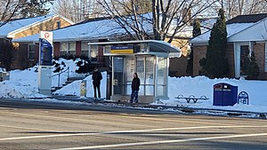
Snelling & Highland is a bus rapid transit station on the Metro A Line in Saint Paul, Minnesota. The station is located at the intersection of Highland Parkway on Snelling Avenue. Both station platforms are located north of Highland Parkway.

Ford & Fairview station
Bus station in Saint Paul, Minnesota
Distance: Approx. 631 meters
Latitude and longitude: 44.91795833,-93.17720833
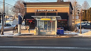
Ford & Fairview is a bus rapid transit station on the Metro A Line in Saint Paul, Minnesota. The station is located at the intersection of Fairview Avenue on Ford Parkway. Both station platforms are located far-side of Fairview Avenue.

Ford & Kenneth station
Bus station in Saint Paul, Minnesota
Distance: Approx. 1000 meters
Latitude and longitude: 44.91792778,-93.18480833
Ford & Kenneth is a bus rapid transit station on the Metro A Line in Saint Paul, Minnesota. The station is located at the intersection of Kenneth Street on Ford Parkway. Both station platforms are located near-side of Kenneth Street.

Ford & Finn station
Bus station in Saint Paul, Minnesota
Distance: Approx. 1317 meters
Latitude and longitude: 44.91793889,-93.18951111
Ford & Finn is a bus rapid transit station on the Metro A Line in Saint Paul, Minnesota. The station is located at the intersection of Finn Street on Ford Parkway. Both station platforms are located far-side of Finn Street.

Hidden Falls (Saint Paul, Minnesota)
Park and hiking area in Minnesota, United States
Distance: Approx. 1435 meters
Latitude and longitude: 44.90968,-93.19233
Hidden Falls is a waterfall along the Mississippi River bluffs in Saint Paul, Minnesota, United States. The waterfall is within Hidden Falls Regional Park, a public park maintained by the City of Saint Paul. The main feature of the park is the small, spring-fed waterfall for which the park is named.
Weather in this IP's area
overcast clouds
-22 Celsius
-29 Celsius
-22 Celsius
-22 Celsius
1034 hPa
75 %
1034 hPa
996 hPa
10000 meters
3.82 m/s
5.98 m/s
296 degree
100 %