70.91.145.9 - IP Lookup: Free IP Address Lookup, Postal Code Lookup, IP Location Lookup, IP ASN, Public IP
Country:
Region:
City:
Location:
Time Zone:
Postal Code:
IP information under different IP Channel
ip-api
Country
Region
City
ASN
Time Zone
ISP
Blacklist
Proxy
Latitude
Longitude
Postal
Route
Luminati
Country
Region
fl
City
jacksonville
ASN
Time Zone
America/New_York
ISP
COMCAST-7922
Latitude
Longitude
Postal
IPinfo
Country
Region
City
ASN
Time Zone
ISP
Blacklist
Proxy
Latitude
Longitude
Postal
Route
IP2Location
70.91.145.9Country
Region
florida
City
jacksonville
Time Zone
America/New_York
ISP
Language
User-Agent
Latitude
Longitude
Postal
db-ip
Country
Region
City
ASN
Time Zone
ISP
Blacklist
Proxy
Latitude
Longitude
Postal
Route
ipdata
Country
Region
City
ASN
Time Zone
ISP
Blacklist
Proxy
Latitude
Longitude
Postal
Route
Popular places and events near this IP address

Jacksonville Port Terminal Railroad
Distance: Approx. 2043 meters
Latitude and longitude: 30.3552,-81.6254
The Jacksonville Port Terminal Railroad (reporting mark JXPT) is a short line terminal railroad run by Watco. It serves the Jacksonville Port Authority and tenants with over ten miles of track. It has only one main line, running west from the Tallyrand Marine Terminal on the St Johns River to an interchange with CSX and Norfolk Southern northeast of downtown Jacksonville, Florida.

Darnell-Cookman School of the Medical Arts
Secondary school in Jacksonville, Florida
Distance: Approx. 2018 meters
Latitude and longitude: 30.345919,-81.666166
Darnell-Cookman School of the Medical Arts (DCSoMA) is a secondary school within the Duval County Public Schools system in Jacksonville, Florida, USA. It is a National Blue Ribbon School as recognized by the US Department of Education. It is also an "A" school in Florida's grading system. The school is across 8th Street from UF Health Shands Hospital.

Bethel Church (Jacksonville, Florida)
Historic church in Florida, United States
Distance: Approx. 2120 meters
Latitude and longitude: 30.33583333,-81.65833333
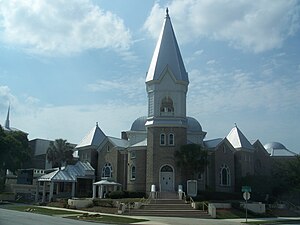
The Bethel Church (formerly Bethel Baptist Institutional Church) is a historically-black Baptist megachurch in Jacksonville, Florida, in the United States. Founded in 1838, it is the city's oldest Baptist congregation. The attendance is 12,000 members.

Henry John Klutho House
United States historic place
Distance: Approx. 1012 meters
Latitude and longitude: 30.34666667,-81.655
The Henry John Klutho House (also known as the Klutho Residence) is a historic home in Jacksonville, Florida. The house was designed and lived in by the New York City architect Henry John Klutho, who helped in the rebuilding of Jacksonville after the Great Fire of 1901. It is located at 28-30 West 9th Street.
Andrew Jackson High School (Jacksonville)
Public/magnet school in Jacksonville, Florida, USA
Distance: Approx. 1386 meters
Latitude and longitude: 30.362255,-81.65414
Andrew Jackson High School of Advanced Technology, A Dedicated Magnet School is the oldest fully accredited high school in Duval County, Florida. It is located just north of downtown Jacksonville on Main Street (U.S. Highway 17). It opened in 1927, the same year the city opened Robert E. Lee High School (now Riverside High School).

UF Health Jacksonville
Hospital in Florida, United States
Distance: Approx. 1737 meters
Latitude and longitude: 30.347,-81.6635
UF Health Jacksonville is a teaching hospital and medical system of the University of Florida in Jacksonville, Florida, United States. Part of the larger University of Florida Health system, it includes the 603-bed UF Health Jacksonville hospital, the 92-bed UF Health North hospital, associated clinics, and is the Jacksonville campus of UF's Health Science Center. Together with UF Health Shands Hospital in Gainesville, UF Health Jacksonville (formerly Shands Jacksonville) is one of two academic hospitals in the UF Health system, and serves 19 counties in Florida and several in Georgia.
Clay Hill, Florida
Unincorporated area in Florida, United States
Distance: Approx. 2199 meters
Latitude and longitude: 30.33694444,-81.66138889
Clay Hill is an unincorporated community in Clay County, Florida, United States. It is located in the northwest corner of the county and lies along County Road 218. It is a rural community that serves as a bedroom community for the surrounding areas, and home to several working farms.
Matthew Gilbert High School
Public, segregated school
Distance: Approx. 1349 meters
Latitude and longitude: 30.3411,-81.6397
Matthew Gilbert High School was a high school for black students in Jacksonville, Florida. Like many black high schools of the time, it was reclassified as a junior high school after integration. It is now Matthew Gilbert Middle School.
Old City Cemetery (Jacksonville, Florida)
Historic site in Jacksonville, Florida
Distance: Approx. 2173 meters
Latitude and longitude: 30.3324,-81.6488
The Old City Cemetery in Jacksonville, Florida was established in 1852 as Jacksonville's main burial ground. After the American Civil War the cemetery later interred many Confederate veterans and veterans of the Union Army’s United States Colored Troops. Because the cemetery is over 160 years old, the Jacksonville Historic Landmarks Commission has deemed it a historic landmark of Jacksonville.

Florida's Tribute to the Women of the Confederacy
Outdoor memorial to Confederate women in Jacksonville, Florida's Springfield Park
Distance: Approx. 2048 meters
Latitude and longitude: 30.33481,-81.65447
Florida's Tribute to the Women of the Confederacy, also known as A Tribute to the Women of the Southern Confederacy and the Monument to the Women of the Confederacy, was an outdoor Confederate memorial installed in Jacksonville, Florida's Springfield Park. The memorial was erected in 1915, during the peak of Confederate monument-building, part of widespread campaigns to promote and justify Jim Crow laws in the South. A plaque says the memorial honors women of the Confederate states who "sacrificed their all upon their country's altar" during the Confederacy's 1861-65 war to secede from the United States.

Sub-Tropical Exposition
Exposition held in Jacksonville, Florida, US (1888–1890)
Distance: Approx. 2006 meters
Latitude and longitude: 30.3355,-81.6552
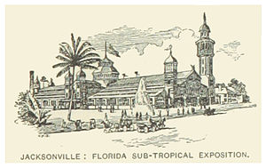
The Sub-Tropical Exposition was held from January until May 1888 in Jacksonville, Florida and seasonally in two subsequent years. Grover Cleveland attended the opening. The exposition building was designed by Ellis & McClure.

Jacksonville Jewish Center
United States historic place
Distance: Approx. 1797 meters
Latitude and longitude: 30.339463,-81.658367
The Jacksonville Jewish Center was formed by Orthodox Jewish families in Jacksonville, Florida. The congregation incorporated as the Hebrew Orthodox Congregation B'nai Israel in 1901. The congregation grew and a synagogue was built at the corner of Jefferson and Duval Streets in 1907.
Weather in this IP's area
clear sky
10 Celsius
9 Celsius
8 Celsius
12 Celsius
1025 hPa
65 %
1025 hPa
1024 hPa
10000 meters
3.6 m/s
300 degree
