Country:
 USA
USARegion:
City:
Latitude and Longitude:
Time Zone:
Postal Code:
IP information under different IP Channel
ip-api
Country
Region
City
ASN
Time Zone
ISP
Blacklist
Proxy
Latitude
Longitude
Postal
Route
IPinfo
Country
Region
City
ASN
Time Zone
ISP
Blacklist
Proxy
Latitude
Longitude
Postal
Route
MaxMind
Country
Region
City
ASN
Time Zone
ISP
Blacklist
Proxy
Latitude
Longitude
Postal
Route
Luminati
Country
USASN
Time Zone
America/Chicago
ISP
INTERNAP-BLK3
Latitude
Longitude
Postal
db-ip
Country
Region
City
ASN
Time Zone
ISP
Blacklist
Proxy
Latitude
Longitude
Postal
Route
ipdata
Country
Region
City
ASN
Time Zone
ISP
Blacklist
Proxy
Latitude
Longitude
Postal
Route
Popular places and events near this IP address

Central Avenue station (BMT Myrtle Avenue Line)
New York City Subway station in Brooklyn
Distance: Approx. 448 meters
Latitude and longitude: 40.698015,-73.9252
The Central Avenue station is a station on the BMT Myrtle Avenue Line of the New York City Subway. Located at Myrtle Avenue and Cedar Street in Bushwick, Brooklyn, it is served by the M train at all times.
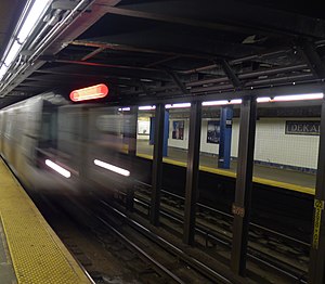
DeKalb Avenue station (BMT Canarsie Line)
New York City Subway station in Brooklyn
Distance: Approx. 414 meters
Latitude and longitude: 40.704294,-73.919277
The DeKalb Avenue station is a station on the BMT Canarsie Line of the New York City Subway. Located at the intersection of Wyckoff and DeKalb Avenues in Bushwick, Brooklyn, it is served by the L train at all times.

Knickerbocker Avenue station
New York City Subway station in Brooklyn
Distance: Approx. 391 meters
Latitude and longitude: 40.698731,-73.918376
The Knickerbocker Avenue station is a station on the BMT Myrtle Avenue Line of the New York City Subway. Located at the intersection of Myrtle and Knickerbocker Avenues in Bushwick, Brooklyn, it is served by the M train at all times.
Saint Frances Cabrini School (Brooklyn)
Private, roman catholic school in Brooklyn, New York, United States
Distance: Approx. 384 meters
Latitude and longitude: 40.7,-73.92611111
Saint Frances Cabrini Catholic Academy was a small Catholic elementary and middle school in the neighborhood of Bushwick in Brooklyn, New York. The grades went from pre-K to eighth grade, and the school was associated with the National Catholic Educational Association (NCEA). The school closed June 2019, and it merged with “Saint Brigid Catholic Academy”, also in Brooklyn, to become “St.

Wyckoff Heights, New York City
Neighborhood in Brooklyn and Queens
Distance: Approx. 317 meters
Latitude and longitude: 40.703,-73.919
Wyckoff Heights is an area within the New York City boroughs of Brooklyn and Queens, straddling the border between Bushwick, Brooklyn, and southwest Ridgewood, Queens. Wyckoff Heights was urbanized starting in the late 19th century, and took its name from the Wyckoff family, who owned the land. The area was home first to many German immigrants, later followed by Italian and more recently Latino and Eastern-European residents.

Maria Hernandez Park
Public park in Brooklyn, New York
Distance: Approx. 285 meters
Latitude and longitude: 40.70308333,-73.92394444
Maria Hernandez Park is a municipal park in Bushwick, Brooklyn, New York City. It is located between Knickerbocker Avenue on the southwest to Irving Avenue on the northeast, and Starr Street on the northwest to Suydam Street on the southeast. The park is 6.87 acres (2.78 ha) and is near the Jefferson Street station of the New York City Subway (L train).

83rd Precinct Police Station and Stable
United States historic place
Distance: Approx. 165 meters
Latitude and longitude: 40.70166667,-73.92361111
The 83rd Precinct Police Station and Stable is a historic police station and stable located at the corner of DeKalb and Wilson Avenues in Bushwick, Brooklyn, New York City. It was built in 1894 in the Romanesque Revival style to a design by William Tubby. It was designated a landmark by the New York City Landmarks Preservation Commission in 1977, and was listed on the National Register of Historic Places in 1982.

Willoughby–Suydam Historic District
Historic district in New York, United States
Distance: Approx. 537 meters
Latitude and longitude: 40.70583333,-73.92055556
Willoughby–Suydam Historic District is a national historic district in Brooklyn, New York, New York. It consists of 50 contributing residential buildings built between 1902 and 1904. They are three story brick tenements that have two apartments per floor.

Wyckoff Heights Medical Center
Hospital in New York, United States
Distance: Approx. 516 meters
Latitude and longitude: 40.70416667,-73.91722222
Wyckoff Heights Medical Center is a 350-bed teaching hospital located in the Wyckoff Heights section of Bushwick, Brooklyn in New York City. The hospital is an academic affiliate of the NewYork-Presbyterian's Weill Cornell Medical College of Cornell University, the New York Medical College and New York Institute of Technology College of Osteopathic Medicine. The primary goal of the center is to train future physicians that are qualified medically and personably.
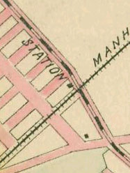
Ridgewood station (LIRR Evergreen Branch)
Distance: Approx. 331 meters
Latitude and longitude: 40.703678,-73.919847
Ridgewood (formerly known as DeKalb Avenue) was a train station in New York along the Evergreen Branch of the Long Island Rail Road. The station opened on July 14, 1878. DeKalb Avenue was renamed Ridgewood in June 1882.
Microscope Gallery
Distance: Approx. 580 meters
Latitude and longitude: 40.706291,-73.921167
Microscope Gallery is a contemporary art gallery located at 525 West 29th Street, New York, NY 10001. It was founded by artists and curators Elle Burchill and Andrea Monti and opened in September 2010 in Bushwick, Brooklyn, NY. The gallery specializes in time-based works, particularly film, sound, digital and performance art. Sculpture, installation, painting, mixed media and photographic works are also regularly shown at Microscope.

Radio Free Brooklyn
Radio station in Brooklyn, New York
Distance: Approx. 364 meters
Latitude and longitude: 40.698913,-73.925014
Radio Free Brooklyn (RFB) is a 501(c)3 non-profit organization that operates a freeform internet radio station headquartered at 199 Cook Street in the Bushwick neighborhood of Brooklyn, NY. The station currently offers 78 original radio programs produced by members of the organization, including 63 weekly live broadcasts originating from their Brooklyn studio. The station also airs two syndicated programs: Democracy Now! and The BradCast.
Weather in this IP's area
few clouds
22 Celsius
22 Celsius
20 Celsius
23 Celsius
1009 hPa
64 %
1009 hPa
1008 hPa
10000 meters
4.63 m/s
310 degree
20 %
06:58:39
18:27:47