Country:
 USA
USARegion:
City:
Latitude and Longitude:
Time Zone:
Postal Code:
IP information under different IP Channel
ip-api
Country
Region
City
ASN
Time Zone
ISP
Blacklist
Proxy
Latitude
Longitude
Postal
Route
IPinfo
Country
Region
City
ASN
Time Zone
ISP
Blacklist
Proxy
Latitude
Longitude
Postal
Route
MaxMind
Country
Region
City
ASN
Time Zone
ISP
Blacklist
Proxy
Latitude
Longitude
Postal
Route
Luminati
Country
USASN
Time Zone
America/Chicago
ISP
INTERNAP-2BLK
Latitude
Longitude
Postal
db-ip
Country
Region
City
ASN
Time Zone
ISP
Blacklist
Proxy
Latitude
Longitude
Postal
Route
ipdata
Country
Region
City
ASN
Time Zone
ISP
Blacklist
Proxy
Latitude
Longitude
Postal
Route
Popular places and events near this IP address

San Bruno, California
City in California, United States
Distance: Approx. 629 meters
Latitude and longitude: 37.62527778,-122.42527778
San Bruno (from Spanish 'St. Bruno') is a city in San Mateo County, California, United States, incorporated in 1914. The population was 43,908 at the 2020 United States Census.

Golden Gate National Cemetery
Veterans cemetery in San Mateo County, California
Distance: Approx. 976 meters
Latitude and longitude: 37.63527778,-122.43111111
Golden Gate National Cemetery is a United States national cemetery in California, located in the city of San Bruno, 12 miles (20 km) south of San Francisco. Because of the name and location, it is frequently confused with San Francisco National Cemetery, which dates to the 19th century and is in the Presidio of San Francisco, in view of the Golden Gate. Around 1937, San Francisco residents voted to bar the opening of new cemeteries within the city proper and, as a result, the site for the new national cemetery was selected south of the city limits in adjacent San Mateo County.
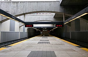
San Bruno station (BART)
Rapid transit station in San Francisco Bay Area
Distance: Approx. 1014 meters
Latitude and longitude: 37.6383,-122.4165
San Bruno station is a Bay Area Rapid Transit (BART) station located adjacent to the Tanforan shopping center in San Bruno, California in northern San Mateo County. It consists of two main tracks and a shared underground island platform. Service at the station began on June 22, 2003 as part of the BART San Mateo County Extension project that extended BART service southward from Colma to Millbrae and San Francisco International Airport.

The Shops at Tanforan
Regional shopping mall in the United States
Distance: Approx. 726 meters
Latitude and longitude: 37.636,-122.418
The Shops at Tanforan is a regional shopping mall in San Bruno, California, United States. It is located on the San Francisco Peninsula, 10 miles (16 km) south of San Francisco city limits. The site was originally used as a horse racing track from 1899 until 1964, when the grandstand was destroyed by fire.

Leo J. Ryan Federal Building
Distance: Approx. 302 meters
Latitude and longitude: 37.631975,-122.424693
The Leo J. Ryan Memorial Federal Building, also known as the Leo J. Ryan Memorial Federal Archives and Records Center, is a United States federal government archive and office facility which opened in 1973, and is located in San Bruno, California. It houses the National Archives and Records Administration (NARA) for the Pacific Sierra Region of the United States. The building was posthumously renamed in honor and memory of congressman Leo Ryan, through Congressional legislation which passed in 1984.
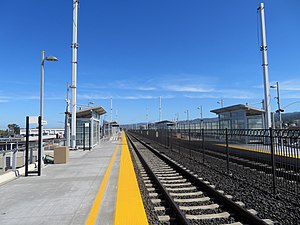
San Bruno station (Caltrain)
Train station in San Bruno, California, U.S.
Distance: Approx. 911 meters
Latitude and longitude: 37.63055556,-122.41166667
San Bruno station is a Caltrain station located in San Bruno, California. The station is located just northeast of downtown San Bruno, above the intersection of San Mateo and San Bruno Avenues, adjacent to Artichoke Joe's Casino.
San Bruno Park School District
School district in California, United States
Distance: Approx. 1070 meters
Latitude and longitude: 37.62166667,-122.41666667
San Bruno Park Elementary School District was created in 1906 in San Bruno, California to meet the needs of a growing population following the San Francisco earthquake and fire.

Tanforan Racetrack
Distance: Approx. 629 meters
Latitude and longitude: 37.6354361,-122.4190361
Tanforan Racetrack, also known as Tanforan Park, was a thoroughbred horse racing facility in San Bruno on the San Francisco Peninsula in California. It operated from November 4, 1899 to 1964. The horse racing track and buildings were constructed to serve a clientele from nearby San Francisco.

San Bruno pipeline explosion
2010 natural gas pipeline explosion which killed 8 people
Distance: Approx. 1961 meters
Latitude and longitude: 37.6225,-122.44194444
The San Bruno pipeline explosion occurred at 6:11 pm PDT on September 9, 2010, in San Bruno, California, when a 30-inch (76 cm) diameter steel natural gas pipeline owned by Pacific Gas & Electric exploded into flames in the Crestmoor residential neighborhood 2 miles (3.2 km) west of San Francisco International Airport near Skyline Boulevard and San Bruno Avenue. The loud roar and shaking led some residents of the area, first responders, and news media to initially believe that it was an earthquake or that a large airplane had crashed. It took crews nearly an hour to determine it was a gas pipeline explosion.

Artichoke Joe's Casino
Distance: Approx. 1042 meters
Latitude and longitude: 37.627552,-122.410699
Artichoke Joe's Casino is a card club in San Bruno, California. The club is owned by Dennis Sammut and managed, in part, by Ron Cox, a former Foster City councilman.

Tanforan Assembly Center
Place in California, United States
Distance: Approx. 629 meters
Latitude and longitude: 37.6354361,-122.4190361
The Tanforan Assembly Center was created to temporarily detain nearly 8,000 Japanese Americans, mostly from the San Francisco Bay Area, under the auspices of Executive Order 9066. After the order was signed in February 1942, the Wartime Civil Control Administration acquired Tanforan Racetrack on April 4 for use as a temporary assembly center; plans called for the site to be used to accommodate up to 10,000 "evacuees" while permanent relocation sites were being prepared further inland. The Tanforan Assembly Center began operation in late April 1942, the first stop for thousands who were forced to relocate and undergo internment during World War II. The majority were U.S. citizens of Japanese ancestry who were born in the United States.

YouTube headquarters shooting
2018 shooting in San Bruno, California
Distance: Approx. 448 meters
Latitude and longitude: 37.62816,-122.4263
On April 3, 2018, at approximately 12:46 p.m. PDT, a shooting occurred at the headquarters of the American video-sharing website YouTube in San Bruno, California. The shooter was identified as 38-year-old Nasim Najafi Aghdam, an Iranian-American woman, who entered through an exterior parking garage, approached an outdoor patio, and opened fire with a Smith & Wesson 9 mm semi-automatic pistol.
Weather in this IP's area
few clouds
13 Celsius
13 Celsius
11 Celsius
16 Celsius
1011 hPa
93 %
1011 hPa
1009 hPa
10000 meters
0.45 m/s
1.34 m/s
149 degree
22 %
06:46:23
19:28:17