Country:
 USA
USARegion:
City:
Latitude and Longitude:
Time Zone:
Postal Code:
IP information under different IP Channel
ip-api
Country
Region
City
ASN
Time Zone
ISP
Blacklist
Proxy
Latitude
Longitude
Postal
Route
IPinfo
Country
Region
City
ASN
Time Zone
ISP
Blacklist
Proxy
Latitude
Longitude
Postal
Route
MaxMind
Country
Region
City
ASN
Time Zone
ISP
Blacklist
Proxy
Latitude
Longitude
Postal
Route
Luminati
Country
USASN
Time Zone
America/Chicago
ISP
INTERNAP-2BLK
Latitude
Longitude
Postal
db-ip
Country
Region
City
ASN
Time Zone
ISP
Blacklist
Proxy
Latitude
Longitude
Postal
Route
ipdata
Country
Region
City
ASN
Time Zone
ISP
Blacklist
Proxy
Latitude
Longitude
Postal
Route
Popular places and events near this IP address

Palo Alto Airport
Airport in California, U.S.
Distance: Approx. 1214 meters
Latitude and longitude: 37.46111111,-122.115
Palo Alto Airport (IATA: PAO, ICAO: KPAO, FAA LID: PAO) is a general aviation airport in the city of Palo Alto in Santa Clara County, California, United States, near the south end of San Francisco Bay on the western shore.

Palo Alto Art Center
Multi-purpose center open to the public in Palo Alto, California
Distance: Approx. 1773 meters
Latitude and longitude: 37.4441,-122.1389
The Palo Alto Art Center is a multi-purpose center open to the public for art activities for all ages, located at 1313 Newell Road in Palo Alto, California. It is managed by the City of Palo Alto, California and supported by the non-profit Palo Alto Art Center Foundation (PAACF). The center is located adjacent to Rinconada Park and the Rinconada Public Library.

Silicon Valley International School
Private school in Palo Alto, Santa Clara County, CA, USA
Distance: Approx. 382 meters
Latitude and longitude: 37.4520295,-122.1252189
Silicon Valley International School, colloquially INTL, (pronounced "international"), is a private grade day school located in Silicon Valley, with two campuses in Palo Alto (formerly International School of the Peninsula, ISTP) and Menlo Park (formerly Alto International School). Silicon Valley International School teaches in English language, Mandarin Chinese, French language and German language. INTL is an International Baccalaureate World School, and teaches the Primary Years Programme (PYP), the Middle Years Programme (MYP) and the Diploma Programme (DP).

San Francisquito Creek
River in California, United States
Distance: Approx. 1725 meters
Latitude and longitude: 37.46611111,-122.11527778
San Francisquito Creek (Spanish for "Little San Francisco"—the "little" referring to size of the settlement compared to Mission San Francisco de Asís) is a creek that flows into southwest San Francisco Bay in California, United States. Historically it was called the Arroyo de San Francisco by Juan Bautista de Anza in 1776. San Francisquito Creek courses through the towns of Portola Valley and Woodside, as well as the cities of Menlo Park, Palo Alto, and East Palo Alto.

CK-12 Foundation
California-based non-profitable organization
Distance: Approx. 2072 meters
Latitude and longitude: 37.43503056,-122.10960833
The CK-12 Foundation is a California-based non-profit organization which aims to increase access to low-cost K-12 education in the United States and abroad. CK-12 provides free and customizable K-12 open educational resources aligned to state curriculum standards. As of 2022, the foundation's tools were used by over 200,000,000 students worldwide.
Rancho Rinconada del Arroyo de San Francisquito
Mexican land grant in California
Distance: Approx. 1685 meters
Latitude and longitude: 37.45,-122.14
Rancho Rinconada del Arroyo de San Francisquito was a 2,230-acre (9.0 km2) Mexican land grant in present-day Santa Clara County, California given in 1841 by Governor Juan Alvarado to María Antonia Mesa. The name means "ranch at the bend in San Francisquito Creek". The grant was located south of San Francisquito Creek, and encompassed present day Menlo Park and downtown Palo Alto.
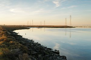
Palo Alto Baylands Nature Preserve
Marshland in the San Francisco Bay, California
Distance: Approx. 1587 meters
Latitude and longitude: 37.459608,-122.106412
The Palo Alto Baylands Nature Preserve, known officially as the Baylands Nature Preserve, is the largest tract of undisturbed marshland remaining in the San Francisco Bay. Fifteen miles of multi-use trails provide access to a unique mixture of tidal and fresh water habitats. The preserve encompasses 1,940 acres in both Palo Alto and East Palo Alto, and is owned by the city of Palo Alto, California, United States.

Barron Creek
River in California, United States
Distance: Approx. 2202 meters
Latitude and longitude: 37.43388889,-122.10916667
Barron Creek is a 5.8-mile-long (9.3 km) northward-flowing stream originating in the lower foothills of the Santa Cruz Mountains in Los Altos Hills in Santa Clara County, California, United States. It courses northerly through the cities of Los Altos Hills and Palo Alto, before joining Adobe Creek just south of U.S. Highway 101. As Adobe Creek, its waters continue northwards to southwest San Francisco Bay after crossing under Highway 101 and traversing the Palo Alto Flood Basin.
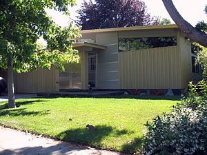
Green Gables (Palo Alto, California)
Historic place in California, United States
Distance: Approx. 670 meters
Latitude and longitude: 37.44583333,-122.12416667
Green Gables is a 1950s subdivision located in Palo Alto, California, United States. The subdivision was developed by Joseph Eichler, whose company built its first 63 homes in 1950. Eichler hired the architecture firm Anshen & Allen to design the one-story modernist houses.

Palo Alto Junior Museum and Zoo
Distance: Approx. 2222 meters
Latitude and longitude: 37.4438,-122.1443
Palo Alto Junior Museum and Zoo is located in Palo Alto, California and part of the City of Palo Alto's Community Services Department (CSD). It was founded in 1934 by Josephine O’Hara in the basement of a local elementary school. The small zoo holds approximately 200 species of mostly indigenous wildlife such as bobcats, raccoons, hedgehogs, ducks, bats, snakes and more.
Eastside College Preparatory School
School in East Palo Alto, CA, United States
Distance: Approx. 1691 meters
Latitude and longitude: 37.463626,-122.132178
Eastside College Preparatory School is a private high school in East Palo Alto, California, with a focus on readying first-generation students from low-income families to attend and succeed in 4-year colleges. It includes boarding facilities.

Hooks Island
Island in San Francisco Bay, California
Distance: Approx. 2145 meters
Latitude and longitude: 37.45611111,-122.0975
Hooks Island is an uninhabited, approximately 36-acre (15 ha) tidal salt marsh island in San Francisco Bay, in Palo Alto, California, United States. In the 2010s, it was observed to be a home for tens of near-endangered California clapper rails.
Weather in this IP's area
clear sky
14 Celsius
14 Celsius
12 Celsius
16 Celsius
1011 hPa
90 %
1011 hPa
1011 hPa
10000 meters
1.54 m/s
290 degree
06:45:18
19:26:58