70.42.11.148 - IP Lookup: Free IP Address Lookup, Postal Code Lookup, IP Location Lookup, IP ASN, Public IP
Country:
Region:
City:
Location:
Time Zone:
Postal Code:
IP information under different IP Channel
ip-api
Country
Region
City
ASN
Time Zone
ISP
Blacklist
Proxy
Latitude
Longitude
Postal
Route
Luminati
Country
ASN
Time Zone
America/Chicago
ISP
ASN-INTERNAP-BLK
Latitude
Longitude
Postal
IPinfo
Country
Region
City
ASN
Time Zone
ISP
Blacklist
Proxy
Latitude
Longitude
Postal
Route
IP2Location
70.42.11.148Country
Region
california
City
los altos
Time Zone
America/Los_Angeles
ISP
Language
User-Agent
Latitude
Longitude
Postal
db-ip
Country
Region
City
ASN
Time Zone
ISP
Blacklist
Proxy
Latitude
Longitude
Postal
Route
ipdata
Country
Region
City
ASN
Time Zone
ISP
Blacklist
Proxy
Latitude
Longitude
Postal
Route
Popular places and events near this IP address

Los Altos Hills, California
City in California, United States
Distance: Approx. 535 meters
Latitude and longitude: 37.37138889,-122.1375
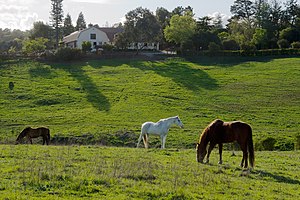
Los Altos Hills (US: ; Los Altos, Spanish for "The Heights") is an incorporated town in Santa Clara County, California, United States. The population was 8,489 at the 2020 census. The town is known for its affluence and expensive residential real estate.
Foothill College
College in Los Altos Hills, California
Distance: Approx. 928 meters
Latitude and longitude: 37.3613,-122.1289
Foothill College is a public community college in Los Altos Hills, California. It is part of the Foothill–De Anza Community College District. It was founded on January 15, 1957, and offers 84 Associate degree programs, 2 Bachelor's degree programs, and 124 certificate programs.

Pinewood School, Los Altos
Private, non-sectarian school in the United States
Distance: Approx. 2761 meters
Latitude and longitude: 37.36753889,-122.10581667
Pinewood School is a private, non-sectarian college preparatory school in the affluent Silicon Valley communities of Los Altos and Los Altos Hills, in Santa Clara County, California. The school was founded as an extracurricular center for performing arts but in the 1960’s, they renovated to become a full time school. They are made up of 3 campuses, Lower campus, Middle Campus, and Upper Campus.

Foothill Observatory
Observatory
Distance: Approx. 621 meters
Latitude and longitude: 37.363125,-122.13151389
Foothill Observatory is an astronomical observatory owned and operated by Peninsula Astronomical Society (PAS) and Foothill College. It is located on the college's campus in Los Altos Hills, California (US). The observatory is used by students enrolled in the introductory astronomy lab on campus, which is part of the college's thriving astronomy for non-scientists program, serving over 800 students per year.
Hidden Villa
Non-profit organisation in the USA
Distance: Approx. 2717 meters
Latitude and longitude: 37.351361,-122.160987
Hidden Villa is a United States nonprofit educational organization teaching programs on environmental and multicultural awareness. In 1924, Frank and Josephine Duveneck founded this working organic farm and wilderness area on land comprising the upper Adobe Creek watershed on the foothills of Black Mountain in Los Altos Hills, California, part of the Santa Cruz Mountains. Hidden Villa is important historically as the site of the West's first American youth hostel and the nation's first multicultural children's summer camp.

Rancho La Purísima Concepción
Template for California Historical Landmarks in Santa Clara County.
Distance: Approx. 1884 meters
Latitude and longitude: 37.38,-122.15
Rancho La Purísima Concepción was a 4,439-acre (17.96 km2) Mexican land grant in present day Santa Clara County, California given in 1840 by Governor Juan Alvarado to José Gorgonio and his son José Ramon, Ohlone Native Americans. The granted extended from Matadero Creek (Rancho Corte de Madera) to Adobe Creek and encompassed present day Los Altos Hills.

Los Altos History Museum
Distance: Approx. 2737 meters
Latitude and longitude: 37.381039,-122.111956
The Los Altos History Museum (LAHM) is a museum in Los Altos, California. Founded in 2001, the museum showcases the history of Los Altos and surrounding areas, including the transformation of the agricultural paradise once known as the "Valley of Heart's Delight" into the high-tech Silicon Valley. The Los Altos History Museum is situated in one of the few remaining apricot orchards in the San Francisco Bay area.

Purisima Creek (Santa Clara County)
River in California, United States
Distance: Approx. 1706 meters
Latitude and longitude: 37.36777778,-122.11777778
Purisima Creek is a 2-mile-long (3.2 km) eastward-flowing stream originating in Los Altos Hills in Santa Clara County, California, United States. It is a tributary of Adobe Creek which it joins just after entering Los Altos.

David and Lucile Packard Foundation Headquarters
Office in California, United States
Distance: Approx. 2264 meters
Latitude and longitude: 37.37645,-122.11461
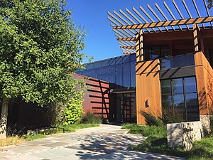
The David and Lucile Packard Foundation Headquarters is the corporate headquarters of the David and Lucile Packard Foundation, located in Los Altos, California. The Packard Foundation was created in 1964 by David Packard and his wife Lucile Salter Packard, one of the top 100 grant-making foundations in the United States, with the goals of improving the lives of children, enabling the creative pursuit of science, advancing reproductive health, and conserving and restoring the Earth’s natural systems. The David and Lucile Packard Foundation Headquarters is designed by EHDD to be the largest net zero energy building in California, and it has successfully reduced the energy use by 65% over conventional buildings.
Lantarnam Hall
Historic house in California, United States
Distance: Approx. 1731 meters
Latitude and longitude: 37.35666667,-122.12194444
Lantarnam Hall is a historic mansion in Los Altos Hills, California. It was built in 1914 to 1916 for Percy Morgan, a director of Wells Fargo and trustee of Stanford University. The house was later repurposed as a school.
Willard Griffin House and Carriage House
Historic house in Santa Clara County, California, United States
Distance: Approx. 1181 meters
Latitude and longitude: 37.36194444,-122.125
The Willard Griffin House and Carriage House is a historic mansion and carriage house located in Los Altos, California. The estate, constructed in 1901, features a three-story main house designed in the American Craftsman style. The Willard Griffin House and Carriage House was placed on the National Register of Historic Places on April 13, 1977.
Los Altos station
Former railway station
Distance: Approx. 2071 meters
Latitude and longitude: 37.377202,-122.117764
Los Altos station is a former railway station in Los Altos, California. The station's establishment marked the beginning of the town as the Mayfield Cutoff was built through the area in 1907. Initially, Southern Pacific steam trains stopped at the two boxcars which made up the station.
Weather in this IP's area
light intensity drizzle
11 Celsius
10 Celsius
9 Celsius
12 Celsius
1019 hPa
92 %
1019 hPa
1004 hPa
10000 meters
2.57 m/s
330 degree
75 %
