Country:
Region:
City:
Latitude and Longitude:
Time Zone:
Postal Code:
IP information under different IP Channel
ip-api
Country
Region
City
ASN
Time Zone
ISP
Blacklist
Proxy
Latitude
Longitude
Postal
Route
Luminati
Country
Region
ca
City
forestville
ASN
Time Zone
America/Los_Angeles
ISP
AS-SONICTELECOM
Latitude
Longitude
Postal
IPinfo
Country
Region
City
ASN
Time Zone
ISP
Blacklist
Proxy
Latitude
Longitude
Postal
Route
db-ip
Country
Region
City
ASN
Time Zone
ISP
Blacklist
Proxy
Latitude
Longitude
Postal
Route
ipdata
Country
Region
City
ASN
Time Zone
ISP
Blacklist
Proxy
Latitude
Longitude
Postal
Route
Popular places and events near this IP address

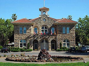
Sonoma County, California
County in California, United States
Distance: Approx. 3000 meters
Latitude and longitude: 38.51,-122.93
Sonoma County ( ) is a county located in the U.S. state of California. As of the 2020 United States Census, its population was 488,863. Its seat of government and largest city is Santa Rosa.

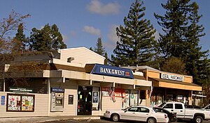
Forestville, California
Census-designated place in California, United States
Distance: Approx. 1900 meters
Latitude and longitude: 38.48166667,-122.89611111
Forestville is a census-designated place (CDP) in Sonoma County, California, United States. It was settled during the late 1860s and was originally spelled Forrestville after one of its founders. The spelling long ago became standardized with one "r".

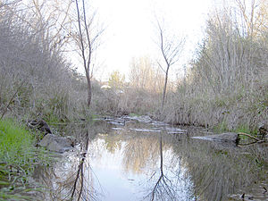
Mark West Creek
Stream in the state of California
Distance: Approx. 725 meters
Latitude and longitude: 38.49388889,-122.89305556
Mark West Creek is a 29.9-mile-long (48.1 km) stream that rises in the Mayacamas Mountains of Sonoma County, California, United States. Tributaries of Mark West Creek include Porter Creek and Hummingbird Creek, both of which originate in the same mountain range. Discharge waters of Mark West Creek reach the Russian River after a confluence with the Laguna de Santa Rosa.

KJOR
Radio station in Windsor, California
Distance: Approx. 4738 meters
Latitude and longitude: 38.54111111,-122.90138889
KJOR (104.1 FM) is a radio station broadcasting a Classic Regional Mexican and Ranchera music radio format. Licensed to Windsor, California, United States, it serves the Santa Rosa area.
Green Valley Creek
Stream in California
Distance: Approx. 1093 meters
Latitude and longitude: 38.50472222,-122.90861111
Green Valley Creek is a 10.7-mile-long (17.2 km) stream in Sonoma County, California, United States, which springs from the hills above the Bohemian Grove and is a tributary of the Russian River.

Windsor Creek
River in California, United States
Distance: Approx. 4305 meters
Latitude and longitude: 38.49666667,-122.84944444
Windsor Creek is an 8.8-mile-long (14.2 km) southward-flowing stream in Sonoma County, California, United States, which rises near Healdsburg, California, and feeds into Mark West Creek west of the Sonoma County Airport. Its waters reach the Pacific Ocean by way of the Russian River.

Steelhead Beach Regional Park
Distance: Approx. 188 meters
Latitude and longitude: 38.5,-122.9
Steelhead Beach Regional Park is a regional park on the Russian River north of Forestville, California, U.S.A. that is maintained by the Sonoma County Regional Parks Department. The day use fee is $7 per vehicle.
El Molino High School
Public school in Forestville, California, United States
Distance: Approx. 2073 meters
Latitude and longitude: 38.48166667,-122.88888889
El Molino High School was a public four-year comprehensive high school located at 7050 Covey Road in Forestville, California, United States. El Molino High School serves the West Sonoma County Union High School District. Matt Dunkle is the principal.
Rancho El Molino
Distance: Approx. 3253 meters
Latitude and longitude: 38.48,-122.87
Rancho El Molino was a 17,892-acre (72.41 km2) Mexican land grant in present-day Sonoma County, California granted by Governor José Figueroa in 1833 to John B.R. Cooper. The grant was officially confirmed by Governor Nicolás Gutiérrez in 1836. "Molino" means "mill" in Spanish, and the name refers to Cooper's sawmill.

Cooper's Sawmill
Historic site in Sonoma County
Distance: Approx. 629 meters
Latitude and longitude: 38.49346,-122.8958
Cooper's Sawmill is a California Historical Landmark located almost two miles north of Forestville, California, and is located in the jurisdiction of Santa Rosa, in the United States. It was the site of the first power-operated sawmill used for commercial purposes in California.
Wilson Grove, California
Unincorporated community in California, United States
Distance: Approx. 4334 meters
Latitude and longitude: 38.51666667,-122.85472222
Wilson Grove is an unincorporated community in Sonoma County, California, United States.
Hacienda, Sonoma County, California
Distance: Approx. 2898 meters
Latitude and longitude: 38.51138889,-122.92777778
Hacienda (also Cosmo) is a community in Sonoma County, California. It is located west of Santa Rosa on the Russian River. First settled in 1871, it was served by the Northwestern Pacific Railroad from 1876 to 1935.
Weather in this IP's area
overcast clouds
18 Celsius
17 Celsius
17 Celsius
20 Celsius
1015 hPa
44 %
1015 hPa
1013 hPa
10000 meters
0.89 m/s
0.89 m/s
225 degree
96 %
06:47:32
17:03:32
