70.33.17.246 - IP Lookup: Free IP Address Lookup, Postal Code Lookup, IP Location Lookup, IP ASN, Public IP
Country:
 USA
USARegion:
City:
Location:
Time Zone:
Postal Code:
ISP:
ASN:
language:
User-Agent:
Proxy IP:
Blacklist:
IP information under different IP Channel
ip-api
Country
Region
City
ASN
Time Zone
ISP
Blacklist
Proxy
Latitude
Longitude
Postal
Route
db-ip
Country
Region
City
ASN
Time Zone
ISP
Blacklist
Proxy
Latitude
Longitude
Postal
Route
IPinfo
Country
Region
City
ASN
Time Zone
ISP
Blacklist
Proxy
Latitude
Longitude
Postal
Route
IP2Location
70.33.17.246Country
usRegion
montana
City
pony
Time Zone
America/Denver
ISP
Language
User-Agent
Latitude
Longitude
Postal
ipdata
Country
Region
City
ASN
Time Zone
ISP
Blacklist
Proxy
Latitude
Longitude
Postal
Route
Popular places and events near this IP address

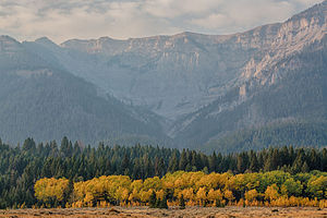
Tobacco Root Mountains
Mountain in the state of Montana
Distance: Approx. 6628 meters
Latitude and longitude: 45.555,-111.975
The Tobacco Root Mountains lie in the northern Rocky Mountains, between the Jefferson and Madison Rivers in southwest Montana. The highest peak is Hollowtop at 10,604 feet (3,232 m). The range contains 43 peaks rising to elevations greater than 10,000 feet (3048 m).
Centennial Mountains
Mountain range in Idaho and Montana, United States
Distance: Approx. 5658 meters
Latitude and longitude: 45.60277778,-112.00694444
The Centennial Mountains are the southernmost sub-range of the Bitterroot Range in the U.S. states of Idaho and Montana. The Centennial Mountains include the Western and Eastern Centennial Mountains. The range extends east from Monida Pass along the Continental Divide to Henrys Fork 48 km (30 mi) NNW of Ashton, Idaho; bounded on the west by Beaver Creek, on the north by Centennial Valley and Henrys Lake Mountains, on the east by Henrys Lake Flat, and on the south by Shotgun Valley and the Snake River Plain.

Mammoth, Montana
Census-designated place in Montana, United States
Distance: Approx. 9444 meters
Latitude and longitude: 45.66916667,-112.01777778
Mammoth is an unincorporated community and census-designated place (CDP) in Madison County, Montana, United States. It is in the northern part of the county, in the valley of the South Boulder River within the northern end of the Tobacco Root Mountains. Via the South Boulder River, it is part of the Jefferson River watershed, one of the headwaters of the Missouri River.
Weather in this IP's area
broken clouds
-20 Celsius
-24 Celsius
-20 Celsius
-20 Celsius
1037 hPa
90 %
1037 hPa
790 hPa
3515 meters
1.39 m/s
1.52 m/s
9 degree
69 %