69.84.47.137 - IP Lookup: Free IP Address Lookup, Postal Code Lookup, IP Location Lookup, IP ASN, Public IP
Country:
Region:
City:
Location:
Time Zone:
Postal Code:
ISP:
ASN:
language:
User-Agent:
Proxy IP:
Blacklist:
IP information under different IP Channel
ip-api
Country
Region
City
ASN
Time Zone
ISP
Blacklist
Proxy
Latitude
Longitude
Postal
Route
db-ip
Country
Region
City
ASN
Time Zone
ISP
Blacklist
Proxy
Latitude
Longitude
Postal
Route
IPinfo
Country
Region
City
ASN
Time Zone
ISP
Blacklist
Proxy
Latitude
Longitude
Postal
Route
IP2Location
69.84.47.137Country
Region
ohio
City
kidron
Time Zone
America/New_York
ISP
Language
User-Agent
Latitude
Longitude
Postal
ipdata
Country
Region
City
ASN
Time Zone
ISP
Blacklist
Proxy
Latitude
Longitude
Postal
Route
Popular places and events near this IP address

Apple Creek, Ohio
Village in Ohio, United States
Distance: Approx. 7792 meters
Latitude and longitude: 40.75055556,-81.83555556
Apple Creek is a village in East Union Township, Wayne County, Ohio, United States. The population was 1,188 at the 2020 census. The village takes its name from nearby Apple Creek.

Dalton, Ohio
Village in Ohio, United States
Distance: Approx. 7387 meters
Latitude and longitude: 40.79944444,-81.70361111
Dalton is a village in Wayne County, Ohio, United States. The 2020 census indicated a population of 1,927.

Mount Eaton, Ohio
Village in Ohio, United States
Distance: Approx. 6210 meters
Latitude and longitude: 40.69472222,-81.70222222
Mount Eaton is a village in Wayne County, Ohio, United States. The population was 171 at the 2020 census.

East Union Township, Ohio
Township in Ohio, United States
Distance: Approx. 6860 meters
Latitude and longitude: 40.76222222,-81.82027778
East Union Township is one of the sixteen townships of Wayne County, Ohio, United States. The 2020 census found 6,946 people in the township.

Paint Township, Wayne County, Ohio
Township in Ohio, United States
Distance: Approx. 5720 meters
Latitude and longitude: 40.69694444,-81.70833333
Paint Township is one of the sixteen townships of Wayne County, Ohio, United States. The 2020 census found 3,458 people in the township.

Sugar Creek Township, Wayne County, Ohio
Township in Ohio, United States
Distance: Approx. 5167 meters
Latitude and longitude: 40.77944444,-81.71055556
Sugar Creek Township is one of the sixteen townships of Wayne County, Ohio, United States. The 2020 census found 7,187 people in the township.

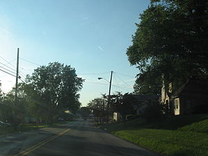
Kidron, Ohio
CDP in Ohio, United States
Distance: Approx. 425 meters
Latitude and longitude: 40.74388889,-81.74666667
Kidron is a census-designated place in southwestern Sugar Creek Township, Wayne County, Ohio, United States. The population was 966 at the 2020 census.

Waynedale High School
Public, co-ed school in Apple Creek, Wayne County, Ohio, United States
Distance: Approx. 5711 meters
Latitude and longitude: 40.737222,-81.811667
Waynedale High School is a public high school in Apple Creek, Ohio, United States. It is the only high school in the Waynedale Local School District. They are nicknamed the "Golden Bears" and wear the colors of brown and gold for athletic events.

Central Christian High School (Kidron, Ohio)
Private, co-ed school in Kidron, Ohio, United States
Distance: Approx. 1161 meters
Latitude and longitude: 40.751,-81.743
Central Christian School is a private Mennonite Christian school in Kidron, Ohio. It is a coed school, and they serve 330 students in grades Kindergarten through 12.
Kingsway Christian School
Private christian school in Orrville, Ohio, United States
Distance: Approx. 7075 meters
Latitude and longitude: 40.798091,-81.779889
Kingsway Christian School is a private, coeducational Christian school located south of Orrville, Ohio and west of Riceland. It serves students in grades K-12.
Maysville, Wayne County, Ohio
Unincorporated community in Ohio, U.S.
Distance: Approx. 6324 meters
Latitude and longitude: 40.69722222,-81.7925
Maysville is an unincorporated community in Wayne County, in the U.S. state of Ohio.
West Lebanon, Ohio
Unincorporated community in Ohio, U.S.
Distance: Approx. 6707 meters
Latitude and longitude: 40.72444444,-81.6675
West Lebanon is an unincorporated community in Wayne County, in the U.S. state of Ohio.
Weather in this IP's area
light rain
1 Celsius
-5 Celsius
-0 Celsius
3 Celsius
1008 hPa
93 %
1008 hPa
967 hPa
10000 meters
8.75 m/s
11.83 m/s
290 degree
100 %