Country:
 USA
USARegion:
City:
Latitude and Longitude:
Time Zone:
Postal Code:
IP information under different IP Channel
ip-api
Country
Region
City
ASN
Time Zone
ISP
Blacklist
Proxy
Latitude
Longitude
Postal
Route
IPinfo
Country
Region
City
ASN
Time Zone
ISP
Blacklist
Proxy
Latitude
Longitude
Postal
Route
MaxMind
Country
Region
City
ASN
Time Zone
ISP
Blacklist
Proxy
Latitude
Longitude
Postal
Route
Luminati
Country
USASN
Time Zone
America/Chicago
ISP
AMAZON-AS
Latitude
Longitude
Postal
db-ip
Country
Region
City
ASN
Time Zone
ISP
Blacklist
Proxy
Latitude
Longitude
Postal
Route
ipdata
Country
Region
City
ASN
Time Zone
ISP
Blacklist
Proxy
Latitude
Longitude
Postal
Route
Popular places and events near this IP address

Castlewood, Colorado
Neighborhood in Arapahoe County, Colorado, United States
Distance: Approx. 2275 meters
Latitude and longitude: 39.5847104,-104.9010903
Castlewood is a neighborhood in the City of Centennial, Colorado. A former census-designated place (CDP), the population was 25,567 at the 2000 census. It has been a part of the City of Centennial since the city's incorporation in 2001.

Greenwood Village, Colorado
City in Colorado, United States
Distance: Approx. 2400 meters
Latitude and longitude: 39.61583333,-104.91138889
The City of Greenwood Village is a home rule municipality located in Arapahoe County, Colorado, United States. The city population was 15,691 at the 2020 United States Census. Greenwood Village is a part of the Denver–Aurora–Lakewood, CO Metropolitan Statistical Area and the Front Range Urban Corridor.
Arrow Electronics
American company
Distance: Approx. 2189 meters
Latitude and longitude: 39.590568,-104.869118
Arrow Electronics is an American Fortune 500 company headquartered in Centennial, Colorado. A global provider of electronic components and enterprise computing products, the company specializes in distribution and value-added services for original equipment manufacturers, value-added resellers, managed service providers, contract manufacturers and other commercial customers. The company was ranked No.
Denver Technological Center
Distance: Approx. 2410 meters
Latitude and longitude: 39.6241,-104.89468
Denver Technological Center, better known as The Denver Tech Center or DTC, is a business and economic trading center located in Colorado in the southeastern portion of the Denver Metropolitan Area, within portions of the cities of Denver and Greenwood Village. It is home to several major businesses and corporations. The DTC roughly corresponds to the area surrounding the I-25 corridor between I-225 and SH 88 (Arapahoe Road) and has a similar business community reputation to Irvine, California.
Cherry Creek, Colorado
Census Designated Place in Colorado, United States
Distance: Approx. 2227 meters
Latitude and longitude: 39.6094629,-104.8644692
Cherry Creek is an unincorporated community and a census-designated place (CDP) located in and governed by Arapahoe County, Colorado, United States. The CDP is a part of the Denver–Aurora–Lakewood, CO Metropolitan Statistical Area. The population of the Cherry Creek CDP was 11,488 at the United States Census 2020.

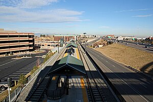
Orchard station (RTD)
Light rail station in Greenwood Village, Colorado
Distance: Approx. 1322 meters
Latitude and longitude: 39.6134,-104.8962
Orchard station is an light rail station in Greenwood Village, Colorado, United States. It is served by the E and R Lines, operated by the Regional Transportation District (RTD), and was opened on November 17, 2006. The station features a public art installation of stamped concrete illustrating magnified apple leaves and stainless steel birds entitled Orchard Memory.

Arapahoe at Village Center station
Light rail station in Greenwood Village, Colorado
Distance: Approx. 269 meters
Latitude and longitude: 39.6005,-104.8886
Arapahoe at Village Center station is an light rail station in Greenwood Village, Colorado, United States. It is served by the E and R Lines, operated by the Regional Transportation District (RTD), and was opened on November 17, 2006. In addition to numerous office buildings and corporate campuses, the station is the destination for people attending concerts at the Fiddler's Green Amphitheatre.
Dry Creek station
Light rail station in Centennial, Colorado
Distance: Approx. 2916 meters
Latitude and longitude: 39.5786,-104.8763
Dry Creek station is an light rail station in Centennial, Colorado, United States. It is served by the E and R Lines, operated by the Regional Transportation District (RTD), and was opened on November 17, 2006. The station features a public art installation of a series of stainless steel tubes holding hourglasses that contain pyrite entitled Fools Gold.
Pioneer Lines
Distance: Approx. 1098 meters
Latitude and longitude: 39.6122586,-104.8930335
Pioneer Lines (formerly Pioneer Railcorp) was a holding company for a number of American short-line railroads. Other subsidiaries offered locomotive and freight car leasing to its own railroads and to third parties, and also freight car cleaning. Pioneer Lines also had interests in real estate and newsletter publishing.
Fiddler's Green Amphitheatre
Concert venue in Colorado, United States
Distance: Approx. 503 meters
Latitude and longitude: 39.60049167,-104.89396111
Fiddler's Green Amphitheatre (formerly Comfort Dental Amphitheatre and Coors Amphitheatre) is an 18,000-person capacity amphitheatre located in Greenwood Village, Colorado, United States. It is the largest outdoor amphitheatre in the Denver metropolitan area and is generally open every year from May to September.

Museum of Outdoor Arts
Art museum in Greenwood Village, Colorado
Distance: Approx. 410 meters
Latitude and longitude: 39.6024266,-104.893743
Museum of Outdoor Arts (MOA) is a non-profit museum and gallery based in Englewood, Colorado. It was founded in 1981 by John W. Madden, Jr. and his daughter, Cynthia Madden Leitner.
Platt College (Colorado)
Private, for-profit educational institution
Distance: Approx. 1428 meters
Latitude and longitude: 39.6131,-104.8991
Platt College is a private, for-profit college in Greenwood Village, Colorado. Platt College currently offers only one degree program, a Bachelor of Science in Nursing (BSN) in 3 years. Platt College graduates are awarded a Bachelor of Science in Nursing degree.
Weather in this IP's area
scattered clouds
22 Celsius
21 Celsius
20 Celsius
23 Celsius
1001 hPa
38 %
1001 hPa
821 hPa
10000 meters
8.75 m/s
210 degree
40 %
06:43:04
19:04:48