69.72.122.168 - IP Lookup: Free IP Address Lookup, Postal Code Lookup, IP Location Lookup, IP ASN, Public IP
Country:
Region:
City:
Location:
Time Zone:
Postal Code:
ISP:
ASN:
language:
User-Agent:
Proxy IP:
Blacklist:
IP information under different IP Channel
ip-api
Country
Region
City
ASN
Time Zone
ISP
Blacklist
Proxy
Latitude
Longitude
Postal
Route
db-ip
Country
Region
City
ASN
Time Zone
ISP
Blacklist
Proxy
Latitude
Longitude
Postal
Route
IPinfo
Country
Region
City
ASN
Time Zone
ISP
Blacklist
Proxy
Latitude
Longitude
Postal
Route
IP2Location
69.72.122.168Country
Region
oklahoma
City
hulbert
Time Zone
America/Chicago
ISP
Language
User-Agent
Latitude
Longitude
Postal
ipdata
Country
Region
City
ASN
Time Zone
ISP
Blacklist
Proxy
Latitude
Longitude
Postal
Route
Popular places and events near this IP address

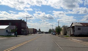
Hulbert, Oklahoma
Town in Oklahoma, United States
Distance: Approx. 7753 meters
Latitude and longitude: 35.93138889,-95.14527778
Hulbert is a town in Cherokee County, Oklahoma, United States, named after Ben H. Hulbert, a prominent Cherokee man. The population was 483 at the 2020 census, previously it was 590 in 2010. Our Lady of the Annunciation of Clear Creek Monastery is a Benedictine monastery located in Hulbert.

Shady Grove, Cherokee County, Oklahoma
Census-designated place in Oklahoma, United States
Distance: Approx. 9472 meters
Latitude and longitude: 35.9625,-95.12611111
Shady Grove is an unincorporated community and census-designated place (CDP) in Cherokee County, Oklahoma, United States. The population was 556 at the 2010 census. This is not to be confused with the similarly-named Shady Grove in McIntosh County, or the Shady Grove in Pawnee County.
Taylor Ferry, Oklahoma
Unincorporated community in Oklahoma, US
Distance: Approx. 4500 meters
Latitude and longitude: 35.94416667,-95.27916667
Taylor Ferry is an unincorporated community in Wagoner County, Oklahoma, United States, situated on Fort Gibson Lake. Taylor Ferry lies within the territory of the Cherokee Nation. The community was the site of a ferry crossing across the Grand River when Oklahoma was the Indian Territory during the 19th century.
Toppers, Oklahoma
Unincorporated community in Oklahoma, United States
Distance: Approx. 7733 meters
Latitude and longitude: 35.97055556,-95.30972222
Toppers is an unincorporated community in Wagoner County, Oklahoma, United States, situated on Fort Gibson Lake.

Fort Gibson Dam
Dam in Oklahoma, US
Distance: Approx. 8532 meters
Latitude and longitude: 35.869665,-95.230436
The Fort Gibson Dam is a gravity dam on the Grand (Neosho) River in Oklahoma, 5.4 mi (9 km) north of the town of Fort Gibson. The dam forms Fort Gibson Lake. The primary purposes of the dam and lake are flood control and hydroelectric power production, although supply of drinking water to local communities, as well as recreation, are additional benefits.

Sequoyah State Park
State park in Oklahoma, United States
Distance: Approx. 3723 meters
Latitude and longitude: 35.917877,-95.2510719
Sequoyah State Park, one of Oklahoma State Park's 32 parks, is a 2,200 acre peninsular recreation space on the eastern shore of Fort Gibson Lake in Cherokee County, Oklahoma. It is 8 miles (13 km) east of Wagoner, Oklahoma and 18 miles (29 km) west of Tahlequah, Oklahoma on State Highway 51. A shortleaf pine-lined drive leads you to the many amenities of the park including camping loops, Paradise Cove Marina, a golf course, Three Forks Nature Center, Sequoyah Riding Stables, and the state's largest state park lodge.
Sequoyah Bay State Park
State park in Oklahoma, United States
Distance: Approx. 7683 meters
Latitude and longitude: 35.886944,-95.272778
Sequoyah Bay State Park is on the western shore of Fort Gibson Lake in Wagoner County, Oklahoma. It is 4.3 miles (6.9 km) south of Wagoner, Oklahoma on State Highway 16. It offers several campgrounds, each named for a notable chief of the Five Civilized Tribes.
Whitehorn Cove, Oklahoma
Census-designated place in Oklahoma, United States
Distance: Approx. 7619 meters
Latitude and longitude: 36.00222222,-95.27805556
Whitehorn Cove is an unincorporated community and census-designated place (CDP) in Wagoner County, Oklahoma, United States. It was first listed as a CDP prior to the 2020 census. The CDP is in eastern Wagoner County, on the west shore of Fort Gibson Lake, a large reservoir on the Neosho River.
Weather in this IP's area
broken clouds
-8 Celsius
-13 Celsius
-8 Celsius
-8 Celsius
1037 hPa
34 %
1037 hPa
1010 hPa
10000 meters
2.38 m/s
4.36 m/s
36 degree
59 %