69.71.18.159 - IP Lookup: Free IP Address Lookup, Postal Code Lookup, IP Location Lookup, IP ASN, Public IP
Country:
Region:
City:
Location:
Time Zone:
Postal Code:
IP information under different IP Channel
ip-api
Country
Region
City
ASN
Time Zone
ISP
Blacklist
Proxy
Latitude
Longitude
Postal
Route
Luminati
Country
Region
mi
City
warren
ASN
Time Zone
America/Detroit
ISP
AS-NETZERO
Latitude
Longitude
Postal
IPinfo
Country
Region
City
ASN
Time Zone
ISP
Blacklist
Proxy
Latitude
Longitude
Postal
Route
IP2Location
69.71.18.159Country
Region
michigan
City
southfield
Time Zone
America/Detroit
ISP
Language
User-Agent
Latitude
Longitude
Postal
db-ip
Country
Region
City
ASN
Time Zone
ISP
Blacklist
Proxy
Latitude
Longitude
Postal
Route
ipdata
Country
Region
City
ASN
Time Zone
ISP
Blacklist
Proxy
Latitude
Longitude
Postal
Route
Popular places and events near this IP address

Lawrence Technological University
Private university in Southfield, Michigan, US
Distance: Approx. 3714 meters
Latitude and longitude: 42.47472222,-83.24888889
Lawrence Technological University (Lawrence Tech, LTU) is a private university in Southfield, Michigan. It was founded in 1932 in Highland Park, Michigan, as the Lawrence Institute of Technology (LIT) by Russell E. Lawrence. The university moved to Southfield in 1955 and has since expanded to 107 acres (43 ha).
WPXD-TV
TV station in Ann Arbor, Michigan
Distance: Approx. 1955 meters
Latitude and longitude: 42.48361111,-83.31222222
WPXD-TV (channel 31) is a television station licensed to Ann Arbor, Michigan, United States, serving as the Ion Television affiliate for the Detroit area. Owned by Inyo Broadcast Holdings, the station broadcasts from a transmitter on West 11 Mile Road in Southfield, Michigan. Channel 31 in Ann Arbor was inserted in 1973 at the request of Gershom Morningstar, a local resident.
Southfield High School
High school in Southfield, Michigan, United States
Distance: Approx. 2640 meters
Latitude and longitude: 42.47,-83.262
Southfield High School for the Arts and Technology is a public high school located in Southfield, Michigan. The school was founded in 1951. It serves grades 9–12 for the Southfield Public Schools.

American Center
Office/retail in Southfield-Detroit, United States
Distance: Approx. 2011 meters
Latitude and longitude: 42.49,-83.29888889
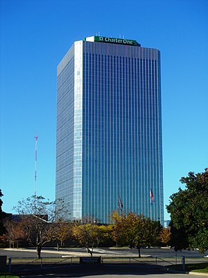
The American Center is a high-rise tower in the Metro Detroit suburb of Southfield, Michigan, built in 1975 as the corporate headquarters for the automaker American Motors Corporation (AMC), which was subsequently acquired by Chrysler Corporation in 1987. The building is located adjacent to Interstate 696, M-10, and US 24 interchange. Upgraded in 2001, the office tower has 27 floors, including a basement, and has been owned and managed since 2017 by Redico, a Southfield-based real estate developer.
WSHJ
Radio station in Southfield, Michigan
Distance: Approx. 2477 meters
Latitude and longitude: 42.47,-83.264
WSHJ (88.3 FM) is a high school radio station broadcasting an Urban Contemporary format. Licensed to Southfield, Michigan it first began broadcasting in 1967.
1947 PGA Championship
Golf tournament
Distance: Approx. 3540 meters
Latitude and longitude: 42.451,-83.262
The 1947 PGA Championship was the 29th PGA Championship, held June 18–24 at Plum Hollow Country Club in Southfield, Michigan, a suburb northwest of Detroit. Jim Ferrier won the match play championship, 2 and 1 over Chick Harbert in the Tuesday final; the winner's share was $3,500 and the runner-up's was $1,500. The match was tied after the first round, and again after 22 holes.
Plum Hollow Country Club
Distance: Approx. 3535 meters
Latitude and longitude: 42.45111111,-83.26194444
Plum Hollow Country Club is a country club located in Southfield, Michigan, a suburb northwest of Detroit The club is privately owned and was established in 1921. Plum Hollow was designed by architects Harry Colt and Charles Hugh Alison of the British firm Colt and Alison. The PGA Championship was held at its golf course in 1947; then a match play event, it was won by Jim Ferrier.
Beaumont Hospital, Farmington Hills
Hospital in Michigan, USA
Distance: Approx. 3765 meters
Latitude and longitude: 42.44658333,-83.32377778
Beaumont Hospital - Farmington Hills, formerly known as Botsford Hospital, is a 330-bed teaching hospital with level II trauma center status. Founded in 1965, the hospital is affiliated with Beaumont Health. The hospital earned three year accreditation from the American Osteopathic Association's Healthcare Facilities Accreditation Program in 2008.
Tel-Twelve Mall
Shopping mall in Michigan, United States
Distance: Approx. 3106 meters
Latitude and longitude: 42.499,-83.283
Tel-Twelve Mall is a shopping mall located in Southfield, Michigan, a suburb of Detroit, Michigan, United States. Developed as an enclosed mall in 1968, it was demolished and rebuilt in 2001 as a power center composed of big box tenants. Its anchor stores include Best Buy, DSW, Lowe's, Meijer, Michaels, Office Depot and PetSmart.
Holy Sepulchre Cemetery (Southfield, Michigan)
Cemetery in Oakland County, Michigan
Distance: Approx. 469 meters
Latitude and longitude: 42.471569,-83.29963
Holy Sepulchre Cemetery in Southfield, Michigan, is an American cemetery operated by the Roman Catholic Archdiocese of Detroit.

Mother of God Cathedral (Southfield, Michigan)
Church in Michigan, United States
Distance: Approx. 1238 meters
Latitude and longitude: 42.47620556,-83.27987778
Mother of God Cathedral also called Our Lady of Chaldeans is a Chaldean Catholic cathedral located in Southfield, Michigan, United States. It is the seat for the Eparchy of St. Thomas the Apostle of Detroit.

John Grace School
United States historic place
Distance: Approx. 3312 meters
Latitude and longitude: 42.44555556,-83.31166667
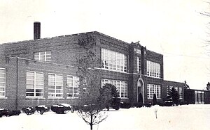
The John Grace School, also known as the District No. 9 Public School or the John Grace Park and Community Center, is a former school located at 21030 Indian Street in Southfield, Michigan. It was listed on the National Register of Historic Places in 2023.
Weather in this IP's area
light snow
-3 Celsius
-9 Celsius
-4 Celsius
-2 Celsius
1026 hPa
65 %
1026 hPa
1001 hPa
10000 meters
5.66 m/s
8.75 m/s
320 degree
100 %