69.71.123.101 - IP Lookup: Free IP Address Lookup, Postal Code Lookup, IP Location Lookup, IP ASN, Public IP
Country:
Region:
City:
Location:
Time Zone:
Postal Code:
ISP:
ASN:
language:
User-Agent:
Proxy IP:
Blacklist:
IP information under different IP Channel
ip-api
Country
Region
City
ASN
Time Zone
ISP
Blacklist
Proxy
Latitude
Longitude
Postal
Route
db-ip
Country
Region
City
ASN
Time Zone
ISP
Blacklist
Proxy
Latitude
Longitude
Postal
Route
IPinfo
Country
Region
City
ASN
Time Zone
ISP
Blacklist
Proxy
Latitude
Longitude
Postal
Route
IP2Location
69.71.123.101Country
Region
kansas
City
north newton
Time Zone
America/Chicago
ISP
Language
User-Agent
Latitude
Longitude
Postal
ipdata
Country
Region
City
ASN
Time Zone
ISP
Blacklist
Proxy
Latitude
Longitude
Postal
Route
Popular places and events near this IP address

Hesston, Kansas
City in Harvey County, Kansas
Distance: Approx. 9247 meters
Latitude and longitude: 38.14,-97.42694444
Hesston is a city in Harvey County, Kansas, United States. As of the 2020 census, the population of the city was 3,505. Large manufacturing facilities for AGCO (farm equipment) and Stanley Black & Decker (lawn mowers) are located in Hesston.

North Newton, Kansas
City in Harvey County, Kansas
Distance: Approx. 6784 meters
Latitude and longitude: 38.07666667,-97.3475
North Newton is a city in Harvey County, Kansas, United States. As of the 2020 census, the population of the city was 1,814. It is located between the north side of the city of Newton (separate entity) and the south side of Interstate I-135.

Walton, Kansas
City in Harvey County, Kansas
Distance: Approx. 5802 meters
Latitude and longitude: 38.11861111,-97.25833333
Walton is a city in Harvey County, Kansas, United States. It is named in honor of one of the 19th century stockholders of Atchison, Topeka and Santa Fe Railway. As of the 2020 census, the population of the city was 219.

Bethel College (Kansas)
Christian college in North Newton, Kansas, US
Distance: Approx. 6861 meters
Latitude and longitude: 38.0747,-97.3425
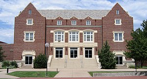
Bethel College is a private Christian college in North Newton, Kansas, United States.

Newton High School (Kansas)
High school in Newton, Kansas, United States
Distance: Approx. 9092 meters
Latitude and longitude: 38.059588,-97.364108
Newton High School is a public high school in Newton, Kansas, United States operated by Newton USD 373 school district, and serves students of grades 9 to 12. It is located on a 90-acre (360,000 m2) campus with a Cedar-tree surrounded parking lot.

Emma Township, Harvey County, Kansas
Township in Kansas, United States
Distance: Approx. 9095 meters
Latitude and longitude: 38.12916667,-97.42527778
Emma Township is a township in Harvey County, Kansas, United States. As of the 2000 census, its population was 4,181.

Highland Township, Harvey County, Kansas
Township in Kansas, United States
Distance: Approx. 671 meters
Latitude and longitude: 38.13888889,-97.31694444
Highland Township is a township in Harvey County, Kansas, United States. As of the 2000 census, its population was 415.
Thresher Stadium
Distance: Approx. 6537 meters
Latitude and longitude: 38.07805556,-97.34388889
Thresher Stadium is a sport stadium in North Newton, Kansas, United States. The facility is primarily used by the Bethel College for college football and men's and women's soccer teams. The stadium is also used for local high school and other community events.

West Branch Township, Marion County, Kansas
Township in Kansas, United States
Distance: Approx. 9310 meters
Latitude and longitude: 38.2176584,-97.3171879
West Branch Township is a township in Marion County, Kansas, United States. As of the 2010 census, the township population was 966, including the city of Goessel.

Zimmerdale, Kansas
Unincorporated community in Harvey County, Kansas
Distance: Approx. 6931 meters
Latitude and longitude: 38.10277778,-97.39
Zimmerdale is an unincorporated community in Harvey County, Kansas, United States. The community is located along Old Highway 81 and a railroad line between Hesston and Newton.

Walton Rural Life Center
Elementary school, charter school in Walton, Kansas, United States
Distance: Approx. 5583 meters
Latitude and longitude: 38.1182786,-97.2610953
Walton Rural Life Center was an agricultural charter elementary school in Walton, Kansas, United States, and operated by Newton USD 373 public school district. During the 2015–2016 school year there were 210 students at Walton Rural Life Center. It taught students from kindergarten to 4th grade and there were two classes for each grade.
Hesston USD 460
Public school district in Hesston, Kansas
Distance: Approx. 8954 meters
Latitude and longitude: 38.13972222,-97.42361111
Hesston USD 460 is a public unified school district headquartered in Hesston, Kansas, United States. The district includes the communities of Hesston, Zimmerdale, and nearby rural areas.
Weather in this IP's area
broken clouds
-9 Celsius
-15 Celsius
-9 Celsius
-9 Celsius
1037 hPa
63 %
1037 hPa
978 hPa
10000 meters
4.85 m/s
6.54 m/s
326 degree
60 %