Country:
 USA
USARegion:
City:
Latitude and Longitude:
Time Zone:
Postal Code:
IP information under different IP Channel
ip-api
Country
Region
City
ASN
Time Zone
ISP
Blacklist
Proxy
Latitude
Longitude
Postal
Route
IPinfo
Country
Region
City
ASN
Time Zone
ISP
Blacklist
Proxy
Latitude
Longitude
Postal
Route
MaxMind
Country
Region
City
ASN
Time Zone
ISP
Blacklist
Proxy
Latitude
Longitude
Postal
Route
Luminati
Country
USRegion
tx
City
navasota
ASN
Time Zone
America/Chicago
ISP
BRAZOSWIFI
Latitude
Longitude
Postal
db-ip
Country
Region
City
ASN
Time Zone
ISP
Blacklist
Proxy
Latitude
Longitude
Postal
Route
ipdata
Country
Region
City
ASN
Time Zone
ISP
Blacklist
Proxy
Latitude
Longitude
Postal
Route
Popular places and events near this IP address

Navasota, Texas
City in Texas, United States
Distance: Approx. 3361 meters
Latitude and longitude: 30.38333333,-96.08333333
Navasota is a city primarily in Grimes County, Texas, United States. The population was 7,643 at the 2020 census. In 2005, the Texas Legislature designated Navasota as the "Blues Capital of Texas" in honor of the late Mance Lipscomb, a Navasota native and blues musician.

Washington-on-the-Brazos, Texas
Unincorporated community in Texas, United States
Distance: Approx. 9729 meters
Latitude and longitude: 30.32527778,-96.15666667
Washington-on-the-Brazos is an unincorporated community along the Brazos River in Washington County, Texas, United States. The town is best known for being the site of the Convention of 1836 and the signing of the Texas Declaration of Independence. The town is named for Washington, Georgia, itself named for George Washington.
Navasota High School
Public school in Navasota, Texas, United States
Distance: Approx. 4699 meters
Latitude and longitude: 30.4006,-96.069
Navasota High School is a public high school located in the city of Navasota, Texas, USA and classified as a 4A school by the University Interscholastic League. It is a part of the Navasota Independent School District located in south central Grimes County. In 2016, the school was rated "Met Standard" by the Texas Education Agency.

Star of the Republic Museum
Distance: Approx. 9527 meters
Latitude and longitude: 30.3239,-96.1537
The Star of the Republic Museum, in Washington, Texas, United States, is the only museum in the state of Texas created specifically to collect and interpret the culture and history of the Republic of Texas from 1836 to 1846. Within the museum's two floors of exhibits, visitors can learn about the history of the time period through media experiences, as well as informative exhibits. The site of the Star of the Republic Museum was selected at Washington on the Brazos where elected delegates gathered on March 2, 1836, to declare Texas’ independence from Mexico.
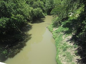
Navasota River
River in Texas, United States
Distance: Approx. 9252 meters
Latitude and longitude: 30.33166667,-96.15416667
The Navasota River is a river in east Texas, United States. It is about 125 miles (201 km) long, beginning near Mount Calm and flowing south into the Brazos River at a point where Brazos, Grimes, and Washington counties converge.
Wallace Pack Unit
Prison in Grimes County, Texas
Distance: Approx. 5642 meters
Latitude and longitude: 30.32444444,-96.10638889
The Wallace Pack Unit (P1) is a Texas Department of Criminal Justice (TDCJ) prison in unincorporated Grimes County, Texas, 5 miles (8.0 km) south of Navasota. It is along Farm to Market Road 1227, in proximity to Houston.
George Washington Carver High School (Navasota, Texas)
Public school in Navasota, Texas, U.S.
Distance: Approx. 2601 meters
Latitude and longitude: 30.3756,-96.0818
George Washington Carver High School was a public secondary school in Navasota, Texas. It served as the high school for black students beginning around 1870 and ending in 1968, when the schools were integrated. In 2008 the buildings were repurposed as the Carver Community Center and are owned by the Navasota George Washington Carver Alumni Association.
Weather in this IP's area
clear sky
28 Celsius
33 Celsius
27 Celsius
29 Celsius
1011 hPa
85 %
1011 hPa
1003 hPa
10000 meters
0.45 m/s
2.24 m/s
219 degree
1 %
07:11:13
19:24:35