Country:
Region:
City:
Latitude and Longitude:
Time Zone:
Postal Code:
IP information under different IP Channel
ip-api
Country
Region
City
ASN
Time Zone
ISP
Blacklist
Proxy
Latitude
Longitude
Postal
Route
Luminati
Country
Region
tx
City
collegestation
ASN
Time Zone
America/Chicago
ISP
BRAZOSWIFI
Latitude
Longitude
Postal
IPinfo
Country
Region
City
ASN
Time Zone
ISP
Blacklist
Proxy
Latitude
Longitude
Postal
Route
db-ip
Country
Region
City
ASN
Time Zone
ISP
Blacklist
Proxy
Latitude
Longitude
Postal
Route
ipdata
Country
Region
City
ASN
Time Zone
ISP
Blacklist
Proxy
Latitude
Longitude
Postal
Route
Popular places and events near this IP address

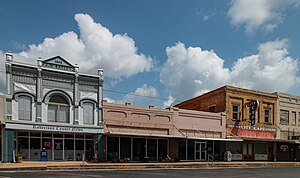
Hearne, Texas
City in Texas, United States
Distance: Approx. 996 meters
Latitude and longitude: 30.8725,-96.59388889
Hearne ( hurn) is a city in Robertson County, Texas, United States. As of the 2020 census, the city population was 4,544. The city is named for a family that settled in the area in the 19th century and promoted the construction of rail lines through the city.

Little River (Texas)
River in the United States
Distance: Approx. 8921 meters
Latitude and longitude: 30.84178,-96.67755
The Little River is a river in Central Texas in the Brazos River watershed. It is formed by the confluence of the Leon River and the Lampasas River near Little River, Texas in Bell County. It flows generally southeast for 75 miles (121 km) until it empties into the Brazos River about 5 miles (8.0 km) southwest of Hearne, at a site called Port Sullivan in Milam County.
KVLX
Radio station in Franklin, Texas
Distance: Approx. 4982 meters
Latitude and longitude: 30.88472222,-96.54138889
KVLX (103.9 FM, "K-LOVE") is a radio station owned by Educational Media Foundation (EMF) licensed to Franklin, Texas with studios in Bryan, Texas. The station carries EMF's K-LOVE contemporary Christian music format. The transmitter is located in Hearne, Texas.
Nashville, Texas
Distance: Approx. 7557 meters
Latitude and longitude: 30.82583333,-96.65277778
Nashville (also known as Nashville-on-the-Brazos) was a community, now a ghost town, on the southeastern bank of the Brazos River in present-day Milam County, Texas, United States. The town was surveyed in the fall of 1835, with Sterling C. Robertson as its founder. It was named in honor of Nashville, Tennessee, Robertson's birthplace.
Valley Junction, Texas
Unincorporated community in Texas, US
Distance: Approx. 5388 meters
Latitude and longitude: 30.84194444,-96.63777778
Valley Junction is a small unincorporated community in Robertson County, Texas, United States. It is located near what was formerly Robertson's Colony, the colony founded by Sterling C. Robertson when he moved from Nashville, Tennessee. Its coordinates are 30°50′31″N 96°38′16″W at an elevation of 276 feet (84 meters).

Camp Hearne
US Prisoner of War camp during World War Two
Distance: Approx. 3809 meters
Latitude and longitude: 30.8863,-96.6194
Camp Hearne, located in Hearne, Texas was a prisoner-of-war camp during the Second World War. Commissioned in 1942, Camp Hearne was one of the few camps that housed prisoners from all three Axis powers during the conflict. After its decommissioning and piecemeal sell-off by the United States government, the site remained abandoned for 70 years.
Weather in this IP's area
clear sky
18 Celsius
17 Celsius
17 Celsius
19 Celsius
1015 hPa
68 %
1015 hPa
1005 hPa
10000 meters
2.3 m/s
2.43 m/s
32 degree
06:48:26
17:32:08