69.36.202.101 - IP Lookup: Free IP Address Lookup, Postal Code Lookup, IP Location Lookup, IP ASN, Public IP
Country:
 USA
USARegion:
City:
Location:
Time Zone:
Postal Code:
ISP:
ASN:
language:
User-Agent:
Proxy IP:
Blacklist:
IP information under different IP Channel
ip-api
Country
Region
City
ASN
Time Zone
ISP
Blacklist
Proxy
Latitude
Longitude
Postal
Route
db-ip
Country
Region
City
ASN
Time Zone
ISP
Blacklist
Proxy
Latitude
Longitude
Postal
Route
IPinfo
Country
Region
City
ASN
Time Zone
ISP
Blacklist
Proxy
Latitude
Longitude
Postal
Route
IP2Location
69.36.202.101Country
usRegion
california
City
tulelake
Time Zone
America/Los_Angeles
ISP
Language
User-Agent
Latitude
Longitude
Postal
ipdata
Country
Region
City
ASN
Time Zone
ISP
Blacklist
Proxy
Latitude
Longitude
Postal
Route
Popular places and events near this IP address
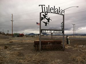
Tulelake, California
City in California, United States
Distance: Approx. 246 meters
Latitude and longitude: 41.95416667,-121.47583333
Tulelake ( TOO-lee-layk) is a city in northeastern Siskiyou County, California, United States. The town is named after nearby Tule Lake. Its population is 902 as of the 2020 census, down from 1,010 from the 2010 census.

First Battle of the Stronghold
Part of the Modoc War of 1872–1873
Distance: Approx. 6940 meters
Latitude and longitude: 41.90932,-121.53305
The First Battle of the Stronghold (January 17, 1873) was the second battle in the Modoc War of 1872–1873. The battle was fought between the United States Army under Lieutenant Colonel Frank Wheaton and a band of the Native American Modoc tribe from Oregon and California, led by Captain Jack (Kintpuash in Modoc). The US Army forces tried to dislodge the Modoc from the natural fortress, now called Captain Jack's Stronghold, in the lava beds along the south shore of Tule Lake in northeastern California.

Battle of Lost River
1872 battle of the Modoc War
Distance: Approx. 5885 meters
Latitude and longitude: 41.996,-121.524
The Battle of Lost River in November 1872 was the first battle in the Modoc War in the northwestern United States. The skirmish, which was fought near the Lost River along the California–Oregon border, was the result of an attempt by the U.S. 1st Cavalry Regiment of the United States Army to force a band of the Modoc tribe to relocate back to the Klamath Reservation, which they had left in objection of its conditions. In the subsequent war, Captain Jack of the Modoc and 53 warriors held off more than 1000 U.S. soldiers for 7 months in the area of the present-day Lava Beds National Monument.

Lost River (California)
River in California and Oregon, United States
Distance: Approx. 2909 meters
Latitude and longitude: 41.94,-121.50527778
Lost River begins and ends in a closed basin in northern California and southern Oregon in the United States. The river, 60 miles (97 km) long, flows in an arc from Clear Lake Reservoir in Modoc County, California, through Klamath County, Oregon, to Tule Lake in Siskiyou County, California. About 46 mi (74 km) of Lost River are in Oregon, and 14 miles (23 km) are in California.

Tule Lake
Seasonal lake on the California-Oregon border, United States
Distance: Approx. 6940 meters
Latitude and longitude: 41.90932,-121.53305
Tule Lake ( TOO-lee) is an intermittent lake covering an area of 13,000 acres (53 km2), 8.0 km (5.0 mi) long and 4.8 km (3.0 mi) across, in northeastern Siskiyou County and northwestern Modoc County in California, along the border with Oregon.

Klamath Basin National Wildlife Refuge Complex
Distance: Approx. 7318 meters
Latitude and longitude: 41.94666667,-121.565
The Klamath Basin National Wildlife Refuge Complex is a wildlife preserve operated by the United States Fish and Wildlife Service in the Klamath Basin of southern Oregon and northern California near Klamath Falls, Oregon. It consists of Bear Valley, Klamath Marsh and Upper Klamath National Wildlife Refuge (NWR) in southern Oregon and Lower Klamath, Tule Lake, and Clear Lake NWR in northern California. Lower Klamath NWR, established in 1908, was the first waterfowl refuge in the United States.

Tule Lake National Wildlife Refuge
Wildlife refuge in northern California, United States
Distance: Approx. 7318 meters
Latitude and longitude: 41.94666667,-121.565
The Tule Lake National Wildlife Refuge is a National Wildlife Refuge of the United States in northern California near the Oregon border. It covers 39,116 acres (15,830 ha) in the Tule Lake basin. It is part of the Klamath Basin National Wildlife Refuge Complex, and is a crucial part of the Pacific Flyway corridor for migratory birds.
Malin Airport
Airport in Malin, Oregon
Distance: Approx. 8375 meters
Latitude and longitude: 42.00098889,-121.39638056
Malin Airport (FAA LID: 4S7), is a public airport 1 mile (1.6 km) southeast of Malin in Klamath County, in the U.S. state of Oregon.

Camp Tulelake
American isolation camp during World War II
Distance: Approx. 7634 meters
Latitude and longitude: 41.9688,-121.5681
Camp Tulelake was a federal work facility and War Relocation Authority isolation center located in Siskiyou County, five miles (8 km) west of Tulelake, California. It was established by the United States government in 1935 during the Great Depression for vocational training and work relief for young men, in a program known as the Civilian Conservation Corps. The camp was established initially for CCC enrollees to work on the Klamath Reclamation Project.
Lost River Jr./Sr. High School
Public high school (north america) school in Merrill, , Oregon, United States
Distance: Approx. 6990 meters
Latitude and longitude: 42.015755,-121.503457
Lost River Jr./Sr. High School is a junior/senior public high school serving Merrill, Oregon and Malin, Oregon United States. It is named after the Lost River in Southern Oregon and Northern California.
Hatfield, California–Oregon
Unincorporated community in California, United States
Distance: Approx. 5828 meters
Latitude and longitude: 41.99805556,-121.51944444
Hatfield is an unincorporated community in both Siskiyou County, California, and Klamath County, Oregon, in the United States. Hatfield is located at the junction of Oregon Route 39, California State Route 161, and California State Route 139; all three routes terminate at a four-way junction in the community. The Lost River also runs through Hatfield.
Ainsworth Corner, California
Unincorporated community in California, United States
Distance: Approx. 8295 meters
Latitude and longitude: 41.99861111,-121.55972222
Ainsworth Corner is an unincorporated community in Siskiyou County, California, United States.
Weather in this IP's area
overcast clouds
3 Celsius
-2 Celsius
3 Celsius
3 Celsius
996 hPa
82 %
996 hPa
849 hPa
10000 meters
6.71 m/s
10.73 m/s
149 degree
100 %