69.36.143.24 - IP Lookup: Free IP Address Lookup, Postal Code Lookup, IP Location Lookup, IP ASN, Public IP
Country:
Region:
City:
Location:
Time Zone:
Postal Code:
IP information under different IP Channel
ip-api
Country
Region
City
ASN
Time Zone
ISP
Blacklist
Proxy
Latitude
Longitude
Postal
Route
Luminati
Country
ASN
Time Zone
America/Chicago
ISP
SBS
Latitude
Longitude
Postal
IPinfo
Country
Region
City
ASN
Time Zone
ISP
Blacklist
Proxy
Latitude
Longitude
Postal
Route
IP2Location
69.36.143.24Country
Region
california
City
san mateo
Time Zone
America/Los_Angeles
ISP
Language
User-Agent
Latitude
Longitude
Postal
db-ip
Country
Region
City
ASN
Time Zone
ISP
Blacklist
Proxy
Latitude
Longitude
Postal
Route
ipdata
Country
Region
City
ASN
Time Zone
ISP
Blacklist
Proxy
Latitude
Longitude
Postal
Route
Popular places and events near this IP address
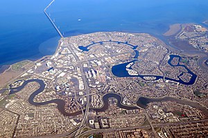
Foster City, California
City in California, United States
Distance: Approx. 353 meters
Latitude and longitude: 37.55138889,-122.26638889
Foster City is a master-planned city located in San Mateo County, California, United States. Foster City is sometimes considered to be part of Silicon Valley for its local industry and its proximity to Silicon Valley cities. There are many notable companies headquartered in Foster City like Gilead Sciences, Zoox, Sledgehammer Games, and Replit.

Sony Interactive Entertainment
Sony's video game division
Distance: Approx. 1520 meters
Latitude and longitude: 37.56055556,-122.28416667
Sony Interactive Entertainment LLC (SIE) is an American video game and digital entertainment company that is a major subsidiary of Sony Group Corporation. It primarily operates the PlayStation brand of video game consoles and products. It is also the world's largest company in the video game industry based on its equity investments.
Model N (company)
American software company
Distance: Approx. 2040 meters
Latitude and longitude: 37.537,-122.2584
Model N, Inc. is an American software company founded in 1999 and headquartered in San Mateo, California. The company offers revenue management software technology and life sciences companies.
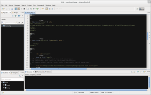
Aptana
Text editor
Distance: Approx. 1622 meters
Latitude and longitude: 37.556588,-122.287681
Aptana, Inc. is a company that makes web application development tools for use with a variety of programming languages (such as JavaScript, Ruby, PHP and Python). Aptana's main products include Aptana Studio, Aptana Cloud and Aptana Jaxer.

Marine World/Africa USA
Zoo in California, United States
Distance: Approx. 2197 meters
Latitude and longitude: 37.53333333,-122.26666667
Marine World/Africa USA was an animal theme park located in the Redwood Shores area of Redwood City, California. The park was named Marine World when it first opened in 1968, before merging with a land-animal park called Africa USA in 1972. In 1986, the park relocated to Vallejo, California, and is now known as Six Flags Discovery Kingdom.

Leo J. Ryan Memorial Park
Distance: Approx. 646 meters
Latitude and longitude: 37.55856,-122.27153
Leo J. Ryan Memorial Park is a recreational city park, located in Foster City, California and run by the city government and local citizens. Originally called "Central Park", the park was renamed in 1979 in honor and memory of Congressman Leo J. Ryan. The park is situated on 20 acres (8 ha) which overlook Foster City's lagoon.

Ray of Light (sculpture)
Distance: Approx. 2642 meters
Latitude and longitude: 37.53074,-122.25918
Ray of Light, is a public artwork by artist Barton Rubenstein, located on the north side of the Redwood Shores Library, in Redwood City, California, United States. The sculpture, constructed from stainless steel, was commissioned as part of the G. R. Cress Bird Bath Project.

Design Tech High School
Public charter high school in Redwood City, California, United States
Distance: Approx. 2319 meters
Latitude and longitude: 37.5326,-122.264
Design Tech High School, commonly referred to as d.tech, is a public charter high school in the San Francisco Bay Area. The school is located on the Oracle Corporation campus in Redwood City, California, and is part of the San Mateo Union High School District. Founded in 2014, the school has 567 students (as of December 2024) and focuses on implementing technology, self-direction, and the process of design thinking into its curriculum.
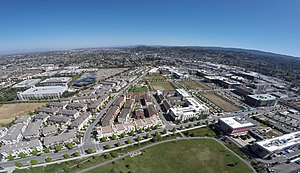
Bay Meadows (neighborhood)
Neighborhood in San Mateo, CA, US
Distance: Approx. 2677 meters
Latitude and longitude: 37.543361,-122.297739
Bay Meadows is an 83-acre mixed-use, transit-oriented development in the City of San Mateo, California. The neighborhood is divided into station/mixed-use and residential districts, which are further divided into 18 development blocks. The station/mixed-use district is primarily adjacent to Delaware Street, the major north–south street through the neighborhood.

Brewer Island
Island in California
Distance: Approx. 696 meters
Latitude and longitude: 37.55694444,-122.26388889
Brewer Island is an island in the San Francisco Bay, in San Mateo County, California. Originally owned by W. P. A. Brewer, for over one hundred years it was used for hay farming. Several attempts to develop the island failed between 1912 and 1959.
Bridgepointe Shopping Center
Shopping mall in California, U.S.
Distance: Approx. 1301 meters
Latitude and longitude: 37.5599,-122.2817
Bridgepointe Shopping Center is a shopping mall in San Mateo, California, United States. Opened in 1982 as San Mateo Fashion Island, it was originally an enclosed shopping mall featuring JCPenney, Bullock's, Liberty House, and Montgomery Ward as its anchor stores. Following the closures of Bullock's and Liberty House, the mall went into decline throughout the 1990s, leading to its closure and demolition in favor of a power center.
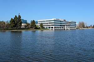
Belmont Creek
Creek in California
Distance: Approx. 2672 meters
Latitude and longitude: 37.5289,-122.2697
Belmont Creek is a creek in San Mateo County, California. The creek rises in Belmont and flows east under the Bayshore Freeway entering the Belmont Slough in Redwood Shores.
Weather in this IP's area
overcast clouds
10 Celsius
9 Celsius
9 Celsius
12 Celsius
1022 hPa
81 %
1022 hPa
1022 hPa
10000 meters
2.06 m/s
130 degree
100 %
