Country:
 USA
USARegion:
City:
Latitude and Longitude:
Time Zone:
Postal Code:
IP information under different IP Channel
ip-api
Country
Region
City
ASN
Time Zone
ISP
Blacklist
Proxy
Latitude
Longitude
Postal
Route
IPinfo
Country
Region
City
ASN
Time Zone
ISP
Blacklist
Proxy
Latitude
Longitude
Postal
Route
MaxMind
Country
Region
City
ASN
Time Zone
ISP
Blacklist
Proxy
Latitude
Longitude
Postal
Route
Luminati
Country
USRegion
ca
City
fostercity
ASN
Time Zone
America/Los_Angeles
ISP
SBS
Latitude
Longitude
Postal
db-ip
Country
Region
City
ASN
Time Zone
ISP
Blacklist
Proxy
Latitude
Longitude
Postal
Route
ipdata
Country
Region
City
ASN
Time Zone
ISP
Blacklist
Proxy
Latitude
Longitude
Postal
Route
Popular places and events near this IP address

Aliso Viejo, California
City in California, United States
Distance: Approx. 897 meters
Latitude and longitude: 33.575,-117.72555556
Aliso Viejo (Spanish for "Old Sycamore") is a city in the San Joaquin Hills of southern Orange County, California. It had a population of 52,176 as of the 2020 census, up from 47,823 as of the 2010 census. It became Orange County's 34th city on July 1, 2001, the only city in Orange County to be incorporated since 2000.
Laguna Hills, California
City in California, United States
Distance: Approx. 3250 meters
Latitude and longitude: 33.59972222,-117.69944444
Laguna Hills (; laguna being Spanish for 'lagoon') is a city in southern Orange County, California, United States. Its name refers to its proximity to Laguna Canyon and the much older Laguna Beach. Other newer cities nearby—Laguna Niguel and Laguna Woods—are similarly named.

Laguna Woods, California
City in Orange County, California, U.S.
Distance: Approx. 2968 meters
Latitude and longitude: 33.60916667,-117.73277778
Laguna Woods (Laguna, Spanish for "Lagoon") is a city in Orange County, California, United States. The population was 17,644 at the 2020 census, up from 16,192 at the 2010 census, with a median age of 74.5 (as of 2021). Laguna Woods became Orange County's 32nd city on March 24, 1999, after local residents voted to incorporate.

Area code 949
Telephone area code for southern Orange County, California
Distance: Approx. 3226 meters
Latitude and longitude: 33.6,-117.7
Area code 949 is a telephone area code in the North American Numbering Plan (NANP) for the U.S. state of California in southern Orange County. The area code was assigned on April 18, 1998, to a numbering plan area that resulted from a boundary change of area code 714 to exclude the southern cities of Orange County.
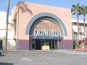
Laguna Hills Mall
Shopping mall in Laguna Hills, California (1973–2018)
Distance: Approx. 3672 meters
Latitude and longitude: 33.61081,-117.70709
Laguna Hills Mall was a shopping mall in Laguna Hills, California, United States, in southern Orange County that is being redeveloped into a lifestyle center by the owners as Village at Laguna Hills. The enclosed mall closed on December 31, 2018, and was completely demolished in 2023. The exterior stores remain open.

Aliso Niguel High School
Public high school in Aliso Viejo, California, United States
Distance: Approx. 2534 meters
Latitude and longitude: 33.56111111,-117.71972222
Aliso Niguel High School (ANHS), which is part of the Capistrano Unified School District, is located in the city of Aliso Viejo, California. Most of its students reside in the communities of Aliso Viejo and Laguna Niguel. The school is a California Distinguished School, a National Blue Ribbon School, and a New American High School.
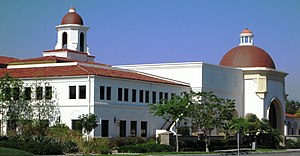
Soka University of America
Private university in Aliso Viejo, California, USA
Distance: Approx. 3162 meters
Latitude and longitude: 33.555,-117.735
Soka University of America (SUA) is a private Buddhist liberal arts college in Aliso Viejo, California. Originally founded in 1987, it was established on its current campus in 2001 by Daisaku Ikeda, the founder of the Soka Gakkai International Buddhist movement. Though affiliated with Soka Gakkai, it maintains a secular curriculum which emphasizes pacifism, human rights, and the creative coexistence of nature and humanity.

Monterey Formation
Miocene geological sedimentary formation in California
Distance: Approx. 3226 meters
Latitude and longitude: 33.6,-117.7
The Monterey Formation is an extensive Miocene oil-rich geological sedimentary formation in California, with outcrops of the formation in parts of the California Coast Ranges, Peninsular Ranges, and on some of California's off-shore islands. The type locality is near the city of Monterey, California. The Monterey Formation is the major source-rock for 37 to 38 billion barrels of oil in conventional traps such as sandstones.
Sheep Hills, California
Distance: Approx. 3400 meters
Latitude and longitude: 33.55308083,-117.7364425
The Sheep Hills are a mountain range in Orange County, California.

Chet Holifield Federal Building
Distance: Approx. 2718 meters
Latitude and longitude: 33.56166667,-117.71333333
The Chet Holifield Federal Building, colloquially known as "the Ziggurat Building", is a United States government building in Laguna Niguel, California. It was built between 1968 and 1971 for North American Aviation/Rockwell International, and designed by William Pereira. Since 1974 it has been owned and managed by the General Services Administration.
Rancho Niguel
Mexican land grant
Distance: Approx. 3038 meters
Latitude and longitude: 33.56,-117.71
Rancho Niguel was a 13,316-acre (53.89 km2) Mexican land grant in the San Joaquin Hills, within present-day Orange County, California. It was granted in 1842 by Governor Juan B. Alvarado to Juan Avila. The rancho was named for a local Indian village called "Niguili." The grant extended along the Pacific coast from Laguna Canyon and Laguna Beach, past Aliso Creek to Dana Point and San Juan Creek.

2022 Laguna Woods shooting
2022 shooting in Laguna Woods, California, U.S.
Distance: Approx. 3029 meters
Latitude and longitude: 33.60964,-117.73338
On May 15, 2022, a mass shooting occurred at the Geneva Presbyterian Church in Laguna Woods, California, United States. The Orange County church was hosting a congregation of the Irvine Taiwanese Presbyterian Church for Sunday services. The shooter killed one person and wounded five others.
Weather in this IP's area
broken clouds
18 Celsius
18 Celsius
17 Celsius
20 Celsius
1013 hPa
83 %
1013 hPa
995 hPa
10000 meters
1.79 m/s
2.68 m/s
129 degree
83 %
06:37:24
18:51:41