Country:
Region:
City:
Latitude and Longitude:
Time Zone:
Postal Code:
IP information under different IP Channel
ip-api
Country
Region
City
ASN
Time Zone
ISP
Blacklist
Proxy
Latitude
Longitude
Postal
Route
Luminati
Country
ASN
Time Zone
America/Chicago
ISP
INTERNAP-2BLK
Latitude
Longitude
Postal
IPinfo
Country
Region
City
ASN
Time Zone
ISP
Blacklist
Proxy
Latitude
Longitude
Postal
Route
db-ip
Country
Region
City
ASN
Time Zone
ISP
Blacklist
Proxy
Latitude
Longitude
Postal
Route
ipdata
Country
Region
City
ASN
Time Zone
ISP
Blacklist
Proxy
Latitude
Longitude
Postal
Route
Popular places and events near this IP address

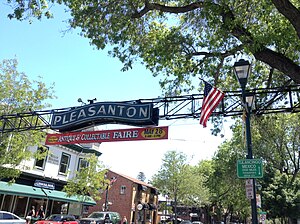
Pleasanton, California
City in the San Francisco Bay Area
Distance: Approx. 27 meters
Latitude and longitude: 37.6625,-121.87472222
Pleasanton is a city in Alameda County, California, United States. Located in the Amador Valley, it is a suburb in the East Bay region of the San Francisco Bay Area. The population was 79,871 at the 2020 census.

Tri-Valley
Area of the East Bay
Distance: Approx. 27 meters
Latitude and longitude: 37.6625,-121.87472222
The Tri-Valley area is grouping of three valleys in the East Bay region of California's Bay Area. The three valleys are Amador Valley, San Ramon Valley, and Livermore Valley. The Tri-Valley encompasses the cities of Dublin, Livermore, Pleasanton and San Ramon, the town of Danville and the CDPs of Alamo, Blackhawk and Diablo.

Pleasanton Public Library
Distance: Approx. 750 meters
Latitude and longitude: 37.6575,-121.88083333
The Pleasanton Public Library serves the city of Pleasanton in Alameda County, California. The library is located near downtown Pleasanton at 400 Old Bernal Avenue. The Pleasanton Women's Improvement Club was formed in 1908 to improve the community of Pleasanton, an agricultural town located in the "Tri-Valley" area east of San Francisco.
Pleasanton Independent School District
School district in Texas, United States
Distance: Approx. 788 meters
Latitude and longitude: 37.6554,-121.8763
Pleasanton Independent School District is a public school district based in Pleasanton, Texas (USA). In 2011, the School District was rated "Academically Acceptable" by the Texas Education Agency. The ratings varied greatly from campus to campus with the Primary, Elementary and Intermediate campuses receiving a rating of Recognized, the Junior High received a rating of Academically Acceptable while the High School and the School of Choice were rated as Academically Unacceptable.

Pleasanton Unified School District
School district in California, United States
Distance: Approx. 704 meters
Latitude and longitude: 37.65611111,-121.87583333
The Pleasanton Unified School District (PUSD) is a public primary and secondary education school district located in Pleasanton, California, United States, a suburban town east of San Francisco. It consists of nine elementary schools, three middle schools, two comprehensive high schools, and one alternative high school. It includes the majority of Pleasanton and sections of Hayward and Sunol.

Amador Valley High School
Public high school in Pleasanton, California
Distance: Approx. 662 meters
Latitude and longitude: 37.66833333,-121.87444444
Amador Valley High School is a comprehensive public high school in Pleasanton, California. It is one of three high schools in the Pleasanton Unified School District, along with Foothill High School and Village High School. Founded as Amador Valley Joint Union High School (AVJUHS), it graduated its first class in 1923.
Pleasanton station
Train station in Pleasanton, California, U.S.
Distance: Approx. 774 meters
Latitude and longitude: 37.65841111,-121.88219444
Pleasanton station is a train station in Pleasanton, California served by Altamont Corridor Express (ACE) trains. It is located northwest of downtown Pleasanton adjacent to the Alameda County Fairgrounds. The station has a single side platform on the single track of the Union Pacific Railroad Oakland Subdivision.

Alameda County Fairgrounds
Fairground in Pleasanton, California, U.S.
Distance: Approx. 1278 meters
Latitude and longitude: 37.66138,-121.88944
The Alameda County Fairgrounds is a 270-acre (110 ha) facility located in Pleasanton, California. It is home to the annual Alameda County Fair, held since 1912, as well as numerous trade shows and community events. Located on its grounds, the Pleasanton Fairgrounds Racetrack was built in 1858, making it the oldest one-mile (1.6 km) horse racing track in the United States.

Livermore-Pleasanton Fire Department
Fire department in California, U.S.
Distance: Approx. 1641 meters
Latitude and longitude: 37.66673333,-121.85719722
The Livermore-Pleasanton Fire Department (LPFD) provides fire suppression and emergency medical services to the neighboring cities of Livermore and Pleasanton, California. The organization uses a joint powers authority (JPA) model with essential support services provided by both cities. This partnership promotes more efficient administration and effective delivery of services.
Rancho Santa Rita
Mexican land grant in California
Distance: Approx. 954 meters
Latitude and longitude: 37.67,-121.87
Rancho Santa Rita was a 8,894-acre (35.99 km2) Mexican land grant in the Amador Valley and western Livermore Valley, which is in present day Alameda County, California. It was given in 1839 by Governor Juan Alvarado to Jose Dolores Pacheco. The rancho included present day Pleasanton, Asco, and Dougherty.
Village High School
Public school in California, United States
Distance: Approx. 731 meters
Latitude and longitude: 37.65583333,-121.875
Village High School (commonly called Village) is a public continuation high school located in Pleasanton, California, United States, a community in the San Francisco East Bay area. Village is a part of the Pleasanton Unified School District, which also includes Amador Valley High School and Foothill High School. The high school was formed for students from Amador Valley and Foothill with low grades, multiple absences, or credit deficiencies.
Tri-Valley University
Distance: Approx. 1459 meters
Latitude and longitude: 37.67199,-121.86372
Tri-Valley University (TVU) was an unaccredited private university in Pleasanton, California. It was shut down after being raided by Immigration and Customs Enforcement due to possible visa fraud.
Weather in this IP's area
clear sky
7 Celsius
7 Celsius
5 Celsius
9 Celsius
1016 hPa
80 %
1016 hPa
1003 hPa
10000 meters
0.89 m/s
2.24 m/s
307 degree
06:49:19
16:55:44

