69.25.31.121 - IP Lookup: Free IP Address Lookup, Postal Code Lookup, IP Location Lookup, IP ASN, Public IP
Country:
Region:
City:
Location:
Time Zone:
Postal Code:
IP information under different IP Channel
ip-api
Country
Region
City
ASN
Time Zone
ISP
Blacklist
Proxy
Latitude
Longitude
Postal
Route
Luminati
Country
ASN
Time Zone
America/Chicago
ISP
INTERNAP-BLK
Latitude
Longitude
Postal
IPinfo
Country
Region
City
ASN
Time Zone
ISP
Blacklist
Proxy
Latitude
Longitude
Postal
Route
IP2Location
69.25.31.121Country
Region
california
City
san francisco
Time Zone
America/Los_Angeles
ISP
Language
User-Agent
Latitude
Longitude
Postal
db-ip
Country
Region
City
ASN
Time Zone
ISP
Blacklist
Proxy
Latitude
Longitude
Postal
Route
ipdata
Country
Region
City
ASN
Time Zone
ISP
Blacklist
Proxy
Latitude
Longitude
Postal
Route
Popular places and events near this IP address

San Francisco Transbay Terminal
Former transit terminal in San Francisco, CA, USA
Distance: Approx. 189 meters
Latitude and longitude: 37.78944444,-122.39638889
The San Francisco Transbay Terminal was a transportation complex in San Francisco, California, United States, roughly in the center of the rectangle bounded north–south by Mission Street and Howard Street, and east–west by Beale Street and 2nd Street in the South of Market area of the city. It opened on January 14, 1939 as a train station and was converted into a bus depot in 1959. The terminal mainly served San Francisco's downtown and Financial District, as transportation from surrounding communities of the Bay Area terminated there such as: Golden Gate Transit buses from Marin County, AC Transit buses from the East Bay, and SamTrans buses from San Mateo County.

199 Fremont Street
Commercial offices in San Francisco, California
Distance: Approx. 157 meters
Latitude and longitude: 37.7899,-122.3948
199 Fremont Street is a class-A office skyscraper in South of Market district of San Francisco, California. The 111 m (364 ft), 27-story tower was designed by KMD Architects (Kaplan Mclaughlin Diaz), and completed in 2000.
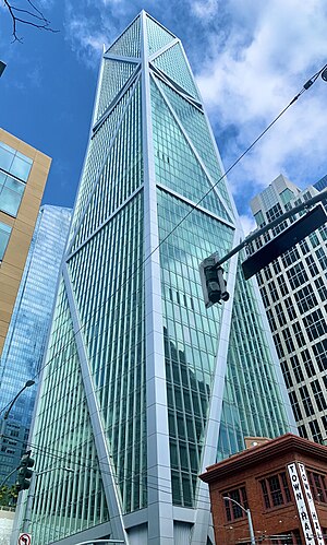
181 Fremont
803-foot mixed-use skyscraper in the South of Market District of San Francisco
Distance: Approx. 149 meters
Latitude and longitude: 37.7897,-122.39535
181 Fremont is an 803-foot (245 m) mixed-use skyscraper in the South of Market District of San Francisco, California. The building, designed by Heller Manus Architects, is located adjacent to the Transbay Transit Center and 199 Fremont Street developments. 181 Fremont is owned and operated by Jay Paul Company, which was the sole developer of the project.

Foundry Square
Four linked buildings in San Francisco, US
Distance: Approx. 125 meters
Latitude and longitude: 37.78854,-122.39602
Foundry Square is a complex of four architecturally-linked, 10-story mid-rise buildings located at Howard and First Streets near the Salesforce Transit Center in the South of Market neighborhood of San Francisco, California. Each of the four buildings stands on a different corner of the street. Each building is a mixed-use structure.
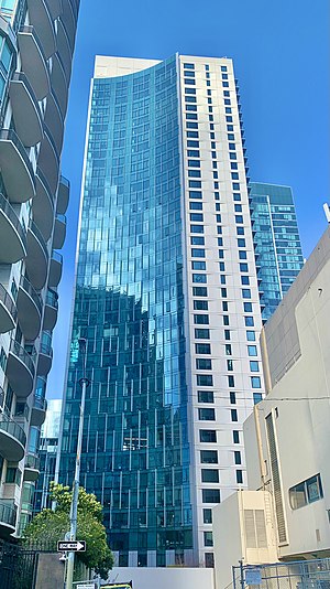
340 Fremont Street
Residential apartments in San Francisco, California
Distance: Approx. 217 meters
Latitude and longitude: 37.78704,-122.39296
340 Fremont Street is a 440-foot (130 m) residential skyscraper in the Rincon Hill neighborhood of San Francisco, California. The tower has 348 residential units on 40 floors.

Park Tower at Transbay
43-story, 605-foot office skyscraper in San Francisco
Distance: Approx. 202 meters
Latitude and longitude: 37.7903,-122.3943
Park Tower at Transbay is a 43-story, 605-foot (184 m) office skyscraper in San Francisco, California. The tower is located on Block 5 of the San Francisco Transbay development plan at the corner of Beale and Howard Streets, near the Salesforce Transit Center. The tower contains 743,000 square feet (69,000 m2) of office space.
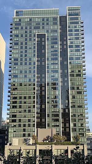
33 Tehama
Apartment complex located in San Francisco, California, United States
Distance: Approx. 194 meters
Latitude and longitude: 37.7873,-122.3962
33 Tehama was a luxury residential apartment complex in South of Market, San Francisco, California. The building is 380 feet (120 m) tall, 35 stories, and contains 403 residential units. Groundbreaking was in mid-2015, and construction finished in 2018.
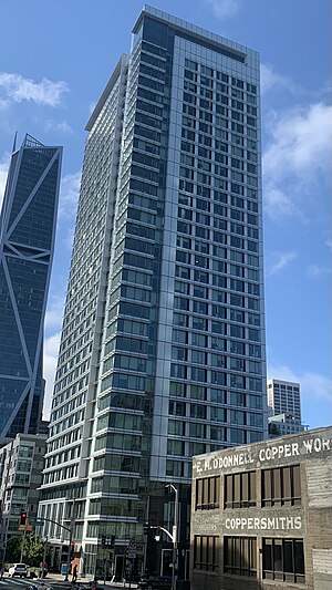
Solaire (San Francisco)
Residential apartments in San Francisco, California
Distance: Approx. 86 meters
Latitude and longitude: 37.7879778,-122.393875
BridgeView is a 300-foot (91 m) residential skyscraper in the Rincon Hill neighborhood of San Francisco, California. The tower has 32 floors.
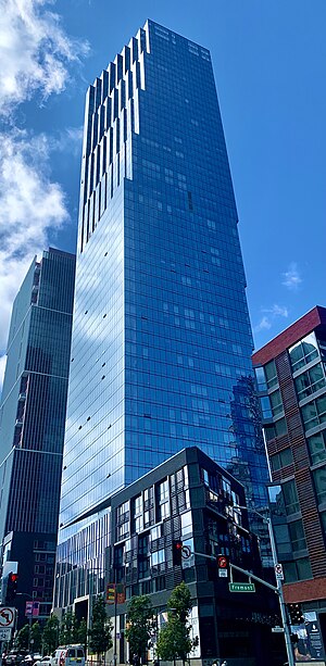
The Avery
Residential building in San Francisco, California
Distance: Approx. 89 meters
Latitude and longitude: 37.787778,-122.394167
The Avery is a 57-story, 618 ft (188 m) residential skyscraper in the South of Market district of San Francisco, California. The tower site is bounded by Folsom Street on the south and Fremont Street on the east. The building features 118 luxurious condominium residences starting on the 33rd floor and upwards, and premium luxury apartment rentals on floors 2-32 at Avery 450.
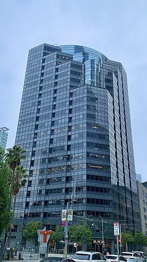
301 Howard Street
Commercial offices in San Francisco, California
Distance: Approx. 121 meters
Latitude and longitude: 37.78957101,-122.39437953
301 Howard Street is a twenty-three-floor, 307-foot (94 m) skyscraper in San Francisco, California, completed in 1988.

Edwin Klockars' Blacksmith Shop
Historic site in California, United States
Distance: Approx. 123 meters
Latitude and longitude: 37.787465,-122.394106
Edwin Klockars' Blacksmith Shop is a historic 1912 building in the Rincon Hill neighborhood at 443 Folsom Street, San Francisco, California, United States. It remained an active blacksmith shop within multiple generations of the same family, from 1912 until 2017. It has been listed by the city as a San Francisco Designated Landmark since 1992.
Guy Place Mini Park
Park in San Francisco, California, US
Distance: Approx. 201 meters
Latitude and longitude: 37.7867,-122.3944
The Guy place mini park is a park in San Francisco, located to the Bay Bridge and steps from the Transbay Transit Center. The park is 3,500 square feet.
Weather in this IP's area
light rain
10 Celsius
9 Celsius
7 Celsius
11 Celsius
1021 hPa
88 %
1021 hPa
1020 hPa
10000 meters
1.34 m/s
2.24 m/s
142 degree
28 %