Country:
Region:
City:
Latitude and Longitude:
Time Zone:
Postal Code:
IP information under different IP Channel
ip-api
Country
Region
City
ASN
Time Zone
ISP
Blacklist
Proxy
Latitude
Longitude
Postal
Route
Luminati
Country
Region
ky
City
georgetown
ASN
Time Zone
America/New_York
ISP
ASN-INTERNAP-BLK
Latitude
Longitude
Postal
IPinfo
Country
Region
City
ASN
Time Zone
ISP
Blacklist
Proxy
Latitude
Longitude
Postal
Route
db-ip
Country
Region
City
ASN
Time Zone
ISP
Blacklist
Proxy
Latitude
Longitude
Postal
Route
ipdata
Country
Region
City
ASN
Time Zone
ISP
Blacklist
Proxy
Latitude
Longitude
Postal
Route
Popular places and events near this IP address

South Bay (Los Angeles County)
Region in California, United States
Distance: Approx. 2406 meters
Latitude and longitude: 33.83694444,-118.31805556
The South Bay is a region of the Los Angeles metropolitan area, located in the southwest corner of Los Angeles County. The name stems from its geographic location stretching along the southern shore of Santa Monica Bay. The South Bay contains sixteen cities plus portions of the City of Los Angeles and unincorporated portions of the county.
Herbalife
American global multi-level marketing company
Distance: Approx. 1674 meters
Latitude and longitude: 33.8572,-118.2919
Herbalife Nutrition Ltd., also called Herbalife International, Inc. (with a U.S. subsidiary called Herbalife International of America) or simply Herbalife, is an American multinational multi-level marketing (MLM) corporation that develops and sells dietary supplements. The company has been alleged to have fraudulently operated a pyramid scheme.

Toyota Motor Sales, USA
American car distributor
Distance: Approx. 174 meters
Latitude and longitude: 33.857163,-118.3118381
Toyota Motor Sales, USA, Inc. (TMS, also known as Toyota USA) is the North American Toyota sales, marketing, and distribution subsidiary devoted to the United States market. Founded in 1957 in California, TMS currently employs more than 6,500 people.
Harbor Gateway, Los Angeles
Neighborhood of Los Angeles in California, United States
Distance: Approx. 1306 meters
Latitude and longitude: 33.850072,-118.299068
The Harbor Gateway, historically and sometimes informally known as the Shoestring due to its shape, is a 5.14-square-mile residential and industrial area (13.3 km2) in the South Bay and Los Angeles Harbor Region, in the southern part of the City of Los Angeles. The neighborhood is narrow and long, running along a north-south axis. The Shoestring Annexation, as it was called at the time, was attached to Los Angeles in 1906 to serve as a link to the Pacific Ocean port cities of Wilmington and San Pedro, both of which were later annexed into Los Angeles themselves in 1909.

Ascot Park (speedway)
Former dirt race track
Distance: Approx. 2075 meters
Latitude and longitude: 33.86444444,-118.28916667
Ascot Park, first named Los Angeles Speedway and later New Ascot Stadium, was a dirt racetrack located near Gardena, California. Ascot Park was open between 1957 and 1990. The track held numerous United States Auto Club (USAC) national tour races and three NASCAR Grand National (now NASCAR Cup Series) races.

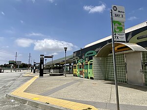
Harbor Gateway Transit Center
Public transit hub in Los Angeles, California
Distance: Approx. 2455 meters
Latitude and longitude: 33.86973,-118.2879
Harbor Gateway Transit Center, formerly Artesia Transit Center, is a large bus station at the southern end of the Harbor Transitway that serves as a transport hub (known locally as a transit center) for the South Bay region of Los Angeles County including the Harbor Gateway neighborhood of Los Angeles and cities of Carson, Gardena, and Torrance. The station consists of one large island platform with 12 bus bays and a 980 space park and ride parking lot located in the southwest corner of Interstate 110 (Harbor Freeway) and California State Route 91 (Gardena Freeway). The station is one of the stops on J Line, a bus rapid transit route which runs between El Monte, Downtown Los Angeles and San Pedro as part of the Metro Busway system.

Gardena High School
High school in Los Angeles, California, U.S.
Distance: Approx. 1657 meters
Latitude and longitude: 33.867378,-118.296586
Gardena High School (GHS) is a public high school in the Harbor Gateway neighborhood of Los Angeles, California, United States, adjacent to the City of Gardena. It serves grades 9 through 12 and is a part of the Los Angeles Unified School District.
Pacific Lutheran High School
School in Gardena, California, United States
Distance: Approx. 1192 meters
Latitude and longitude: 33.8659,-118.302
Pacific Lutheran Jr. / Sr. High School is a private Lutheran high school located in Gardena, California.
Montrose Chemical Corporation of California
Largest producer of insecticide DDT in U.S.
Distance: Approx. 1303 meters
Latitude and longitude: 33.84861111,-118.30083333
The Montrose Chemical Corporation of California was a chemical corporation that was the largest producer of the insecticide DDT in the United States from 1947 until it stopped production in 1982. The president of Montrose was Pincus Rothberg before 1968, then Samuel Rotrosen thereafter. Montrose Chemical Corporation improperly disposed chemical waste from DDT production, resulting in serious environmental damage to the Pacific Ocean near Los Angeles.

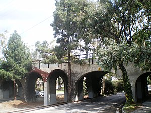
Pacific Electric Railroad Bridge
United States historic place
Distance: Approx. 2223 meters
Latitude and longitude: 33.83758333,-118.31169444
The Pacific Electric Railroad Bridge or Southern Pacific Railroad Bridge now officially named the "Pacific Electric Railway- El Prado Bridge" is a historic double-tracked arch bridge located in Torrance, California US, spanning Torrance Boulevard at Bow Avenue, a short distance west of Western Avenue. It was once part of the north/south San Pedro via Gardena Line of the Pacific Electric Railway, that agency's first interurban line to San Pedro. Torrance, California is a town that was planned on the drawing board.
American Honda Motor Company
American automobile distributor
Distance: Approx. 2244 meters
Latitude and longitude: 33.8378194,-118.3152342
The American Honda Motor Company, Inc. (sometimes abbreviated as AHM) is the North American subsidiary of Japanese Honda Motor Company. Founded in 1959, the company combines product sales, service and coordinating functions of Honda in North America, and is responsible for distribution, marketing and sales of Honda and Acura brand automobiles, Honda Powersports products (motorcycles, scooters and all-terrain vehicles), Honda Power Equipment products (garden tools and generators), Honda Engines products, Honda Marine engines, and the HondaJet aircraft.
Del Amo (Superfund site)
Waste-disposal site in southern Los Angeles County
Distance: Approx. 1921 meters
Latitude and longitude: 33.8469,-118.2936
The Del Amo Superfund Site is located in southern Los Angeles County between the cities of Torrance and Carson. It is a U.S. EPA Region 9 Superfund Site. The waste-disposal site of a rubber manufacturer is one of 94 Superfund Sites in California as of November 29, 2010.
Weather in this IP's area
clear sky
15 Celsius
14 Celsius
14 Celsius
18 Celsius
1016 hPa
57 %
1016 hPa
1014 hPa
10000 meters
06:16:42
16:56:59

