Country:
Region:
City:
Latitude and Longitude:
Time Zone:
Postal Code:
IP information under different IP Channel
ip-api
Country
Region
City
ASN
Time Zone
ISP
Blacklist
Proxy
Latitude
Longitude
Postal
Route
Luminati
Country
ASN
Time Zone
America/Chicago
ISP
INTERNAP-BLOCK-4
Latitude
Longitude
Postal
IPinfo
Country
Region
City
ASN
Time Zone
ISP
Blacklist
Proxy
Latitude
Longitude
Postal
Route
db-ip
Country
Region
City
ASN
Time Zone
ISP
Blacklist
Proxy
Latitude
Longitude
Postal
Route
ipdata
Country
Region
City
ASN
Time Zone
ISP
Blacklist
Proxy
Latitude
Longitude
Postal
Route
Popular places and events near this IP address
South Portland, Portland, Oregon
Neighborhood in Portland, Oregon, United States
Distance: Approx. 514 meters
Latitude and longitude: 45.49,-122.677
South Portland is a long, narrow neighborhood just south of Downtown Portland, Oregon, hemmed in between the Willamette River and the West Hills. It stretches from I-405 and the Marquam Bridge on the north, to SW Canby St. and the Sellwood Bridge in the south.

Precision Castparts Corp.
American manufacturing company
Distance: Approx. 428 meters
Latitude and longitude: 45.4891271,-122.6728299
Precision Castparts Corp. is an American industrial goods and metal fabrication company that manufactures investment castings, forged components, and airfoil castings for use in the aerospace, industrial gas turbine, and defense industries. In 2009 it ranked 362nd on the Fortune 500 list, and 11th in the aerospace and defense industry.

John Ross Tower
Residential building in Portland, Oregon, U.S.
Distance: Approx. 1294 meters
Latitude and longitude: 45.496729,-122.670218
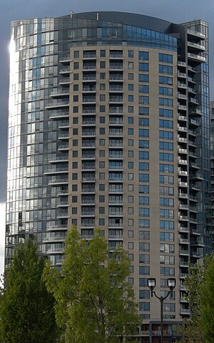
John Ross Tower is a condominium skyscraper in the South Waterfront neighborhood in Portland, Oregon. It stands at a height of 99.1 m (325 ft), the first building in the district to reach the maximum height allowed for development and Portland's seventh-tallest building. It is also the largest residential building built in Portland since the KOIN Center in 1984.
The Ardea
Residential skyscraper in Portland, Oregon, U.S.
Distance: Approx. 1201 meters
Latitude and longitude: 45.4959,-122.6704
The Ardea, formerly 3720, is a 30-story 99.06 m (325.0 ft) apartment skyscraper in the South Waterfront district of Portland, Oregon. The building was completed in March 2009, however was turned over in phases allowing occupancy beginning in August 2008. The Ardea was developed by Gerding Edlen, designed by GBD Architects, and constructed by Hoffman Construction.

American College of Healthcare Sciences
Online college in Oregon, US
Distance: Approx. 167 meters
Latitude and longitude: 45.48694444,-122.67594444
The American College of Healthcare Sciences (ACHS) is a private for-profit online college headquartered in Portland, Oregon, that specializes in holistic health education. It was founded in 1978.

Ross Island (Oregon)
Island in Portland, Oregon, United States
Distance: Approx. 794 meters
Latitude and longitude: 45.49,-122.667
Ross Island is the main island of a four-island cluster in the Willamette River in Portland, Oregon, in the United States. The islands, covering a total of about 400 acres (160 ha), are owned mainly by Ross Island Sand and Gravel (RISG), which mined them extensively between 1926 and 2001. The other three islands are Hardtack, East, and Toe.

Holt–Saylor–Liberto House
Historic building in Portland, Oregon, U.S.
Distance: Approx. 1295 meters
Latitude and longitude: 45.496842,-122.679261
The Holt–Saylor–Liberto House is a house located in southwest Portland, Oregon, that is listed on the National Register of Historic Places. It was added to the register in 1978. Earlier, it was designated a Portland Historic Landmark by the city's Historic Landmarks Commission, in October 1977.

Jewish Shelter Home
Historic building in Portland, Oregon, U.S.
Distance: Approx. 863 meters
Latitude and longitude: 45.493279,-122.676517
The Jewish Shelter Home, also known as Elmer Colwell House, located in southwest Portland, Oregon, is listed on the National Register of Historic Places.
Marquam Nature Park
Public park in Portland, Oregon, U.S.
Distance: Approx. 1269 meters
Latitude and longitude: 45.49,-122.69
Marquam Nature Park is a 203.5-acre (82.4 ha) park, located in the gulch northeast of Marquam hill in southwest Portland, Oregon, United States. The park was acquired by Portland Parks & Recreation in 1979. Marquam Nature Park is in Southwest Portland in the Tualatin Mountains, also known as the West Hills, and has several miles of hiking trails.
Atwater Place
Building in Portland, Oregon, U.S.
Distance: Approx. 1307 meters
Latitude and longitude: 45.4964582,-122.6686278
Atwater Place is a high-rise condominium tower in Portland, Oregon's South Waterfront district, in the United States. It is managed by the Atwater Place Condominiums Owners Association. All units are privately owned.
George Himes Park
Public park in Portland, Oregon, U.S.
Distance: Approx. 1087 meters
Latitude and longitude: 45.47777778,-122.68333333
George Himes Park is a 35.97-acre (14.56 ha) public park in southwest Portland, Oregon. The space was acquired in 1903.

Riva on the Park
Residential building in Portland, Oregon, U.S.
Distance: Approx. 1204 meters
Latitude and longitude: 45.49611111,-122.67138889
Riva on the Park is a skyscraper in Portland, Oregon's South Waterfront district, in the United States.
Weather in this IP's area
light rain
7 Celsius
6 Celsius
6 Celsius
8 Celsius
1020 hPa
89 %
1020 hPa
1018 hPa
10000 meters
1.79 m/s
3.13 m/s
269 degree
51 %
07:10:40
16:40:24


