Country:
Region:
City:
Latitude and Longitude:
Time Zone:
Postal Code:
IP information under different IP Channel
ip-api
Country
Region
City
ASN
Time Zone
ISP
Blacklist
Proxy
Latitude
Longitude
Postal
Route
Luminati
Country
Region
ks
City
argonia
ASN
Time Zone
America/Chicago
ISP
B2R
Latitude
Longitude
Postal
IPinfo
Country
Region
City
ASN
Time Zone
ISP
Blacklist
Proxy
Latitude
Longitude
Postal
Route
db-ip
Country
Region
City
ASN
Time Zone
ISP
Blacklist
Proxy
Latitude
Longitude
Postal
Route
ipdata
Country
Region
City
ASN
Time Zone
ISP
Blacklist
Proxy
Latitude
Longitude
Postal
Route
Popular places and events near this IP address

Sumner County, Kansas
County in Kansas, United States
Distance: Approx. 9903 meters
Latitude and longitude: 37.23333333,-97.48333333
Sumner County is a county located in the U.S. state of Kansas. Its county seat is Wellington. As of the 2020 census, the population was 22,382.

Wellington, Kansas
City in Sumner County, Kansas
Distance: Approx. 1742 meters
Latitude and longitude: 37.26722222,-97.4
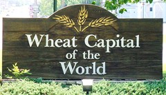
Wellington is a city in and the county seat of Sumner County, Kansas, United States. As of the 2020 census, the population of the city was 7,715.
KGHF (FM)
Radio station in Belle Plaine, Kansas
Distance: Approx. 9289 meters
Latitude and longitude: 37.336,-97.465
KGHF (99.7 FM) is an American radio station broadcasting a classic country format in Wichita, Kansas. The station is licensed to Belle Plaine, Kansas. KGHF broadcasts in the HD Radio format; the station's HD2 sub-channel airs a Regional Mexican format branded as "La Raza" (which is also heard on 250 watt FM translator K273CX at 102.5 MHz), while its HD3 and HD4 sub-channels carry simulcasts of KGSO and KQAM, respectively.
KLEY (AM)
Radio station in Wellington, Kansas
Distance: Approx. 4433 meters
Latitude and longitude: 37.24111111,-97.40111111
KLEY (1130 kHz) is an AM radio station broadcasting a classic hits format to the Wellington, Kansas, United States, area. The station is owned by My Town Media. 1130 AM is a clear-channel frequency shared by Canada and the United States.

Cicero, Kansas
Unincorporated community in Sumner County, Kansas
Distance: Approx. 7359 meters
Latitude and longitude: 37.33388889,-97.34055556
Cicero is an unincorporated community in Sumner County, Kansas, United States. It is located about 4 miles northeast of Wellington at about 2.5 miles east of the intersection of U.S. Route 81 and E 50th Ave N, next to the railroad.
Downtown Wellington Historic District
Historic district in Kansas, United States
Distance: Approx. 1720 meters
Latitude and longitude: 37.26666667,-97.39861111
The Downtown Wellington Historic District, in Wellington, Kansas, is a 21 acres (8.5 ha) historic district which was listed on the National Register of Historic Places in 2007. The district follows Washington Avenue, the main business thoroughfare, and is roughly bounded by 19th St., 4th St., Jefferson Ave. and the alley behind the Washington Ave.-facing buildings.

Edwin Smith House (Wellington, Kansas)
Historic house in Kansas, United States
Distance: Approx. 1916 meters
Latitude and longitude: 37.265,-97.39944444
The Edwin Smith House in Wellington, Kansas was built in 1935. Also known as the Pink House, it was listed on the National Register of Historic Places in 2004. It has a 60 feet (18 m)-long facade topped by a parapet.

H. F. Smith House
Historic house in Kansas, United States
Distance: Approx. 2242 meters
Latitude and longitude: 37.26583333,-97.40638889
The H. F. Smith House, at 721 W. Harvey Ave. in Wellington, Kansas, is a Queen Anne-style house built in 1886 as a one-story residence. It was expanded in 1896 by builder and architect Elbert Dumond to become the two-story Queen Anne Free Classic structure that it is now.

Wellington Carnegie Library
United States historic place
Distance: Approx. 1658 meters
Latitude and longitude: 37.2675,-97.39888889
The Wellington Carnegie Library, located at 121 W. Seventh in Wellington, Kansas, is a Carnegie library built in c.1916. It was listed on the National Register of Historic Places in 1987. It is one of 63 Carnegie libraries built in Kansas during the early 20th century.

Chisholm Trail Museum (Wellington, Kansas)
Distance: Approx. 1430 meters
Latitude and longitude: 37.26993,-97.39857
The Chisholm Trail Museum in Wellington, Kansas is a museum that celebrates the Chisholm Trail. The Museum was formed in 1963 by a group of Wellington citizens. In 1965, the Hatcher Hospital Building was donated to the museum.
Wellington USD 353
Public school district in Wellington, Kansas
Distance: Approx. 1939 meters
Latitude and longitude: 37.26388889,-97.3975
Wellington USD 353 is a public unified school district headquartered in Wellington, Kansas, United States. The district includes the communities of Wellington, Mayfield, Perth, Riverdale, Rome, and nearby rural areas.
Weather in this IP's area
heavy intensity rain
9 Celsius
5 Celsius
8 Celsius
10 Celsius
1021 hPa
91 %
1021 hPa
976 hPa
4869 meters
7.87 m/s
15.98 m/s
76 degree
100 %
07:01:57
17:24:48