69.178.253.41 - IP Lookup: Free IP Address Lookup, Postal Code Lookup, IP Location Lookup, IP ASN, Public IP
Country:
Region:
City:
Location:
Time Zone:
Postal Code:
ISP:
ASN:
language:
User-Agent:
Proxy IP:
Blacklist:
IP information under different IP Channel
ip-api
Country
Region
City
ASN
Time Zone
ISP
Blacklist
Proxy
Latitude
Longitude
Postal
Route
db-ip
Country
Region
City
ASN
Time Zone
ISP
Blacklist
Proxy
Latitude
Longitude
Postal
Route
IPinfo
Country
Region
City
ASN
Time Zone
ISP
Blacklist
Proxy
Latitude
Longitude
Postal
Route
IP2Location
69.178.253.41Country
Region
north dakota
City
fargo
Time Zone
America/Chicago
ISP
Language
User-Agent
Latitude
Longitude
Postal
ipdata
Country
Region
City
ASN
Time Zone
ISP
Blacklist
Proxy
Latitude
Longitude
Postal
Route
Popular places and events near this IP address

Briarwood, North Dakota
City in North Dakota, United States
Distance: Approx. 3827 meters
Latitude and longitude: 46.78694444,-96.79472222
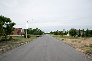
Briarwood is a city in Cass County, North Dakota, United States. The population was 57 at the 2020 census. Briarwood was founded in 1973.

Frontier, North Dakota
City in North Dakota, United States
Distance: Approx. 2932 meters
Latitude and longitude: 46.80027778,-96.83333333
Frontier is a city in Cass County, North Dakota, United States. The population was 195 at the 2020 census. Frontier is located south of the city of Fargo and is located roughly six miles southwest of that city's downtown.

Prairie Rose, North Dakota
City in North Dakota, United States
Distance: Approx. 2102 meters
Latitude and longitude: 46.81722222,-96.83527778
Prairie Rose is a city in Cass County, North Dakota, United States. The population was 56 at the 2020 census. The city is an enclave suburb of Fargo.

Fargo–Moorhead
Metropolitan area in North Dakota and Minnesota
Distance: Approx. 3822 meters
Latitude and longitude: 46.85,-96.78333333
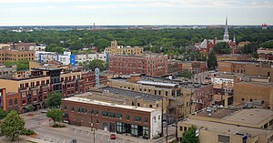
Fargo–Moorhead, also known as the FM area, is a common name given to the metropolitan area comprising Fargo, North Dakota; Moorhead, Minnesota; and the surrounding communities. These two cities lie on the North Dakota–Minnesota border, on opposite banks of the Red River of the North. The region is the cultural, retail, health care, educational, and industrial center of southeastern North Dakota and northwestern Minnesota.

Shanley High School
School in North Dakota, US
Distance: Approx. 2464 meters
Latitude and longitude: 46.79888889,-96.81722222
Shanley High School (formerly Sacred Heart Academy), is a Catholic high school located in Fargo, North Dakota and operated by the Diocese of Fargo as part of the John Paul II Catholic Schools Network. As of 2014, it served approximately 314 students. Academics are strongly oriented towards college preparatory with approximately 99% of the student body continuing to either a 2 or 4-year degree program.

Fargo South High School
Public school in Fargo, North Dakota , United States
Distance: Approx. 3989 meters
Latitude and longitude: 46.85583333,-96.81194444
Fargo South High School, more commonly known as Fargo South , South High, or South is a public high school located in Fargo, North Dakota. The campus serves about 1,000 students in grades 9-12. The school is a part of the Fargo Public Schools system.

KBVB
Country music radio station in Barnesville, Minnesota, United States
Distance: Approx. 3209 meters
Latitude and longitude: 46.8191,-96.7659
KBVB (95.1 FM, "Bob 95 FM") is a radio station broadcasting a country format. Licensed to Barnesville, Minnesota, it serves the Fargo-Moorhead metropolitan area. It first began broadcasting in 1980 under the call sign KDLM-FM on 95.3 Detroit Lakes, Minnesota.
KVXR
Radio station in Moorhead, Minnesota
Distance: Approx. 3234 meters
Latitude and longitude: 46.81944444,-96.76555556
KVXR (1280 AM) is a radio station located in Moorhead, MN airing Catholic programming the Real Presence Radio, including programming from the national EWTN Radio network.

Episcopal Diocese of North Dakota
Diocese of the Episcopal Church in the United States
Distance: Approx. 1049 meters
Latitude and longitude: 46.82611111,-96.81861111
The Episcopal Diocese of North Dakota is the diocese of the Episcopal Church in the United States of America with jurisdiction over the state of North Dakota plus Clay County, Minnesota. It has 19 congregations in North Dakota and one in Moorhead, Minnesota. It is in Province VI and its cathedral, Gethsemane Episcopal Cathedral, is in Fargo, as are the diocesan offices.

Gethsemane Episcopal Cathedral (Fargo, North Dakota)
Church in North Dakota, United States
Distance: Approx. 1057 meters
Latitude and longitude: 46.82615833,-96.81869167
Gethsemane Episcopal Cathedral is an Episcopal cathedral in Fargo, North Dakota, United States. It is the seat of the Diocese of North Dakota.

Bluestem Amphitheater
Distance: Approx. 949 meters
Latitude and longitude: 46.818,-96.795927
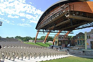
Bluestem Center for the Arts is a 3,000 seat outdoor theater in Moorhead, Minnesota that exhibits performing arts and concerts. Since its opening, it has earned a national reputation as a premier contemporary amphitheater.

Sts. Anne and Joachim Catholic Church
Church in North Dakota, United States of America
Distance: Approx. 2089 meters
Latitude and longitude: 46.8025,-96.8175
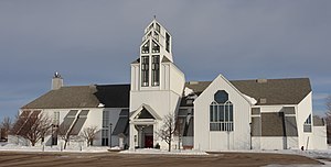
Sts. Anne and Joachim is a Roman Catholic church located in Fargo, North Dakota. Planning for the church began in 1995 and was completed in 2010.
Weather in this IP's area
broken clouds
-4 Celsius
-11 Celsius
-5 Celsius
-4 Celsius
1022 hPa
59 %
1022 hPa
987 hPa
10000 meters
8.23 m/s
240 degree
75 %