69.167.49.244 - IP Lookup: Free IP Address Lookup, Postal Code Lookup, IP Location Lookup, IP ASN, Public IP
Country:
Region:
City:
Location:
Time Zone:
Postal Code:
ISP:
ASN:
language:
User-Agent:
Proxy IP:
Blacklist:
IP information under different IP Channel
ip-api
Country
Region
City
ASN
Time Zone
ISP
Blacklist
Proxy
Latitude
Longitude
Postal
Route
db-ip
Country
Region
City
ASN
Time Zone
ISP
Blacklist
Proxy
Latitude
Longitude
Postal
Route
IPinfo
Country
Region
City
ASN
Time Zone
ISP
Blacklist
Proxy
Latitude
Longitude
Postal
Route
IP2Location
69.167.49.244Country
Region
utah
City
provo
Time Zone
America/Denver
ISP
Language
User-Agent
Latitude
Longitude
Postal
ipdata
Country
Region
City
ASN
Time Zone
ISP
Blacklist
Proxy
Latitude
Longitude
Postal
Route
Popular places and events near this IP address

Nu Skin Enterprises
American multi-level marketing company
Distance: Approx. 139 meters
Latitude and longitude: 40.233437,-111.660171
Nu Skin Enterprises, Inc. is an American multilevel marketing company that develops and sells personal care products and dietary and nutritional supplements. Under the Nu Skin and Pharmanex brands, the company sells its products in 54 markets through a network of approximately 1.2 million independent distributors.

Reed O. Smoot House
Historic house in Utah, United States
Distance: Approx. 371 meters
Latitude and longitude: 40.23277778,-111.65444444
The Reed Smoot House, also known as Mrs. Harlow E. Smoot House, was the home of Reed Smoot from 1892 to his death in 1941, and is located at 183 E. 100 South, Provo, Utah, United States. Smoot was a prominent US Senator best known for advocacy of protectionism and the Smoot–Hawley Tariff Act.

Festival Latinoamericano
Annual festival in Provo, Utah
Distance: Approx. 21 meters
Latitude and longitude: 40.23361111,-111.65861111
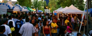
Festival Latinoamericano, or Latin American Festival, is an annual three-day Labor Day weekend festival in downtown Provo, Utah. The festival highlights Utah's Hispanic culture through food, vendors, and performances and is free to the public. Festival Latinoamericano.

Harvey H. Cluff House
Historic house in Utah, United States
Distance: Approx. 349 meters
Latitude and longitude: 40.23611111,-111.65583333
The Harvey H. Cluff house is a house in central Provo, Utah, United States, built in 1877 that is on the National Register of Historic Places. It was originally owned by Harvey H. Cluff.

Provo Tabernacle
Historic church in Utah, United States
Distance: Approx. 138 meters
Latitude and longitude: 40.23263889,-111.65916667
The Provo Tabernacle was a tabernacle of the Church of Jesus Christ of Latter-day Saints (LDS Church) from 1898 to 2010 in downtown Provo, Utah, United States. It was a historic icon of Provo and had been home to many religious and cultural events. All but the outer walls of the building were destroyed by fire in December 2010.

Dr. Samuel H. Allen House and Carriage House
Historic house in Utah, United States
Distance: Approx. 426 meters
Latitude and longitude: 40.23666667,-111.65527778
The Samuel H. Allen Home is a historic house located at 135 E. 200 North in Provo, Utah. It is listed on the National Register of Historic Places.

William D. Alexander House
Historic house in Utah, United States
Distance: Approx. 334 meters
Latitude and longitude: 40.23083333,-111.65916667
The William D. Alexander House is a historic house located in Provo, Utah. It is listed on the National Register of Historic Places. It is asserted to be the only period example of Stick Style architecture in the state of Utah.

Knight Block
United States historic place
Distance: Approx. 102 meters
Latitude and longitude: 40.23416667,-111.6575
The Knight Block is a historic building located on South University Avenue (U.S. Route 189) in downtown Provo, Utah, United States. It is listed on the National Register of Historic Places. The Knight Block was constructed in 1900, and served as headquarters for Jesse Knight (1845-1921), a local businessman primarily in the mining industry.

Provo City Center Temple
Latter-day Saint temple in Provo, Utah, United States
Distance: Approx. 150 meters
Latitude and longitude: 40.232484,-111.658972
The Provo City Center Temple is a temple of the Church of Jesus Christ of Latter-day Saints (LDS Church), built on the site of the former Provo Tabernacle in Provo, Utah. Completed in 2016, the temple uses much of the external shell of the tabernacle that remained from the original building after a fire in December 2010. The intent to build the temple was announced on October 1, 2011, by church president Thomas S. Monson, during the church's general conference.

Provo Downtown Historic District
Historic district in Utah, United States
Distance: Approx. 57 meters
Latitude and longitude: 40.23333333,-111.65888889
The Provo Downtown Historic District is a 25-acre (10 ha) historic area located in Provo, Utah, United States. It is listed on the National Register of Historic Places. The district is composed of four blocks of Center Street (100 East to 300 West) and one and a half blocks of University Avenue.

Velour Live Music Gallery
Music venue in Provo, Utah, U.S.
Distance: Approx. 197 meters
Latitude and longitude: 40.23555556,-111.65888889
Velour Live Music Gallery (often just Velour) is a music venue, on University Avenue, in Provo, Utah. Velour is owned by Corey Fox. It acts as an all-ages music venue catering to an eclectic mix of genres.

St. Mary's Episcopal Church (Provo, Utah)
Distance: Approx. 348 meters
Latitude and longitude: 40.236803,-111.659745
St. Mary's Episcopal Church, in Provo, Utah, is a congregation of the Episcopal Diocese of Utah in the Episcopal Church in the United States of America. The church building was built in 1907; in 1962, 4,800 square feet (450 m2) was added to make room for a new church office, parish hall, Sunday school, and the church library.
Weather in this IP's area
overcast clouds
-2 Celsius
-6 Celsius
-3 Celsius
-0 Celsius
1022 hPa
47 %
1022 hPa
837 hPa
10000 meters
3.09 m/s
170 degree
100 %