69.16.74.97 - IP Lookup: Free IP Address Lookup, Postal Code Lookup, IP Location Lookup, IP ASN, Public IP
Country:
Region:
City:
Location:
Time Zone:
Postal Code:
IP information under different IP Channel
ip-api
Country
Region
City
ASN
Time Zone
ISP
Blacklist
Proxy
Latitude
Longitude
Postal
Route
Luminati
Country
ASN
Time Zone
America/Chicago
ISP
UMASSNET-AS1968
Latitude
Longitude
Postal
IPinfo
Country
Region
City
ASN
Time Zone
ISP
Blacklist
Proxy
Latitude
Longitude
Postal
Route
IP2Location
69.16.74.97Country
Region
massachusetts
City
shrewsbury
Time Zone
America/New_York
ISP
Language
User-Agent
Latitude
Longitude
Postal
db-ip
Country
Region
City
ASN
Time Zone
ISP
Blacklist
Proxy
Latitude
Longitude
Postal
Route
ipdata
Country
Region
City
ASN
Time Zone
ISP
Blacklist
Proxy
Latitude
Longitude
Postal
Route
Popular places and events near this IP address

Shrewsbury, Massachusetts
Town in Massachusetts, United States
Distance: Approx. 1395 meters
Latitude and longitude: 42.29583333,-71.71333333
Shrewsbury (/ˈʃruzberi/ SHROOZ-bury) is a town in Worcester County, Massachusetts, United States. The population was 38,325 according to the 2020 United States Census, in nearly 15,000 households. Incorporated in 1727, Shrewsbury prospered in the 19th century due to its proximity to Worcester, and from visitors to Lake Quinsigamond.

Lake Quinsigamond
Lake in Central Massachusetts
Distance: Approx. 3132 meters
Latitude and longitude: 42.27083333,-71.755
Lake Quinsigamond (also Long Pond) is a body of water situated between the city of Worcester and the town of Shrewsbury in Worcester County, Massachusetts, United States. It is 4 miles (6.4 km) long, between 50 and 85 feet (15 and 26 m) deep, and has a surface area of approximately 772 acres (3.12 km2). Lake Quinsigamond hosts 8 islands with the majority owned by private citizens.
Spag's
Discount department store in Shrewsbury Massachusetts
Distance: Approx. 2243 meters
Latitude and longitude: 42.27518,-71.74593
Spag's was a discount department store on Route 9 in Shrewsbury, Massachusetts. The store was considered an early pioneer of discount retailing and was notable for its longtime resistance to accepting charge cards (until 1992), offering plastic shopping bags (late 1996), and shopping carts (introduced in 1998). Due to the store’s iconic status in Central Massachusetts culture, “spags” has come to be used in the Central Mass regional dialect as slang for “assorted goods that were obtained at very reasonable prices”, in a manner similar to how a “whiz” in the Westborough dialect refers to hobby stores that utilize their backroom to host tabletop role-playing game tournaments and how “tupperware” colloquially refers to any plastic food container with a lid and sometimes even glass food containers, regardless of brand.

Hoagland-Pincus Conference Center
Distance: Approx. 510 meters
Latitude and longitude: 42.28677778,-71.72811111
The Hoagland-Pincus Conference Center is a conference facility of the University of Massachusetts Medical School. It is named for Hudson Hoagland and Gregory Goodwin Pincus, the co-founders of the Worcester Foundation for Experimental Biology. It is located in Shrewsbury, Massachusetts at the site of the former Worcester Foundation for Experimental Biology, where the first birth control pill was developed.

General Artemas Ward House
Historic house in Massachusetts, United States
Distance: Approx. 2336 meters
Latitude and longitude: 42.295,-71.69722222
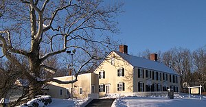
The General Artemas Ward House is a historic house at 786 Main Street in Shrewsbury, Massachusetts. Commonly known as the "Artemas Ward House", it was the lifelong home of Artemas Ward, American Major General in the American Revolutionary War and a Congressman from Massachusetts. The house is listed on the National Register of Historic Places.

White City (Shrewsbury, Massachusetts)
Distance: Approx. 2823 meters
Latitude and longitude: 42.27317222,-71.75246944
White City was an amusement park located in Shrewsbury, a suburb of Worcester, Massachusetts. It bordered Lake Quinsigamond and ran from 1905 to 1960.
Worcester Foundation for Biomedical Research
WBFR was a biomedical research institute in Shrewsbury, Massachusetts
Distance: Approx. 506 meters
Latitude and longitude: 42.2867,-71.7281
The Worcester Foundation for Biomedical Research (WFBR) was a non-profit biomedical research institute based in Shrewsbury, Massachusetts, United States.

Saint John's High School (Massachusetts)
American private high school
Distance: Approx. 990 meters
Latitude and longitude: 42.2925,-71.72916667
Saint John's High School is a private Catholic boys' high school located in Shrewsbury, Massachusetts. It is located in the Roman Catholic Diocese of Worcester. The school was founded and is currently sponsored by the Xaverian Brothers.

Shrewsbury Historic District (Shrewsbury, Massachusetts)
Historic district in Massachusetts, United States
Distance: Approx. 1590 meters
Latitude and longitude: 42.29805556,-71.71388889
The Shrewsbury Historic District encompasses the historic early center of the town of Shrewsbury, Massachusetts. It consists of the town common, laid out in 1721 at what are now Main and Prospect Streets, and buildings adjacent or nearby. The district was declared locally in 1972, and was added to the National Register of Historic Places in 1976.

Shrewsbury High School (Massachusetts)
Public school in the United States
Distance: Approx. 2720 meters
Latitude and longitude: 42.30333333,-71.74444444
Shrewsbury High School is a public high school located in Shrewsbury, Massachusetts, United States. It is the only public high school in the Shrewsbury Public Schools district. It is a large school offering a wide variety of electives and extracurricular activities.

District No. 5 School (Shrewsbury, Massachusetts)
United States historic place
Distance: Approx. 1716 meters
Latitude and longitude: 42.29138889,-71.74138889
The District No. 5 School is an historic school building and local history museum at 2 Old Mill Road in Shrewsbury, Massachusetts. It is one of two relatively unmodified one-room schoolhouses in the town.
Busta Rhymes Island
Proposed name for an island in Shrewsbury, Massachusetts
Distance: Approx. 1408 meters
Latitude and longitude: 42.2841441,-71.7393413
Busta Rhymes Island is a proposed name for an otherwise unnamed island in Shrewsbury, Worcester County, Massachusetts. The name refers to the rapper Busta Rhymes. The island is located in Mill Pond in Shrewsbury and measures 40 by 40 feet (12 m × 12 m).
Weather in this IP's area
clear sky
1 Celsius
-3 Celsius
0 Celsius
3 Celsius
1014 hPa
59 %
1014 hPa
993 hPa
10000 meters
4.63 m/s
10.29 m/s
310 degree