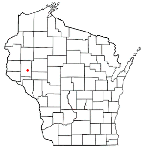
Country:
 USA
USARegion:
City:
Latitude and Longitude:
Time Zone:
Postal Code:
IP information under different IP Channel
ip-api
Country
Region
City
ASN
Time Zone
ISP
Blacklist
Proxy
Latitude
Longitude
Postal
Route
IPinfo
Country
Region
City
ASN
Time Zone
ISP
Blacklist
Proxy
Latitude
Longitude
Postal
Route
MaxMind
Country
Region
City
ASN
Time Zone
ISP
Blacklist
Proxy
Latitude
Longitude
Postal
Route
Luminati
Country
USRegion
wi
City
durand
ASN
Time Zone
America/Chicago
ISP
AIRSTREAMCOMM-NET
Latitude
Longitude
Postal
db-ip
Country
Region
City
ASN
Time Zone
ISP
Blacklist
Proxy
Latitude
Longitude
Postal
Route
ipdata
Country
Region
City
ASN
Time Zone
ISP
Blacklist
Proxy
Latitude
Longitude
Postal
Route
Popular places and events near this IP address

Pepin County, Wisconsin
County in Wisconsin, United States
Distance: Approx. 6279 meters
Latitude and longitude: 44.6,-92
Pepin County ( PEP-in) is a county in the U.S. state of Wisconsin. As of the 2020 census, the population was 7,318, making it the fourth-least populous county in Wisconsin; it is also the smallest county in Wisconsin by area. Its county seat is Durand.

Eau Galle, Dunn County, Wisconsin
Town in Wisconsin, United States
Distance: Approx. 9177 meters
Latitude and longitude: 44.69222222,-92.01166667
The Town of Eau Galle () is located in Dunn County, Wisconsin, United States. The population was 797 at the 2000 census. The unincorporated community of Eau Galle and the ghost town of Welch Point are located in the town.
Red Cedar, Wisconsin
Town in Wisconsin, United States
Distance: Approx. 7558 meters
Latitude and longitude: 44.68916667,-91.88444444
Red Cedar is a town in Dunn County, Wisconsin, United States. The population was 1,673 at the 2000 census. The unincorporated communities of Cedar Falls and Rusk are located in the town.

Lima, Pepin County, Wisconsin
Town in Wisconsin, United States
Distance: Approx. 4830 meters
Latitude and longitude: 44.63388889,-91.87305556
Lima ( LY-mə) is a town in Pepin County, Wisconsin, United States. The population was 693 at the 2020 census. The unincorporated community of Tarrant is located in the town.

Waubeek, Wisconsin
Town in Wisconsin, United States
Distance: Approx. 4624 meters
Latitude and longitude: 44.65222222,-91.98416667
Waubeek ( WAW-beek) is a town in Pepin County, Wisconsin, United States. The population was 423 at the 2020 census.

Durand (town), Wisconsin
Town in Wisconsin, United States
Distance: Approx. 1120 meters
Latitude and longitude: 44.64083333,-91.9375
Durand ( də-RAND) is a town in Pepin County, Wisconsin, United States. The population was 710 at the 2020 census. The City of Durand is located within the town.

Durand, Wisconsin
City in Wisconsin, United States
Distance: Approx. 2217 meters
Latitude and longitude: 44.62861111,-91.96166667
Durand ( də-RAND) is a city in and the county seat of Pepin County, Wisconsin, United States. Situated on the banks of the Chippewa River approximately 15 miles (24 km) from its confluence with the Mississippi River, the city borders the Town of Durand. The population was 1,854 at the 2020 census.

Eau Galle River
Distance: Approx. 5811 meters
Latitude and longitude: 44.6097,-92.0008
The Eau Galle River is a tributary of the Chippewa River in western Wisconsin in the United States. It is about 35 mi (56 km) long. Via the Chippewa River, it is part of the Mississippi River watershed.

Arkansaw, Wisconsin
Census-designated place in Wisconsin, United States
Distance: Approx. 7001 meters
Latitude and longitude: 44.63333333,-92.02222222
Arkansaw ( AR-kən-saw) is an unincorporated census-designated place in the eastern portion of the town of Waterville, in Pepin County, Wisconsin, United States. Located approximately 3 miles (4.8 km) west of Durand, it has the ZIP code of 54721. As of the 2010 census, its population was 177.
Tarrant, Wisconsin
Unincorporated community in Wisconsin, United States
Distance: Approx. 8136 meters
Latitude and longitude: 44.59666667,-91.84333333
Tarrant ( TARR-ənt) is an unincorporated community located in the town of Lima, Pepin County, Wisconsin, United States. Tarrant is 6.5 miles (10.5 km) east-southeast of Durand. Tarrant is 6.5 miles (10.5 km) east-southeast of Durand.
Durand Jr./Sr. High School
School in Durand, Pepin County, Wisconsin, United States
Distance: Approx. 1875 meters
Latitude and longitude: 44.62948056,-91.95745556
Durand-Arkansaw Middle/Senior High School is a public school serving grades 6 through 12 in Durand, Pepin County, Wisconsin, United States. Durand-Arkansaw Middle/High School provides Core Academic, Fine Arts and Vocational courses including Advanced Placement courses in Science, Math, Social Science, English and Visual Arts. Durand-Arkansaw Middle/High School also provides a wide variety of extra-curricular activities including Drama, Forensics, Academic Decathlon, and FFA. Athletic programs include Volleyball, Football, Boys/Girls Cross Country, Wrestling, Boys Basketball, Girls Basketball, Golf, Boys/Girls Track, Softball and Baseball.

Pepin County Courthouse and Jail
United States historic place
Distance: Approx. 2454 meters
Latitude and longitude: 44.62888889,-91.96472222
The Pepin County Courthouse and Jail is located in Durand, Wisconsin. In 1982, the site was added to the National Register of Historic Places. Additionally, it is listed on the Wisconsin State Register of Historic Places.
Weather in this IP's area
few clouds
13 Celsius
11 Celsius
12 Celsius
15 Celsius
1026 hPa
32 %
1026 hPa
995 hPa
10000 meters
4.24 m/s
13.42 m/s
192 degree
12 %
07:28:39
18:16:13