Country:
 Canada
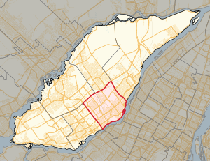
Region:
City:
Latitude and Longitude:
Time Zone:
Postal Code:
IP information under different IP Channel
ip-api
Country
Region
City
ASN
Time Zone
ISP
Blacklist
Proxy
Latitude
Longitude
Postal
Route
IPinfo
Country
Region
City
ASN
Time Zone
ISP
Blacklist
Proxy
Latitude
Longitude
Postal
Route
MaxMind
Country
Region
City
ASN
Time Zone
ISP
Blacklist
Proxy
Latitude
Longitude
Postal
Route
Luminati
Country
CARegion
qc
City
laval
ASN
Time Zone
America/Toronto
ISP
ESTRUXTURE-QC-10929
Latitude
Longitude
Postal
db-ip
Country
Region
City
ASN
Time Zone
ISP
Blacklist
Proxy
Latitude
Longitude
Postal
Route
ipdata
Country
Region
City
ASN
Time Zone
ISP
Blacklist
Proxy
Latitude
Longitude
Postal
Route
Popular places and events near this IP address

Rivière des Prairies
River in Quebec, Canada
Distance: Approx. 2489 meters
Latitude and longitude: 45.58944444,-73.65722222
The Rivière des Prairies (pronounced [ʁivjɛʁ de pʁɛʁi]; lit. 'River of the Prairies'), called the Back River in English, is a delta channel of the Ottawa River in southwestern Quebec, Canada. The Kanien'kehá:ka called it Skowanoti, meaning "River behind the island". The river separates the cities of Laval and Montreal.

Cartier station (Montreal Metro)
Montreal Metro station
Distance: Approx. 2338 meters
Latitude and longitude: 45.56027778,-73.68194444
Cartier station is a Montreal Metro station in Laval, Quebec, Canada. It is operated by the Société de transport de Montréal (STM) and serves the Orange Line. Located in the Pont-Viau district, it is part of an extension into Laval, and opened on April 28, 2007.
Pont-Viau, Quebec
Distance: Approx. 2280 meters
Latitude and longitude: 45.56083333,-73.68166667
Pont-Viau, Quebec is a district in the southern part of Laval, Quebec, Canada. It was a town before August 6, 1965. It was named after Viau Bridge, which links it to Ahuntsic-Cartierville in Montreal, Quebec.
Duvernay, Quebec
District of Laval, Quebec, Canada
Distance: Approx. 2161 meters
Latitude and longitude: 45.593,-73.665
Duvernay is a district in the eastern part of Laval and was a separate city until the municipal mergers on August 6, 1965.
De la Concorde overpass collapse
2006 highway bridge collapse in Canada
Distance: Approx. 941 meters
Latitude and longitude: 45.5835,-73.67526111
The De la Concorde overpass collapse occurred at a bridge over Quebec Autoroute 19 near Montreal, Quebec, Canada, at midday on September 30, 2006. On that Saturday, around 12:30 pm, the centre section of the south lane of an overpass (65-foot or 19.8-metre section of a three-lane overpass) collapsed in Laval, a suburb of Montreal, on Boulevard de la Concorde running over Autoroute 19. The collapsed section crushed two vehicles under it, killing five people and seriously injuring six others who went over the edge while travelling on the overpass.
Laval-des-Rapides (provincial electoral district)
Provincial electoral district in Quebec, Canada
Distance: Approx. 1497 meters
Latitude and longitude: 45.575,-73.704
Laval-des-Rapides is a provincial electoral district in the Laval region of Quebec that elects members to the National Assembly of Quebec. It is located between Autoroute 15 and Autoroute 19 and between Rivière des Prairies and Autoroute 440. It was created for the 1981 election from parts of Fabre and Mille-Îles electoral districts.
Saint-Martin station (Laval, Quebec)
Former railway station in Quebec, Canada
Distance: Approx. 2461 meters
Latitude and longitude: 45.5731,-73.7163
Saint-Martin was a railway station on the Saint-Jérôme line at 800, boul. Saint-Martin Ouest (corner of boulevard Industriel) in Laval, Quebec, Canada. The station was one of the original four stations of the temporary Blainville line opened in 1997 to serve commuters during the construction on the Marius Dufresne Bridge.

Rivière des Prairies generating station
Dam in Laval / Montreal, Quebec
Distance: Approx. 2537 meters
Latitude and longitude: 45.58805556,-73.65583333
The Rivière des Prairies generating station (in French: Centrale de la Rivière des Prairies) is a run of river hydroelectric power station on the Rivière des Prairies between the islands of Jesus and Montreal, Quebec, Canada. Built in 1929, it is now managed and operated by Hydro-Québec. It has a generating capacity of 48 MW. There is no lock allowing boats to bypass the dam.

Papineau-Leblanc Bridge
Bridge in Quebec, Canada
Distance: Approx. 1669 meters
Latitude and longitude: 45.576,-73.6666
The Papineau-Leblanc Bridge was one of the first cable-stayed spans in North America. It is part of Quebec Autoroute 19 and is one of the connections between Laval and Montreal, Quebec, Canada, spanning Rivière des Prairies. It was fabricated from weathering steel and has an orthotropic deck.

Church of La Visitation-de-la-Bienheureuse-Vierge-Marie
Church in Montreal, Canada
Distance: Approx. 2292 meters
Latitude and longitude: 45.5705,-73.661493
L'Église de la Visitation de la Bienheureuse-Vierge-Marie (English: Church of the Visitation of the Blessed Virgin Mary) is a church in the neighbourhood of Recollet Falls in Montreal. The oldest church on the island of Montreal, it was built between 1749 and 1752.

Centre Sportif Bois-de-Boulogne
Distance: Approx. 1628 meters
Latitude and longitude: 45.57416667,-73.70527778
The Centre sportif Bois-de-Boulogne is a soccer centre situated in the city of Laval, a suburb of Montreal, in the province of Quebec in Canada.

L'Île-de-la-Visitation Nature Park
Large nature park in Montreal, Canada
Distance: Approx. 1984 meters
Latitude and longitude: 45.578,-73.6617
L'Île-de-la-Visitation Nature Park (French: Parc-nature de l'Île-de-la-Visitation) is a large nature park in the Ahuntsic-Cartierville and Montréal-Nord boroughs of Montreal, Quebec, Canada. Much of the park is on Île de la Visitation, with the rest being opposite the island on the shore of the Island of Montreal. Bridges connect the two sections.
Weather in this IP's area
broken clouds
10 Celsius
7 Celsius
9 Celsius
11 Celsius
1009 hPa
77 %
1009 hPa
1004 hPa
10000 meters
6.69 m/s
12.86 m/s
250 degree
75 %
06:25:17
19:19:36