Country:
Region:
City:
Latitude and Longitude:
Time Zone:
Postal Code:
IP information under different IP Channel
ip-api
Country
Region
City
ASN
Time Zone
ISP
Blacklist
Proxy
Latitude
Longitude
Postal
Route
IPinfo
Country
Region
City
ASN
Time Zone
ISP
Blacklist
Proxy
Latitude
Longitude
Postal
Route
MaxMind
Country
Region
City
ASN
Time Zone
ISP
Blacklist
Proxy
Latitude
Longitude
Postal
Route
Luminati
Country
Region
wa
City
castlerock
ASN
Time Zone
America/Los_Angeles
ISP
PUD-001
Latitude
Longitude
Postal
db-ip
Country
Region
City
ASN
Time Zone
ISP
Blacklist
Proxy
Latitude
Longitude
Postal
Route
ipdata
Country
Region
City
ASN
Time Zone
ISP
Blacklist
Proxy
Latitude
Longitude
Postal
Route
Popular places and events near this IP address

Castle Rock, Washington
City in Washington, United States
Distance: Approx. 843 meters
Latitude and longitude: 46.27388889,-122.905
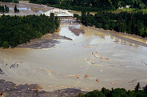
Castle Rock is a city in Cowlitz County, Washington, United States. Located between the Willapa Hills and the western base of Mount St. Helens, Castle Rock is at the heart of Washington timber country in the Pacific temperate rain forest.

Toutle River
River in Washington, United States
Distance: Approx. 3638 meters
Latitude and longitude: 46.31083333,-122.91833333
The Toutle River is a 17.2-mile (27.7 km) tributary of the Cowlitz River in the U.S. state of Washington. It rises in two forks merging near Toutle below Mount St. Helens and joins the Cowlitz near Castle Rock, 20 miles (32 km) upstream of the larger river's confluence with the Columbia River.

Silver Lake, Washington
Unincorporated community in Washington, United States
Distance: Approx. 8224 meters
Latitude and longitude: 46.29722222,-122.81055556
Silver Lake, sometimes Silverlake, is an unincorporated community in Cowlitz County, Washington, in the southwestern portion of the state. Silver Lake is located 6 miles (9.7 km) east of Castle Rock along Washington State Route 504, which is also known as the Spirit Lake Memorial Highway. The area considered Silverlake is about 6 miles (10 km) east of Interstate 5 (I-5) and is approximately 50 miles (80 km) from Portland, Oregon, to the south and Seattle about 110 miles (180 km) to the north.

Seaquest State Park
State park in the U.S. state of Washington
Distance: Approx. 7703 meters
Latitude and longitude: 46.29833333,-122.81805556
Seaquest State Park is a public recreation area located on the western flank of Silver Lake in Cowlitz County, Washington. The 505-acre (204 ha) state park is home to the Mount St. Helens Visitor Center, which offers displays on the Mount St.
KLYK
Radio station in Kelso, Washington
Distance: Approx. 2916 meters
Latitude and longitude: 46.28027778,-122.87611111
KLYK (94.5 FM) is a radio station broadcasting an Adult Top 40 format. Licensed to Kelso, Washington, United States, the station is currently owned by Bicoastal Media Licenses IV, LLC and features programming from Premiere Networks and Westwood One.
Castle Rock High School
Public school in Castle Rock, Washington, United States
Distance: Approx. 641 meters
Latitude and longitude: 46.28219,-122.920039
Castle Rock High School is a rural public high school in Castle Rock, Washington.

Laughlin Round Barn
United States historic place
Distance: Approx. 6937 meters
Latitude and longitude: 46.34027778,-122.92333333
The Laughlin Round Barn near Castle Rock, Washington is a round barn built in 1883. It was listed on the National Register of Historic Places in 1986. The Laughlin Barn is one of fewer than five within the state.
Ostrander, Washington
Unincorporated community in Washington, United States
Distance: Approx. 9700 meters
Latitude and longitude: 46.1925,-122.89194444
Ostrander is an unincorporated community in Cowlitz County, Washington, north of the city of Kelso. Ostrander is located north on North Pacific Avenue from exit 42 of Interstate 5. The Ostrander community is part of the Kelso School District, a K-12 school district of nearly 5,000 students.
Pleasant Hill, Washington
Unincorporated community in Washington, United States
Distance: Approx. 6100 meters
Latitude and longitude: 46.22527778,-122.89388889
Pleasant Hill is an unincorporated community in Cowlitz County, Washington, south of the city of Castle Rock. Pleasant Hill is located along or near Pleasant Hill Road between Castle Rock and Ostrander. The northern end of Pleasant Hill community is part of the Castle Rock School District, while the southern end is part of the Kelso School District.
Sandy Bend, Washington
Unincorporated community in Washington, United States
Distance: Approx. 4202 meters
Latitude and longitude: 46.24055556,-122.91388889
Sandy Bend is an unincorporated community in Cowlitz County, Washington, south of the city of Castle Rock, west of Washington State Route 411, and to the west of the Cowlitz River. Sandy Bend is located along or near Sandy Bend Road between Castle Rock and West Side Highway. The Sandy Bend community is part of the Castle Rock School District, a K-12 school district of about 1,300 students.
Arkansas Creek
Stream in Washington, U.S.
Distance: Approx. 1346 meters
Latitude and longitude: 46.26638889,-122.91694444
Arkansas Creek is a stream in the U.S. state of Washington. Arkansas Creek was named after the state of Arkansas, the native home of a large share of the first settlers.
Weather in this IP's area
scattered clouds
7 Celsius
7 Celsius
4 Celsius
8 Celsius
1026 hPa
97 %
1026 hPa
1024 hPa
10000 meters
0.46 m/s
0.65 m/s
161 degree
41 %
07:39:13
18:12:32