Country:
 USA
USARegion:
City:
Latitude and Longitude:
Time Zone:
Postal Code:
IP information under different IP Channel
ip-api
Country
Region
City
ASN
Time Zone
ISP
Blacklist
Proxy
Latitude
Longitude
Postal
Route
IPinfo
Country
Region
City
ASN
Time Zone
ISP
Blacklist
Proxy
Latitude
Longitude
Postal
Route
MaxMind
Country
Region
City
ASN
Time Zone
ISP
Blacklist
Proxy
Latitude
Longitude
Postal
Route
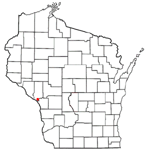
Luminati
Country
USRegion
wi
City
osseo
ASN
Time Zone
America/Chicago
ISP
AIRSTREAMCOMM-NET
Latitude
Longitude
Postal
db-ip
Country
Region
City
ASN
Time Zone
ISP
Blacklist
Proxy
Latitude
Longitude
Postal
Route
ipdata
Country
Region
City
ASN
Time Zone
ISP
Blacklist
Proxy
Latitude
Longitude
Postal
Route
Popular places and events near this IP address

Richmond Township, Winona County, Minnesota
Township in Minnesota, United States
Distance: Approx. 4453 meters
Latitude and longitude: 43.97888889,-91.42888889
Richmond Township is a township in Winona County, Minnesota, United States. The population was 699 at the 2010 census. Richmond Township was organized in 1858, and named for a French settler.
Caledonia, Trempealeau County, Wisconsin
Town in Wisconsin, United States
Distance: Approx. 6084 meters
Latitude and longitude: 44.02027778,-91.35833333
Caledonia ( KAL-ə-DOH-nee-ə) is a town in Trempealeau County, Wisconsin, United States. The population was 928 at the 2020 census.

Trempealeau, Wisconsin
Village in Wisconsin, United States
Distance: Approx. 1256 meters
Latitude and longitude: 44.00791,-91.43887
Trempealeau ( TREM-pə-loh) is a village located along the Mississippi River in Trempealeau County in the U.S. state of Wisconsin. The population was 1,843 at the 2020 census. The village is surrounded by the Town of Trempealeau.

Perrot State Park
State Park in Trempealeau County, Wisconsin
Distance: Approx. 2658 meters
Latitude and longitude: 44.01861111,-91.4675
Perrot State Park is a state park in Wisconsin's Driftless Area at the confluence of the Trempealeau and Mississippi rivers. The 1,270-acre (514 ha) park features views of steep limestone bluffs and the river valleys. It has observation platforms for watching wildlife, including the variety of birds which inhabit or migrate through the park.

Lock and Dam No. 6
Dam in United States. Near Trempealeau, Wisconsin.
Distance: Approx. 2137 meters
Latitude and longitude: 43.99972222,-91.43833333
Lock and Dam No. 6 is a lock and dam located near Trempealeau, Wisconsin on the Upper Mississippi River near river mile 714.1. It was constructed and placed in operation in June 1936.

Centerville, Trempealeau County, Wisconsin
Unincorporated community in Wisconsin, United States
Distance: Approx. 5872 meters
Latitude and longitude: 44.07,-91.45138889
Centerville (also Centreville) is an unincorporated community in the Town of Trempealeau, Trempealeau County, Wisconsin, United States.
Fort Trempealeau
Distance: Approx. 3202 meters
Latitude and longitude: 44.01473,-91.47391
Fort Trempealeau was founded in 1685 by Nicholas Perrot and a groupe of Canadiens. In the fall of 1685, Perrot and his men arrived at Mont Trempealeau by canoe. The Winnebagos called this mountain, Hay-nee-ah-cheh, or the mountain in the water.

Lamoille, Minnesota
Unincorporated community in Minnesota, United States
Distance: Approx. 3566 meters
Latitude and longitude: 44.00222222,-91.4725
Lamoille (also spelled La Moille) is an unincorporated community in Richmond Township, Winona County, Minnesota, United States. Big Trout Creek and the Mississippi River meet at Lamoille.

Coman House
Historic house in Wisconsin, United States
Distance: Approx. 1618 meters
Latitude and longitude: 44.00416667,-91.43416667
The Coman House is a historic house located in Trempealeau, Wisconsin. It is locally significant as the best example of the Italianate style in the village. It was the first brick house built in the community.

Brady's Bluff Prairie State Natural Area
State Natural Area in Trempealeau County, Wisconsin
Distance: Approx. 3970 meters
Latitude and longitude: 44.01916667,-91.48388889
Brady's Bluff Prairie State Natural Area is a Wisconsin Department of Natural Resources-designated State Natural Area featuring a steep, southwest-facing bluff rising over 450 feet above the Mississippi River. Over 100 species of prairie plants have been found at this site.

Trempealeau Mountain State Natural Area
State Natural Area in Wisconsin
Distance: Approx. 4802 meters
Latitude and longitude: 44.02138889,-91.49416667
Trempealeau Mountain State Natural Area is a Wisconsin Department of Natural Resources-designated State Natural Area consisting of a 425-foot conical rock mound surrounded on three sides by the Mississippi and Trempealeau Rivers. It is one of only 3 solid rock islands along the entire Mississippi River.
Cedar Creek (Mississippi River tributary)
Stream in Winona County, Minnesota, U.S.
Distance: Approx. 4983 meters
Latitude and longitude: 44.00972222,-91.49527778
Cedar Creek is a stream in Winona County, in the U.S. state of Minnesota. It is a tributary of the Mississippi River. Cedar Creek was named for the red cedar trees near the stream.
Weather in this IP's area
clear sky
17 Celsius
15 Celsius
15 Celsius
18 Celsius
1026 hPa
33 %
1026 hPa
999 hPa
10000 meters
3.13 m/s
7.15 m/s
171 degree
2 %
07:24:33
18:16:40