68.65.134.196 - IP Lookup: Free IP Address Lookup, Postal Code Lookup, IP Location Lookup, IP ASN, Public IP
Country:
Region:
City:
Location:
Time Zone:
Postal Code:
IP information under different IP Channel
ip-api
Country
Region
City
ASN
Time Zone
ISP
Blacklist
Proxy
Latitude
Longitude
Postal
Route
Luminati
Country
Region
tx
City
houston
ASN
Time Zone
America/Chicago
ISP
US-TELEPACIFIC
Latitude
Longitude
Postal
IPinfo
Country
Region
City
ASN
Time Zone
ISP
Blacklist
Proxy
Latitude
Longitude
Postal
Route
IP2Location
68.65.134.196Country
Region
georgia
City
jonesboro
Time Zone
America/New_York
ISP
Language
User-Agent
Latitude
Longitude
Postal
db-ip
Country
Region
City
ASN
Time Zone
ISP
Blacklist
Proxy
Latitude
Longitude
Postal
Route
ipdata
Country
Region
City
ASN
Time Zone
ISP
Blacklist
Proxy
Latitude
Longitude
Postal
Route
Popular places and events near this IP address

Irondale, Georgia
Place in Georgia, United States
Distance: Approx. 3242 meters
Latitude and longitude: 33.47555556,-84.36027778
Irondale is an unincorporated community and census-designated place (CDP) in Clayton County, Georgia, United States. The population was 8,740 at the 2020 census.
Jonesboro, Georgia
City in Georgia, United States
Distance: Approx. 4605 meters
Latitude and longitude: 33.52444444,-84.35416667
Jonesboro () is a city in and the county seat of Clayton County, Georgia, United States. The population was 4,235 in 2020. The city's name was originally spelled Jonesborough.

Battle of Jonesborough
1864 battle of the American Civil War
Distance: Approx. 4736 meters
Latitude and longitude: 33.5307,-84.3621
The Battle of Jonesborough (August 31–September 1, 1864) was fought between Union Army forces led by William Tecumseh Sherman and Confederate forces under William J. Hardee during the Atlanta Campaign in the American Civil War. On the first day, on orders from Army of Tennessee commander John Bell Hood, Hardee's troops attacked the Federals and were repulsed with heavy losses. That evening, Hood ordered Hardee to send half his troops back to Atlanta.

Clayton County Public Schools
School district in Georgia (U.S. state)
Distance: Approx. 5511 meters
Latitude and longitude: 33.53638889,-84.35722222
The Clayton County Public School District (CCPS) is a public school district headquartered in Jonesboro, Georgia, U.S. It administers schools inside of Clayton County, Georgia. Serving more than 52,000 students, Clayton County Public Schools is ranked among the 100 largest school districts in the United States and is the sixth-largest school system in Georgia. The system has 39 primary/elementary schools (including one public charter), 17 middle schools (including one public charter), 12 high schools, one alternative education center, one psychological education center, and one multi-purpose education center.

Jonesboro Historic District (Jonesboro, Georgia)
Historic district in Georgia, United States
Distance: Approx. 4560 meters
Latitude and longitude: 33.52388889,-84.35416667
Jonesboro Historic District in Jonesboro, Georgia is a historic district that was listed on the National Register of Historic Places (NRHP) in 1972. Jonesboro was the setting of much of the 1936 novel Gone with the Wind; the fictional houses Tara and Twelve Oaks were placed near it, in Clayton County. It includes Stately Oaks, also separately listed on the NRHP, which is believed to be the inspiration for Tara.

Stately Oaks
Historic house in Georgia, United States
Distance: Approx. 4194 meters
Latitude and longitude: 33.51538,-84.35046
Stately Oaks Plantation is a Greek Revival antebellum mansion located in Margaret Mitchell Memorial Park in Jonesboro, Georgia. Built in 1839, the house was listed on the National Register of Historic Places in 1972. It is also known as Orr House, The Oaks, and Robert McCord House and it is included in the Jonesboro Historic District.
Patrick R. Cleburne Confederate Cemetery
American Civil War cemetery in Clayton County, Georgia, United States
Distance: Approx. 5196 meters
Latitude and longitude: 33.5306316,-84.3531128
Patrick R. Cleburne Confederate Cemetery is a memorial cemetery located in the city of Jonesboro, Georgia, United States. It was named in honor of General Patrick Cleburne. This cemetery was a burial site for Confederate soldiers who died in the Battle of Jonesboro in 1864.
Mundy's Mill High School
Public school in Jonesboro, Georgia, United States
Distance: Approx. 428 meters
Latitude and longitude: 33.4914,-84.3839
Mundy's Mill High School is a public school in the Clayton County Public Schools (CCPS) system in Jonesboro, Georgia, United States. The school's teams compete as the Tigers. It opened in October of 2002.
Kenwood, Fayette County, Georgia
Unincorporated community in Georgia, U.S.
Distance: Approx. 4919 meters
Latitude and longitude: 33.51138889,-84.43611111
Kenwood is an unincorporated community in northeastern Fayette County, Georgia. It uses the address of nearby Fayetteville, Georgia.

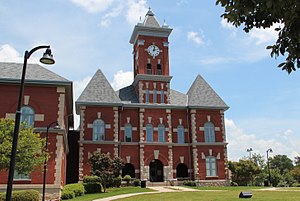
Clayton County Courthouse (Georgia)
Distance: Approx. 4391 meters
Latitude and longitude: 33.52092,-84.35315
The Clayton County Courthouse in Jonesboro, Georgia is a historic courthouse. It was designed by J.W. Golucke. This or a predecessor courthouse was designed by Maximilien van den Corput (c.
Mundys Mill, Georgia
Unincorporated community in Georgia, U.S.
Distance: Approx. 460 meters
Latitude and longitude: 33.49,-84.38944444
Mundy's Mill is an unincorporated community in Clayton County, in the U.S. state of Georgia.

ArieForce One
Steel roller coaster at Fun Spot America Atlanta
Distance: Approx. 3844 meters
Latitude and longitude: 33.4973,-84.4287
ArieForce One is a steel roller coaster at Fun Spot America Atlanta in Fayetteville, Georgia. Manufactured by Rocky Mountain Construction, the ride was first announced by representatives of the Fun Spot America chain in May 2021, and the coaster was formally unveiled at the IAAPA Orlando Expo on November 16, 2021. At an accumulated cost of $18 million, ArieForce One represents the single largest investment on any ride in Fun Spot America's history.
Weather in this IP's area
clear sky
3 Celsius
1 Celsius
1 Celsius
4 Celsius
1025 hPa
81 %
1025 hPa
994 hPa
10000 meters
1.8 m/s
2.18 m/s
90 degree
6 %
