Country:
Region:
City:
Latitude and Longitude:
Time Zone:
Postal Code:
IP information under different IP Channel
ip-api
Country
Region
City
ASN
Time Zone
ISP
Blacklist
Proxy
Latitude
Longitude
Postal
Route
Luminati
Country
Region
ks
City
onaga
ASN
Time Zone
America/Chicago
ISP
BLUE-VALLEY
Latitude
Longitude
Postal
IPinfo
Country
Region
City
ASN
Time Zone
ISP
Blacklist
Proxy
Latitude
Longitude
Postal
Route
db-ip
Country
Region
City
ASN
Time Zone
ISP
Blacklist
Proxy
Latitude
Longitude
Postal
Route
ipdata
Country
Region
City
ASN
Time Zone
ISP
Blacklist
Proxy
Latitude
Longitude
Postal
Route
Popular places and events near this IP address
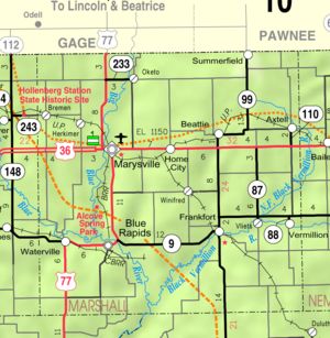
Marshall County, Kansas
County in Kansas, United States
Distance: Approx. 7794 meters
Latitude and longitude: 39.8,-96.55
Marshall County is a county located in the U.S. state of Kansas. Its county seat and largest city is Marysville. As of the 2020 census, the county population was 10,038.

Frankfort, Kansas
City in Marshall County, Kansas
Distance: Approx. 9597 meters
Latitude and longitude: 39.70388889,-96.41694444
Frankfort is a city in Marshall County, Kansas, United States. As of the 2020 census, the population of the city was 730.
Wells Township, Marshall County, Kansas
Township in Marshall County, Kansas, U.S.
Distance: Approx. 4152 meters
Latitude and longitude: 39.6964,-96.5294
Wells Township is a township in Marshall County, Kansas, United States.

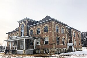
Frankfort School
United States historic place
Distance: Approx. 9566 meters
Latitude and longitude: 39.70472222,-96.41694444
The Frankfort School at 400 Locust St. in Frankfort, Kansas was built during 1902–03. It was listed on the National Register of Historic Places in 1972.
Weather in this IP's area
broken clouds
12 Celsius
10 Celsius
12 Celsius
12 Celsius
1024 hPa
47 %
1024 hPa
973 hPa
10000 meters
3.6 m/s
70 degree
75 %
07:03:17
17:16:32
