Country:
Region:
City:
Latitude and Longitude:
Time Zone:
Postal Code:
IP information under different IP Channel
ip-api
Country
Region
City
ASN
Time Zone
ISP
Blacklist
Proxy
Latitude
Longitude
Postal
Route
Luminati
Country
Region
ks
City
marysville
ASN
Time Zone
America/Chicago
ISP
BLUE-VALLEY
Latitude
Longitude
Postal
IPinfo
Country
Region
City
ASN
Time Zone
ISP
Blacklist
Proxy
Latitude
Longitude
Postal
Route
db-ip
Country
Region
City
ASN
Time Zone
ISP
Blacklist
Proxy
Latitude
Longitude
Postal
Route
ipdata
Country
Region
City
ASN
Time Zone
ISP
Blacklist
Proxy
Latitude
Longitude
Postal
Route
Popular places and events near this IP address

Blue Rapids, Kansas
City in Marshall County, Kansas
Distance: Approx. 2047 meters
Latitude and longitude: 39.67916667,-96.65916667
Blue Rapids is a city in Marshall County, Kansas, United States. As of the 2020 census, the population of the city was 928.
Waterville, Kansas
City in Marshall County, Kansas
Distance: Approx. 9815 meters
Latitude and longitude: 39.69194444,-96.74833333
Waterville is a city in Marshall County, Kansas, United States. As of the 2020 census, the population of the city was 658.
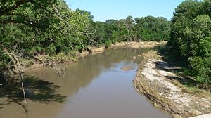
Little Blue River (Kansas/Nebraska)
River in Nebraska and Kansas in the United States
Distance: Approx. 4493 meters
Latitude and longitude: 39.6975,-96.67944444
The Little Blue River is a 245-mile-long (394 km) river in southern Nebraska and northern Kansas in the United States, that was used by Pony Express horseback riders. Ridgelines of this historic watershed defined the wagon train routes first used by Oregon Trail emigrants.
Valley Heights Jr/Sr High School
Public co-ed school in Blue Rapids, Kansas , United States
Distance: Approx. 6614 meters
Latitude and longitude: 39.68638889,-96.71166667
Valley Heights Jr/Sr High School is a public secondary school located between the cities of Blue Rapids and Waterville in Kansas. It is operated by Valley Heights USD 498 school district, and serves students of grades 7 to 12.
Irving, Kansas
Ghost town in Marshall County, Kansas
Distance: Approx. 5195 meters
Latitude and longitude: 39.63888889,-96.5975
Irving is a ghost town in Marshall County, Kansas, United States, located six miles southeast of the city of Blue Rapids along the Big Blue River. Irving was one of the many towns affected by "Big Dam Foolishness" during the construction of Tuttle Creek Lake about ten miles to the south. Although the lake never reached the town, the federal government forced remaining residents to vacate the town.

Alcove Springs
United States historic place in Kansas
Distance: Approx. 8936 meters
Latitude and longitude: 39.74916667,-96.67583333
Alcove Springs was a popular stop along the Oregon Trail near Independence Crossing in Marshall County, Kansas. Travelers along the trail gave the springs its name. The words 'Alcove Springs', carved into the hard limestone cliff by the Donner Party, can still be seen, although some of the carving has weathered away.
Weaver Hotel
United States historic place
Distance: Approx. 9739 meters
Latitude and longitude: 39.69166667,-96.7475
The Weaver Hotel was built in 1905–06 in Waterville, Kansas. The only three-story building in Waterville, it was built by William E. Weaver for his parents. The hotel has operated more or less continuously ever since.
Wells Township, Marshall County, Kansas
Township in Marshall County, Kansas, U.S.
Distance: Approx. 9429 meters
Latitude and longitude: 39.6964,-96.5294
Wells Township is a township in Marshall County, Kansas, United States.
Weather in this IP's area
overcast clouds
12 Celsius
11 Celsius
12 Celsius
13 Celsius
1023 hPa
52 %
1023 hPa
982 hPa
10000 meters
5.76 m/s
10.06 m/s
94 degree
100 %
07:03:37
17:17:07


