68.233.142.97 - IP Lookup: Free IP Address Lookup, Postal Code Lookup, IP Location Lookup, IP ASN, Public IP
Country:
Region:
City:
Location:
Time Zone:
Postal Code:
ISP:
ASN:
language:
User-Agent:
Proxy IP:
Blacklist:
IP information under different IP Channel
ip-api
Country
Region
City
ASN
Time Zone
ISP
Blacklist
Proxy
Latitude
Longitude
Postal
Route
db-ip
Country
Region
City
ASN
Time Zone
ISP
Blacklist
Proxy
Latitude
Longitude
Postal
Route
IPinfo
Country
Region
City
ASN
Time Zone
ISP
Blacklist
Proxy
Latitude
Longitude
Postal
Route
IP2Location
68.233.142.97Country
Region
oregon
City
portland
Time Zone
America/Los_Angeles
ISP
Language
User-Agent
Latitude
Longitude
Postal
ipdata
Country
Region
City
ASN
Time Zone
ISP
Blacklist
Proxy
Latitude
Longitude
Postal
Route
Popular places and events near this IP address

Morrison Bridge
Bridge in Oregon, U.S.
Distance: Approx. 183 meters
Latitude and longitude: 45.517895,-122.669692
The Morrison Bridge is a bascule bridge that spans the Willamette River in Portland, Oregon. Completed in 1958, it is the third bridge at approximately the same site to carry that name. It is one of the most heavily used bridges in Portland.
Oak Street/Southwest 1st Avenue station
Distance: Approx. 201 meters
Latitude and longitude: 45.52,-122.67222222
Oak Street/Southwest 1st Avenue is a light rail station on the MAX Blue and Red Lines in Portland, Oregon. It the 4th stop on the current Eastside MAX. It was previously also served by the Yellow Line, from 2004 to 2009, until that line's relocation to the Portland Transit Mall. The station has side platforms built into the sidewalk.

Yamhill District and Morrison/Southwest 3rd Avenue stations
Light rail stations in Oregon
Distance: Approx. 217 meters
Latitude and longitude: 45.51777778,-122.67472222
Yamhill District and Morrison/Southwest 3rd Avenue are light rail stations on the MAX Blue and Red Lines in downtown Portland, Oregon. Located in the Yamhill Historic District, it is the 3rd stop eastbound on the current Eastside MAX. It was also the eastern terminus of the transit mall. It originally served the Yellow Line from 2004 to 2009 until its relocation to the Portland Transit Mall.

Portland Yamhill Historic District
Historic district in Portland, Oregon, U.S.
Distance: Approx. 205 meters
Latitude and longitude: 45.516985,-122.673972
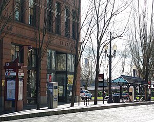
The Portland Yamhill Historic District, located in downtown Portland, Oregon, is listed on the National Register of Historic Places. From 1914 to 1934, the area included part of the Carroll Public Market. The area covered, between the commercial center of Portland and the Willamette River, is within a 22-block section destroyed in the Great Fire of 1873; it includes the Northrup and Blossom-Fitch Building (1858) from before the fire.

Waldo Block
Historic building in Portland, Oregon, U.S.
Distance: Approx. 217 meters
Latitude and longitude: 45.519526,-122.674031
The Waldo Block, located in downtown Portland, Oregon, is listed on the National Register of Historic Places. The building's ground floor houses Mama Mia Trattoria.

The Oregonian Printing Press Park
Public park in Portland, Oregon, U.S.
Distance: Approx. 107 meters
Latitude and longitude: 45.5179,-122.6733
The Oregonian Printing Press Park, or simply Printing Press Park, is a triangular 1,000-square-foot park on the southeastern corner of the intersection of Southwest First Avenue and Morrison Street in Portland, Oregon, United States. The green space marks where editor Thomas J. Dryer operated a small press to publish Portland's weekly newspaper, which would become The Oregonian, beginning on December 4, 1850.

Bank of America Center (Portland, Oregon)
Distance: Approx. 139 meters
Latitude and longitude: 45.51823,-122.67378
The Bank of America Center, also known as the Bank of America Financial Center and One Financial Center, is located at 101–177 Southwest Morrison Street in Portland, Oregon, United States. Construction began in 1985 and was completed in 1987. The 18-story building has 350,000 feet of office space.

Mama Mia Trattoria
Italian restaurant in Portland, Oregon, U.S.
Distance: Approx. 200 meters
Latitude and longitude: 45.5194,-122.6739
Mama Mia Trattoria is an Italian restaurant housed in Portland, Oregon's Waldo Block, in the United States.

Hotel Rose
Hotel in Portland, Oregon, U.S.
Distance: Approx. 151 meters
Latitude and longitude: 45.51722222,-122.67333333
Hotel Rose, sometimes referred to as Staypineapple at Hotel Rose, is a 140-room boutique hotel in southwest Portland, Oregon, United States. Located in downtown Portland across from Tom McCall Waterfront Park, the hotel opened as Riverside West Motor Hotel in 1964 and later operated as a Four Points by Sheraton property and as Hotel Fifty.

Harker Building
Historic building in Portland, Oregon, U.S.
Distance: Approx. 164 meters
Latitude and longitude: 45.51727778,-122.67363889
The Harker Building is a historical structure in southwest Portland, Oregon. The building was completed in 1878, and was soon occupied by the Oregon Conservatory of Music. A United Brethren congregation purchased the building in 1918 and created a Chinese Mission on the second level.

Willamette Block
Historic building in Portland, Oregon, U.S.
Distance: Approx. 206 meters
Latitude and longitude: 45.5175,-122.67444444
Willamette Block is an historic building in Portland, Oregon. The 1882 structures is part of the Portland Yamhill Historic District, which is listed on the National Register of Historic Places.
Portland Winter Ice Rink
Annual ice rink in Portland, Oregon, U.S.
Distance: Approx. 45 meters
Latitude and longitude: 45.5184,-122.6725
The Portland Winter Ice Rink is an ice rink, temporarily installed during winter months in Portland, Oregon, United States. Prosper Portland launched the project for the 2023–2024 season, and popular demand prompted the economic development organization to organize the rink again for the 2024–2025 season.
Weather in this IP's area
clear sky
2 Celsius
-1 Celsius
-0 Celsius
4 Celsius
1028 hPa
65 %
1028 hPa
1017 hPa
10000 meters
3.58 m/s
7.6 m/s
98 degree
