Country:
Region:
City:
Latitude and Longitude:
Time Zone:
Postal Code:
IP information under different IP Channel
ip-api
Country
Region
City
ASN
Time Zone
ISP
Blacklist
Proxy
Latitude
Longitude
Postal
Route
Luminati
Country
Region
ca
City
irvine
ASN
Time Zone
America/Los_Angeles
ISP
USC-AS
Latitude
Longitude
Postal
IPinfo
Country
Region
City
ASN
Time Zone
ISP
Blacklist
Proxy
Latitude
Longitude
Postal
Route
db-ip
Country
Region
City
ASN
Time Zone
ISP
Blacklist
Proxy
Latitude
Longitude
Postal
Route
ipdata
Country
Region
City
ASN
Time Zone
ISP
Blacklist
Proxy
Latitude
Longitude
Postal
Route
Popular places and events near this IP address
Irvine High School
Public secondary school in Irvine, California, United States
Distance: Approx. 2744 meters
Latitude and longitude: 33.7026,-117.7824
Irvine High School is a public high school, located in the city of Irvine in Orange County, California, United States. It is part of the Irvine Unified School District. The school is located in the El Camino Real neighborhood in the north-central part of the city.

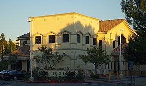
Islamic Center of Irvine
Mosque in Irvine, California
Distance: Approx. 1301 meters
Latitude and longitude: 33.696526,-117.765513
The Islamic Center of Irvine is a mosque and Islamic community center founded by the Muslims of Irvine, California, on August 28, 2004. The mosque has one of the largest congregations in California, with an estimated 2,500 worshipers attending weekly programs and benefiting from a variety of services, including youth programs, an annual summer camp for children, senior workshops and interfaith sports. The Islamic Center of Irvine is partnered with the Islamic Society of Orange County in nearby Garden Grove, the Orange County Islamic Foundation in Mission Viejo and the Islamic Institute of Orange County in Anaheim.

Northwood, Irvine, California
Distance: Approx. 1287 meters
Latitude and longitude: 33.7126,-117.7567
Northwood is a community encompassing the northern portions of the city of Irvine, in Orange County, California.
Northwood Community Park
Distance: Approx. 1744 meters
Latitude and longitude: 33.711284,-117.767506
Northwood Community Park is located in the Northwood, Irvine, California, United States. The park, built in 1980 on the site of a former citrus packing facility, is also known as "Castle Park" because it contains a children's fort structure. The park features Winslow Field—named for resident Chuck Winslow in 1982—which hosts PONY baseball games, and Northwood Gratitude and Honor Memorial, a war memorial.

Heritage Park, Irvine
City park in Irvine, California
Distance: Approx. 2322 meters
Latitude and longitude: 33.70097245,-117.77786251
Heritage Park is located in the city of Irvine in Orange County, California. The park sits next to Heritage Park Regional Library on the corner of Yale and Walnut Avenue(s), and is adjacent to Irvine High School. It was for decades recognized by its iconic wooden "water tower" slide, which stood three stories tall.

Northwood Gratitude and Honor Memorial
Distance: Approx. 1701 meters
Latitude and longitude: 33.7102,-117.7679
The Northwood Gratitude and Honor Memorial is a memorial in Irvine, California, to American troops who died in the wars in Iraq and Afghanistan. The names on the memorial come from US DoD casualty records for Operation Enduring Freedom, Operation Iraqi Freedom, and Operation New Dawn. Located at Northwood Community Park, on the corner of Yale and Bryan in Northwood, Irvine, California, it is the only known memorial in the United States dedicated to listing by name all American service men and women killed in the conflicts in Afghanistan and Iraq.

William Woollett Jr. Aquatics Center
Distance: Approx. 2597 meters
Latitude and longitude: 33.70111111,-117.78083333
The William Woollett Jr. Aquatics Center is an aquatics venue located in Irvine, California, United States. The City of Irvine operates year-round municipal programs in aquatic facility.
Jeffrey Open Space
Distance: Approx. 267 meters
Latitude and longitude: 33.703783,-117.753687
Jeffrey Open Space and the Jeffrey Open Space Trail within it comprise a 96-acre area of parks and trails in Irvine, California. Approximately five miles in length, it primarily follows Jeffrey Road spanning nearly the entire city, from just past Portola Parkway in the north to the Quail Hill open space in the south for 5 miles (8.0 km). Through a series of community meetings, Jeffrey Open Space was commissioned to be a centerpiece greenspace through the heart of Irvine, providing amenities to residents and visitors and connecting with other parks and trails at multiple points.

Frances Packing House
United States historic place
Distance: Approx. 1425 meters
Latitude and longitude: 33.71083333,-117.76333333
The Frances Packing House in Orange County, California near Irvine, California is a historic packing house that was built in 1916. It was listed on the National Register of Historic Places (NRHP) in 1977. The packing house closed in 1971, and the building was demolished in 1977.

Irvine Blacksmith Shop
United States historic place
Distance: Approx. 2868 meters
Latitude and longitude: 33.67611111,-117.75805556
Irvine Blacksmith Shop, at 14952 Sand Canyon Ave. in Irvine, California, was built in 1915-16 by the Irvine Company. It was listed on the National Register of Historic Places in 1986.
Great Park Ice & FivePoint Arena
Ice hockey facility in Irvine, California
Distance: Approx. 2750 meters
Latitude and longitude: 33.67761,-117.74524
Great Park Ice & FivePoint Arena is a 2,500 seat (FivePoint Arena) 4 rink (3 NHL and 1 Olympic) ice hockey facility in Irvine, California. It serves as the practice facility of the Anaheim Ducks, after leaving Anaheim Ice. The facility includes a team store, restaurant (Between the Rinks), pro shop, arcade, and other amenities.

Crean Lutheran High School
Lutheran high school in Irvine, California
Distance: Approx. 1932 meters
Latitude and longitude: 33.70213,-117.73195
Crean Lutheran High School is a private Lutheran high school in Irvine, California. The school was founded in 2007 as Lutheran South High School and had its initial campus at St. Paul's Greek Orthodox Church in the Woodbridge neighborhood of Irvine.
Weather in this IP's area
scattered clouds
17 Celsius
16 Celsius
15 Celsius
18 Celsius
1010 hPa
57 %
1010 hPa
1002 hPa
10000 meters
0.89 m/s
5.36 m/s
68 degree
26 %
06:23:38
16:48:03