67.52.38.84 - IP Lookup: Free IP Address Lookup, Postal Code Lookup, IP Location Lookup, IP ASN, Public IP
Country:
Region:
City:
Location:
Time Zone:
Postal Code:
IP information under different IP Channel
ip-api
Country
Region
City
ASN
Time Zone
ISP
Blacklist
Proxy
Latitude
Longitude
Postal
Route
Luminati
Country
Region
wi
City
milwaukee
ASN
Time Zone
America/Chicago
ISP
TWC-10796-MIDWEST
Latitude
Longitude
Postal
IPinfo
Country
Region
City
ASN
Time Zone
ISP
Blacklist
Proxy
Latitude
Longitude
Postal
Route
IP2Location
67.52.38.84Country
Region
wisconsin
City
oshkosh
Time Zone
America/Chicago
ISP
Language
User-Agent
Latitude
Longitude
Postal
db-ip
Country
Region
City
ASN
Time Zone
ISP
Blacklist
Proxy
Latitude
Longitude
Postal
Route
ipdata
Country
Region
City
ASN
Time Zone
ISP
Blacklist
Proxy
Latitude
Longitude
Postal
Route
Popular places and events near this IP address

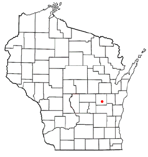
Winnebago County, Wisconsin
County in Wisconsin, United States
Distance: Approx. 7400 meters
Latitude and longitude: 44.06,-88.64
Winnebago County is a county in the U.S. state of Wisconsin. As of the 2020 census, the population was 171,730. Its county seat is Oshkosh.

Algoma, Winnebago County, Wisconsin
Town in Wisconsin, United States
Distance: Approx. 5831 meters
Latitude and longitude: 44.02138889,-88.60472222
Algoma is a town in Winnebago County, Wisconsin, United States. The population was 6,822 at the 2010 census. The unincorporated communities of Highland Shore, Leonards Point, Melrose Park, and Oakwood are located in the town.

Utica, Winnebago County, Wisconsin
Town in Wisconsin, United States
Distance: Approx. 6247 meters
Latitude and longitude: 43.94555556,-88.70055556
Utica (formerly Welaunee) is a town in Winnebago County, Wisconsin, United States. The population was 1,299 at the 2010 census. The unincorporated communities of Elo, Fisk, and Pickett are located in the town.

Omro (town), Wisconsin
Town in Wisconsin, United States
Distance: Approx. 5559 meters
Latitude and longitude: 44.03555556,-88.71305556
Omro is a town in Winnebago County, Wisconsin, United States. The population was 2,116 at the 2010 census. The City of Omro and the unincorporated communities of Harbor Springs, Reighmoor, Rivermoor, and Zion are located in the town.

Omro, Wisconsin
City in Wisconsin, United States
Distance: Approx. 7456 meters
Latitude and longitude: 44.03888889,-88.74166667
Omro is a city in Winnebago County, Wisconsin, United States. The population was 3,517 at the 2010 census. The city is located along the Fox River, approximately 10 miles west of Oshkosh, Wisconsin.

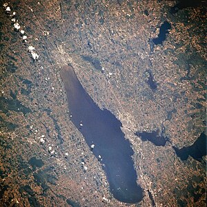
Winnebago Pool
Lakes in Wisconsin, United States
Distance: Approx. 6877 meters
Latitude and longitude: 44,-88.58333333
The Winnebago Pool is a collective name for a group of interconnected lakes in eastern Wisconsin. The terminal point of this watershed is Lake Winnebago itself, which has a surface elevation of 746 feet. Besides Lake Winnebago, the Winnebago Pool includes Big Lake Butte des Morts, Lake Poygan and Lake Winneconne.

EAA Aviation Museum
Aviation Museum in Oshkosh, Wisconsin
Distance: Approx. 7406 meters
Latitude and longitude: 43.98416667,-88.57833333
The EAA Aviation Museum, formerly the EAA AirVenture Museum (or Air Adventure Museum), is a museum dedicated to the preservation and display of historic and experimental aircraft as well as antiques, classics, and warbirds. The museum is located in Oshkosh, Wisconsin, United States, adjacent to Wittman Regional Airport, home of the museum's sponsoring organization, the Experimental Aircraft Association (EAA), and the organization's EAA AirVenture Oshkosh event (the world's biggest fly-in and airshow) that takes place in late July/early August. With over 200 aircraft, indoors and outdoors, and other exhibits and activities (including occasional aircraft rides nearby), the AirVenture Museum is a key tourist attraction in Oshkosh and is a center of activity throughout the AirVenture fly-in and airshow each summer.
Fox River Valley Ethanol
Distance: Approx. 2151 meters
Latitude and longitude: 43.98111111,-88.65361111
Fox River Valley Ethanol is a privately owned ethanol fuel plant located in Oshkosh, Wisconsin. Opened in the spring of 2003 by Utica Energy, the plant produces 52 million gallons of corn based fuel-grade ethanol yearly. Aside from ethanol, Fox River Valley Ethanol produces a number of high quality by-products such as CO2, corn oil, and wet and dried distillers grains.
Elo, Wisconsin
Unincorporated community in Wisconsin, United States
Distance: Approx. 7162 meters
Latitude and longitude: 43.93833333,-88.70611111
Elo is an unincorporated community located in the town of Utica, Winnebago County, Wisconsin, United States. Formerly known as Utica Center, the community was given its current name when the Elo post office was established in February, 1869.
Fisk, Wisconsin
Unincorporated community in Wisconsin, United States
Distance: Approx. 4627 meters
Latitude and longitude: 43.95583333,-88.67805556
Fisk (also Fisk Corners) is an unincorporated community located in the Town of Utica, Winnebago County, Wisconsin, United States.

Pioneer Airport
Airport in Wisconsin, United States
Distance: Approx. 7316 meters
Latitude and longitude: 43.98944444,-88.57833333
Pioneer Airport (FAA LID: WS17) is a privately owned airport located two nautical miles (4 km) south of the central business district of Oshkosh, a city in Winnebago County, Wisconsin, United States. The airport is located on the northwest edge of Wittman Regional Airport, with which it co-hosts the EAA AirVenture Oshkosh airshow.

Mercy Medical Center (Oshkosh, Wisconsin)
Hospital in Wisconsin, United States
Distance: Approx. 5728 meters
Latitude and longitude: 44.012886,-88.601101
Mercy Medical Center, officially Ascension Northeast Wisconsin Mercy Hospital, is a hospital founded in 1891 that serves the city of Oshkosh, in Winnebago County, Wisconsin. Its emergency department is a level III trauma center.
Weather in this IP's area
snow
-6 Celsius
-12 Celsius
-6 Celsius
-5 Celsius
1024 hPa
92 %
1024 hPa
993 hPa
805 meters
4.12 m/s
100 degree
100 %