67.231.57.39 - IP Lookup: Free IP Address Lookup, Postal Code Lookup, IP Location Lookup, IP ASN, Public IP
Country:
Region:
City:
Location:
Time Zone:
Postal Code:
IP information under different IP Channel
ip-api
Country
Region
City
ASN
Time Zone
ISP
Blacklist
Proxy
Latitude
Longitude
Postal
Route
Luminati
Country
Region
fl
City
ocala
ASN
Time Zone
America/New_York
ISP
OFN
Latitude
Longitude
Postal
IPinfo
Country
Region
City
ASN
Time Zone
ISP
Blacklist
Proxy
Latitude
Longitude
Postal
Route
IP2Location
67.231.57.39Country
Region
florida
City
ocala
Time Zone
America/New_York
ISP
Language
User-Agent
Latitude
Longitude
Postal
db-ip
Country
Region
City
ASN
Time Zone
ISP
Blacklist
Proxy
Latitude
Longitude
Postal
Route
ipdata
Country
Region
City
ASN
Time Zone
ISP
Blacklist
Proxy
Latitude
Longitude
Postal
Route
Popular places and events near this IP address

College of Central Florida
Public college in Florida, United States
Distance: Approx. 2212 meters
Latitude and longitude: 29.1654329,-82.1750359
The College of Central Florida (CF) is a public college with campuses in Marion, Citrus, and Levy counties. It is part of the Florida College System. Founded in 1957 as Central Florida Junior College, CF has grown to span three counties and include the Appleton Museum of Art and Vintage Farm.

Ocala Historic Commercial District
Historic district in Florida, United States
Distance: Approx. 6559 meters
Latitude and longitude: 29.18555556,-82.13666667
The Ocala Historic Commercial District is a U.S. Historic District (designated as such on June 3, 1999) located in Ocala, Florida. It encompasses approximately 90 acres (360,000 m2), and is bounded by 1st Street Northwest, 1st Avenue Southeast, 2nd Street Southwest, and 1st Avenue Southwest. It contains 20 historic buildings.

West Ocala Historic District
Historic district in Florida, United States
Distance: Approx. 5953 meters
Latitude and longitude: 29.18805556,-82.14638889
The West Ocala Historic District is a historic district in Ocala, Florida. It is roughly bounded by Northwest 4th Street, West Silver Springs Boulevard, and Northwest 12th Avenue, encompasses approximately 350 acres (1.4 km2), and contains 104 historic buildings. On June 27, 2002, it was added to the U.S. National Register of Historic Places.

Mount Zion A.M.E. Church (Ocala, Florida)
Historic church in Florida, United States
Distance: Approx. 6286 meters
Latitude and longitude: 29.18111111,-82.13694444
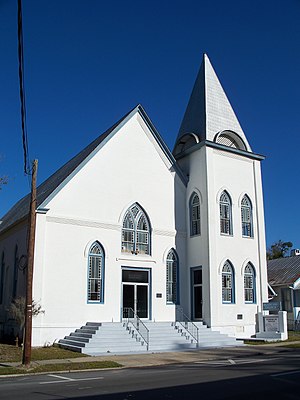
The Mount Zion A.M.E. Church is a historic church in Ocala, Florida, United States. It is located at 623 South Magnolia Avenue. The only surviving brick 19th-century religious structure in Ocala, the present Gothic Revival church stands behind the site of the original white frame building.

Marion Hotel (Ocala, Florida)
United States historic place
Distance: Approx. 6649 meters
Latitude and longitude: 29.18777778,-82.13722222
The Marion Hotel is a historic hotel in Ocala, Florida, United States. It is located at 108 North Magnolia Avenue. On October 16, 1980, it was added to the U.S. National Register of Historic Places.

West Port High School
Public secondary school in Ocala, Florida
Distance: Approx. 5383 meters
Latitude and longitude: 29.15388889,-82.24916667
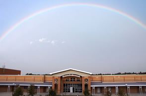
West Port High School is an American high school in Ocala, Florida and one of eight public high schools in Marion County. Founded in 2000 and built at 3733 SW 80th Avenue, it is the district high school for West Ocala. The campus formerly housed both West Port Middle and High Schools.

AdventHealth Ocala
Hospital in Florida, United States
Distance: Approx. 6054 meters
Latitude and longitude: 29.17527778,-82.13638889
AdventHealth Ocala is an acute care non-profit hospital in Ocala, Florida, United States. The healthcare facility is owned by the Marion County Hospital District, and has been leased to AdventHealth since 2018. The hospital district is largely funded by the US$213 million paid to the district by Community Health Systems in 2014 for the right to operate this facility.
Trinity Catholic High School (Florida)
Roman Catholic college preparatory day school in Ocala, Florida, United States
Distance: Approx. 2718 meters
Latitude and longitude: 29.14527778,-82.16777778
Trinity Catholic High School is a Roman Catholic college preparatory day school in Ocala, Florida. Located in the Diocese of Orlando, Trinity Catholic is the first and only Catholic high school in Ocala. Trinity Catholic High School was founded in 2000 by the Diocese of Orlando.
WITG-LP
Radio station in Ocala, Florida
Distance: Approx. 6649 meters
Latitude and longitude: 29.18777778,-82.13722222
WITG-LP (104.7 FM, "Classic Hits 104.7") is a radio station broadcasting a classic hits music format. Licensed to Ocala, Florida, United States, the station is currently owned by WITG Radio Station, Inc.

Paddock Mall
Shopping mall in Florida, United States
Distance: Approx. 2070 meters
Latitude and longitude: 29.158824,-82.17318
Paddock Mall is an enclosed shopping mall in Ocala, Florida. Opened in 1980, the anchor stores are JCPenney, Macy's, and Belk. There is 1 vacant anchor store, formerly occupied by Sears.
Howard Academy
Distance: Approx. 6115 meters
Latitude and longitude: 29.18916667,-82.14527778
Howard Academy, at 306 NW 7th Avenue in Ocala, Florida, was a school for African-American children opened in 1866 or 1867: 40 by the Freedmen's Bureau. Up until that time there had been no public and almost no private education for African Americans in Florida; education for slaves was prohibited by law (see Anti-literacy laws in the United States) and free blacks were made to feel unwelcome and encouraged to leave the state.

Howard High School (Florida)
Distance: Approx. 6341 meters
Latitude and longitude: 29.1983,-82.1525
Howard High School was a segregated black school in Ocala, Florida. It closed in 1969, after the public schools were integrated in 1968. It is now a middle school.
Weather in this IP's area
overcast clouds
18 Celsius
18 Celsius
17 Celsius
18 Celsius
1020 hPa
86 %
1020 hPa
1017 hPa
10000 meters
3.6 m/s
60 degree
100 %