67.23.57.207 - IP Lookup: Free IP Address Lookup, Postal Code Lookup, IP Location Lookup, IP ASN, Public IP
Country:
Region:
City:
Location:
Time Zone:
Postal Code:
IP information under different IP Channel
ip-api
Country
Region
City
ASN
Time Zone
ISP
Blacklist
Proxy
Latitude
Longitude
Postal
Route
Luminati
Country
ASN
Time Zone
America/Chicago
ISP
TELX-LEGACY
Latitude
Longitude
Postal
IPinfo
Country
Region
City
ASN
Time Zone
ISP
Blacklist
Proxy
Latitude
Longitude
Postal
Route
IP2Location
67.23.57.207Country
Region
california
City
san francisco
Time Zone
America/Los_Angeles
ISP
Language
User-Agent
Latitude
Longitude
Postal
db-ip
Country
Region
City
ASN
Time Zone
ISP
Blacklist
Proxy
Latitude
Longitude
Postal
Route
ipdata
Country
Region
City
ASN
Time Zone
ISP
Blacklist
Proxy
Latitude
Longitude
Postal
Route
Popular places and events near this IP address

Bayview–Hunters Point, San Francisco
Neighborhood in San Francisco, California
Distance: Approx. 762 meters
Latitude and longitude: 37.72687,-122.38873
Bayview–Hunters Point (sometimes spelled Bay View or Bayview) is the San Francisco, California, neighborhood combining the Bayview and Hunters Point neighborhoods in the southeastern corner of the city. The decommissioned Hunters Point Naval Shipyard is located within its boundaries and Candlestick Park, which was demolished in 2015, was on the southern edge. Due to the southeastern location, the two neighborhoods are often merged.

Hunters View
Housing project in San Francisco, California, US
Distance: Approx. 882 meters
Latitude and longitude: 37.73577778,-122.38066667
Hunters View is a housing project in the Hunters Point neighborhood in San Francisco.
Hudson/Innes station
Distance: Approx. 719 meters
Latitude and longitude: 37.739962,-122.388921
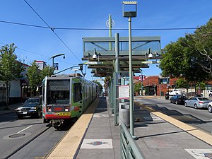
Hudson/Innes station is a light rail station on the Muni Metro T Third Street line in the Bayview neighborhood of San Francisco, California. The station opened with the T Third Street line on January 13, 2007. It has a single island platform located in the median of Third Street between Hudson Avenue and Innes Avenue, with access from crosswalks at both streets.
Kirkwood/La Salle station
Distance: Approx. 443 meters
Latitude and longitude: 37.737559,-122.389766
Kirkwood/La Salle station is a light rail station on the Muni Metro T Third Street line in the Bayview neighborhood of San Francisco, California. The station opened with the T Third Street line on January 13, 2007. It has a single island platform located in the median of Third Street between Kirkwood Avenue and La Salle Avenue, with access from crosswalks at both streets.
Oakdale/Palou station
Distance: Approx. 94 meters
Latitude and longitude: 37.73431389,-122.39086111
Oakdale/Palou station (also signed as Opera House) is a light rail station on the Muni Metro T Third Street line in the Bayview neighborhood of San Francisco, California. The station opened with the T Third Street line on January 13, 2007. It has a single island platform located in the median of Third Street between Oakdale Avenue and Palou Avenue, with access from crosswalks at both streets.
Revere/Shafter station
Distance: Approx. 179 meters
Latitude and longitude: 37.73229444,-122.39149444
Revere/Shafter station is a light rail station on the Muni Metro T Third Street line in the Bayview neighborhood of San Francisco, California. The station opened with the T Third Street line on January 13, 2007. It has a single island platform located in the median of Third Street between Revere Avenue and Shafter Avenue, with access from crosswalks at both streets.
Williams station (Muni Metro)
Distance: Approx. 524 meters
Latitude and longitude: 37.72925,-122.39257
Williams station is a light rail station of the San Francisco Municipal Railway's Muni Metro system located in the median of Third Street at Williams and Van Dyke Avenues in Bayview, San Francisco, California, United States. The station opened along with the T Third Street line on January 13, 2007. It has two side platforms; the northbound platform is north of Williams Avenue, and the southbound platform south of Williams Avenue, so that trains can pass through the intersection before the station stop.
Bayview Opera House
United States historic place
Distance: Approx. 173 meters
Latitude and longitude: 37.73515,-122.39013056
The Bayview Opera House, formerly known as the South San Francisco Opera House, is a theatre at 4705 3rd Street in the Bayview-Hunters Point district in San Francisco, California, United States. Founded in 1888, it is reputed to be the oldest existing theatre in the city. From 2014 to 2016, the theatre underwent renovation.
Silver Terrace, San Francisco
Neighborhood of San Francisco
Distance: Approx. 732 meters
Latitude and longitude: 37.7332,-122.3986
Silver Terrace is a neighborhood in the south eastern corner of San Francisco, between Bayview–Hunters Point and Portola neighborhoods. It is roughly bordered by Third Street to the east, Palou Avenue and Silver Avenue to the north, Williams Avenue to the south and Bayshore Boulevard and U.S. Route 101 to the west. A tunnel used by Caltrain runs under Silver Terrace.

Sylvester House
Historic house in San Francisco
Distance: Approx. 253 meters
Latitude and longitude: 37.731523,-122.389136
Sylvester House is a historic house, begun in 1865 and completed c. 1870 in the Bayview–Hunters Point neighborhood of San Francisco, California. The Sylvester House has been listed as a San Francisco Designated Landmark since April 5, 1974.

Quinn House, San Francisco
Historic house in San Francisco
Distance: Approx. 306 meters
Latitude and longitude: 37.735949,-122.388496
The Quinn House is a historic house built c. 1870 and located in the Bayview–Hunters Point neighborhood of San Francisco, California. The Quinn House has been listed as a San Francisco Designated Landmark since July 6, 1974.

Sam Jordan's Bar
Historic building in San Francisco, California
Distance: Approx. 842 meters
Latitude and longitude: 37.741077,-122.38886
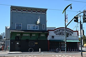
Sam Jordan's Bar is a historic building and a former working-class neighborhood bar (open from 1959 to 2019) located at 4004–4006 3rd Street in the Bayview neighborhood of San Francisco, California, U.S.. It is a San Francisco Designated Landmark (number 263) since February 6, 2013. It also went by the name Sam Jordan's Bar and Grill.
Weather in this IP's area
few clouds
8 Celsius
6 Celsius
7 Celsius
9 Celsius
1023 hPa
87 %
1023 hPa
1018 hPa
10000 meters
2.57 m/s
320 degree
20 %


