Country:
 USA
USARegion:
City:
Latitude and Longitude:
Time Zone:
Postal Code:
IP information under different IP Channel
ip-api
Country
Region
City
ASN
Time Zone
ISP
Blacklist
Proxy
Latitude
Longitude
Postal
Route
IPinfo
Country
Region
City
ASN
Time Zone
ISP
Blacklist
Proxy
Latitude
Longitude
Postal
Route
MaxMind
Country
Region
City
ASN
Time Zone
ISP
Blacklist
Proxy
Latitude
Longitude
Postal
Route
Luminati
Country
USASN
Time Zone
America/Chicago
ISP
SYNOPTEK
Latitude
Longitude
Postal
db-ip
Country
Region
City
ASN
Time Zone
ISP
Blacklist
Proxy
Latitude
Longitude
Postal
Route
ipdata
Country
Region
City
ASN
Time Zone
ISP
Blacklist
Proxy
Latitude
Longitude
Postal
Route
Popular places and events near this IP address
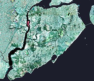
Prall's Island
Island in the Arthur Kill in New York and New Jersey
Distance: Approx. 1823 meters
Latitude and longitude: 40.60888889,-74.20166667
Prall's Island is an uninhabited island in the Arthur Kill between Staten Island, New York, and Linden, New Jersey, in the United States. The 89-acre (0.36 km2) island is one of the minor islands that are part of the borough of Staten Island in New York City. The island is named for a descendant or descendants of early Staten Island settler Arendt Jansen Prall Van Naarden (c.

North Shore, Staten Island
Area in New York City
Distance: Approx. 1840 meters
Latitude and longitude: 40.631,-74.17
The term North Shore is frequently applied to a series of neighborhoods within the New York City borough of Staten Island.
West Shore, Staten Island
Region in the New York City borough of Staten Island
Distance: Approx. 1124 meters
Latitude and longitude: 40.60835,-74.18535
West Shore refers to the section of the New York City borough of Staten Island that borders the Arthur Kill, between the Staten Island Expressway and the Fresh Kills. The Arthur Kill shoreline north of the expressway—most commonly called Port Ivory—is considered part of the North Shore, while the land along the Arthur Kill south of Fresh Kills is generally included within the South Shore. While only one residential neighborhood—Travis—can actually be found on the West Shore, other place names are used to identify locations to the north of Travis, chief among them Bloomfield and Chelsea.
Bloomfield, Staten Island
Neighborhood of Staten Island, New York
Distance: Approx. 804 meters
Latitude and longitude: 40.6125,-74.17861111
Bloomfield is the name of a neighborhood on the West Shore of the New York City borough of Staten Island. It lies immediately to the north of Travis-Chelsea and to the west of Bulls Head. Prall's Island is situated in the Arthur Kill off its coast.
Moore Catholic High School
Catholic school in Staten Island, New York, United States
Distance: Approx. 1921 meters
Latitude and longitude: 40.60972222,-74.16444444
Moore Catholic High School is an American private, Catholic school in the Bulls Head neighborhood of Staten Island, New York. It was founded by the Presentation Sisters of Staten Island in September 1962 and named for Mary Young Moore, a beneficiary to the Roman Catholic Archdiocese of New York, and was the first archdiocesan high school for girls on Staten Island. Moore became co-educational in September 1969, and the name was formally changed from Countess Moore High School to Moore Catholic High School in October 1978.

Arlington Yard
Freight rail yard on Staten Island, New York City
Distance: Approx. 1846 meters
Latitude and longitude: 40.6333,-74.1745
Arlington Yard is a freight yard located on the North Shore Branch right of way of the Staten Island Railway in Staten Island, New York, United States. It lies west of the former Arlington station, east of Western Avenue, and north of the Staten Island Expressway in the Port Ivory neighborhood. The yard leads into the Travis Branch of the railway, the Howland Hook Container Terminal, and the Arthur Kill Lift Bridge to Elizabeth, New Jersey and the Chemical Coast and is part of the ExpressRail network.
Chelsea, Staten Island
Distance: Approx. 2002 meters
Latitude and longitude: 40.60166667,-74.19277778
Chelsea is a small neighborhood located on the West Shore of Staten Island in New York City. It is bordered on the north by South Avenue, on the east by the William T. Davis Wildlife Refuge, on the south by Meredith Avenue, and on the west by the Arthur Kill. The area was originally named Pralltown after a family that was granted land there in 1675.

Church of Our Lady of Pity (Staten Island)
Distance: Approx. 2178 meters
Latitude and longitude: 40.60897222,-74.16151389
The Church of Our Lady of Pity is a Roman Catholic parish church under the authority of the Roman Catholic Archdiocese of New York, located in Staten Island, New York City. The church is located at 1616 Richmond Avenue, just south of the Staten Island Expressway.

Old Place, Staten Island
Distance: Approx. 1340 meters
Latitude and longitude: 40.627,-74.173
Old Place is a neighborhood located in the northwestern section of Staten Island. The neighborhood is located south of Arlington, and west of Mariners Harbor. It is part of Community Board 1.
Teleport (Staten Island)
Business park in New York City
Distance: Approx. 1524 meters
Latitude and longitude: 40.60583333,-74.17694444
The Teleport is a suburban-style 100-acre business park east of New York State Route 440 and west of the Bulls Head neighborhood of Staten Island in New York City. It includes five Class A office and specialized buildings totaling 700,000 square feet, as well as additional development-ready sites. The Teleport was developed in the mid-1980s by the government of New York City and the Port Authority of New York and New Jersey (PANYNJ), which manages it under contract to the city, focusing on new technologies and offering high-speed voice, data and video services via satellite and fiber optic connectivity.

Piles Creek
Stream in Union County, New Jersey
Distance: Approx. 1986 meters
Latitude and longitude: 40.6217,-74.2072
Piles Creek is a stream in Union County, New Jersey. It empties in the Arthur Kill tidal strait in Linden on the Chemical Coast between the mouth of Morses Creek and the mouth of the Rahway River just below the Linden Generating Station, a power plant. It is one of several tributaries of the Arthur Kill along with other rivers and streams including the Elizabeth River, Rahway River, Morses Creek, Fresh Kills, and, via Newark Bay, the Passaic River and the Hackensack River.

1973 Staten Island gas explosion
Gas explosion in New York City
Distance: Approx. 529 meters
Latitude and longitude: 40.62,-74.19
On February 10, 1973, a gas explosion occurred inside a Texas Eastern Transmission Pipeline tank storing liquefied natural gas in the Bloomfield neighborhood of Staten Island, New York City, while 42 workers were cleaning the tank. The tank had supposedly been completely drained ten months earlier, but ignition occurred, causing a plume of combusting gas to rise. Two workers near the top felt the heat and rushed to the safety of scaffolding outside, while the other 40 workers died as the concrete cap on the tank rose 20 to 30 feet (6.1 to 9.1 m) in the air and then came crashing back down, crushing them.
Weather in this IP's area
few clouds
18 Celsius
18 Celsius
15 Celsius
20 Celsius
1020 hPa
60 %
1020 hPa
1020 hPa
10000 meters
3.6 m/s
20 degree
20 %
06:57:36
18:32:08