67.218.90.165 - IP Lookup: Free IP Address Lookup, Postal Code Lookup, IP Location Lookup, IP ASN, Public IP
Country:
Region:
City:
Location:
Time Zone:
Postal Code:
ISP:
ASN:
language:
User-Agent:
Proxy IP:
Blacklist:
IP information under different IP Channel
ip-api
Country
Region
City
ASN
Time Zone
ISP
Blacklist
Proxy
Latitude
Longitude
Postal
Route
db-ip
Country
Region
City
ASN
Time Zone
ISP
Blacklist
Proxy
Latitude
Longitude
Postal
Route
IPinfo
Country
Region
City
ASN
Time Zone
ISP
Blacklist
Proxy
Latitude
Longitude
Postal
Route
IP2Location
67.218.90.165Country
Region
connecticut
City
monroe
Time Zone
America/New_York
ISP
Language
User-Agent
Latitude
Longitude
Postal
ipdata
Country
Region
City
ASN
Time Zone
ISP
Blacklist
Proxy
Latitude
Longitude
Postal
Route
Popular places and events near this IP address

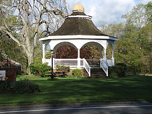
Monroe, Connecticut
Town in Connecticut, United States
Distance: Approx. 893 meters
Latitude and longitude: 41.33611111,-73.22583333
Monroe is a town located in eastern Fairfield County, Connecticut, United States. The population was 18,825 at the 2020 census. The town is part of the Greater Bridgeport Planning Region.
Masuk High School
School in Monroe, Fairfield County, Connecticut, United States
Distance: Approx. 3470 meters
Latitude and longitude: 41.34861111,-73.19416667
Masuk High School is a public high school in Monroe, Connecticut, United States, and includes grades 9 through 12. It is located on Connecticut Route 111 (Monroe Turnpike) in Monroe, between Old Coach Road and Pond View Road. The school has a 25-yard indoor swimming pool and various successful clubs & sports.
Botsford, Connecticut
Village in Newtown, Connecticut, United States
Distance: Approx. 3406 meters
Latitude and longitude: 41.36638889,-73.25694444
Botsford is a village of Newtown in Fairfield County, Connecticut, United States. The town of Newtown has one political body, but consists of multiple geographic subdivisions. It currently contains a fire department and post office.
Great Hollow Lake
Artificial lake in Connecticut, United States
Distance: Approx. 3463 meters
Latitude and longitude: 41.3111,-73.2463
Great Hollow Lake is approximately 16 acres (65,000 m2) in size and is a part of William E. Wolfe Park, located in Monroe, Connecticut. The lake includes a trout park with approximately 700 feet (210 m) of beach and facilities. Fishing, swimming and non-motorized boating are all permitted.

Stepney Cemetery
Historic cemetery in Monroe, Connecticut
Distance: Approx. 3155 meters
Latitude and longitude: 41.3224,-73.263
Stepney Cemetery is an old cemetery in Monroe, Connecticut, United States, located in the village of Stepney. It was established next to the Stepney Green in 1794. Many of the area's earliest settlers are buried in the cemetery; the oldest headstone belongs to Nathaniel W. Knapp (died 1787).
WMNR
Radio station in Connecticut, United States
Distance: Approx. 2930 meters
Latitude and longitude: 41.31888889,-73.25361111
WMNR (88.1 FM, "Fine Arts Radio") is a radio station licensed to Monroe, Connecticut. The station is municipally owned by the Town of Monroe and broadcasts mainly classical music.

Thomas Hawley House
Historic house in Connecticut, United States
Distance: Approx. 4224 meters
Latitude and longitude: 41.30555556,-73.25277778
The Thomas Hawley House at 514 Purdy Hill Road in Monroe, Connecticut, is a historic Colonial American wooden post-and-beam saltbox farm house built in 1730. Hawley was the great grandson of Joseph Hawley (Captain) of Stratford, Connecticut, through Samuel. A drawing and description of the house was included in J. Frederick Kelly's book, The Early Domestic Architecture of Connecticut first published in 1924.

Daniel Basset House
Historic house in Connecticut, United States
Distance: Approx. 3183 meters
Latitude and longitude: 41.34944444,-73.19805556
The Daniel Basset House is a historic house at 1024 Monroe Turnpike in Monroe, Connecticut, built in 1775. It is significant for its association with events in the American Revolutionary War. It is documented to have hosted a ball for French officers of Lauzun's Legion on June 30, 1781; the legion had been encamped near the village center of Monroe.
Nathan B. Lattin Farm
Historic house in Connecticut, United States
Distance: Approx. 3789 meters
Latitude and longitude: 41.36972222,-73.21027778
The Nathan B. Lattin Farm is a historic farm at 22 Walker Hill Road in Newtown, Connecticut. Founded by early colonial settlers to the area in the 18th century, it remains an example of a rural farm property in an increasingly suburbanized area. It was listed on the National Register of Historic Places in 1990.

Monroe Center Historic District
Historic district in Connecticut
Distance: Approx. 2457 meters
Latitude and longitude: 41.3325,-73.20722222
The Monroe Center Historic District is a 120-acre (49 ha) historic district in Monroe, Connecticut with significance dating to 1762. It was listed on the National Register of Historic Places in 1977. It includes about 60 significant buildings, including Federal style St.
Stepney, Connecticut
Census-designated place in Connecticut, United States
Distance: Approx. 4415 meters
Latitude and longitude: 41.30416667,-73.25430556
Stepney, also referred to as Stepney Village and Upper Stepney, is a district of the town of Monroe, Connecticut, United States and is on the Connecticut State Register of Historic Places. Consisting of approximately 8 square miles (21 km2), Stepney extends from the Trumbull town line, along Route 25, to the Newtown town line. It was listed as a census-designated place prior to the 2020 census.
East Village, Connecticut
Census-designated place in Connecticut, United States
Distance: Approx. 4436 meters
Latitude and longitude: 41.35833333,-73.18666667
East Village is a census-designated place (CDP) in the town of Monroe, Fairfield County, Connecticut, United States. It occupies the northeastern end of the town of Monroe, extending northeast to the Housatonic River (the town border with Oxford) and southwest to Walnut Street. It is bordered to the southeast by the city of Shelton and to the northwest by the town of Newtown.
Weather in this IP's area
light snow
-4 Celsius
-8 Celsius
-5 Celsius
-3 Celsius
1010 hPa
82 %
1010 hPa
996 hPa
4023 meters
2.06 m/s
250 degree
100 %

