Country:
Region:
City:
Latitude and Longitude:
Time Zone:
Postal Code:
IP information under different IP Channel
ip-api
Country
Region
City
ASN
Time Zone
ISP
Blacklist
Proxy
Latitude
Longitude
Postal
Route
Luminati
Country
Region
ab
City
leduc
ASN
Time Zone
America/Edmonton
ISP
ASN-WIBAND-1
Latitude
Longitude
Postal
IPinfo
Country
Region
City
ASN
Time Zone
ISP
Blacklist
Proxy
Latitude
Longitude
Postal
Route
db-ip
Country
Region
City
ASN
Time Zone
ISP
Blacklist
Proxy
Latitude
Longitude
Postal
Route
ipdata
Country
Region
City
ASN
Time Zone
ISP
Blacklist
Proxy
Latitude
Longitude
Postal
Route
Popular places and events near this IP address

Dominion City
Community in Manitoba, Canada
Distance: Approx. 6333 meters
Latitude and longitude: 49.14194444,-97.15555556
Dominion City is an unincorporated community in the Municipality of Emerson – Franklin, Manitoba Canada. It is located in southeastern part of the province, approximately 20 kilometres (12 miles) north of the Canada–United States border. Dominion City is served by Roseau Valley School.

Emerson (electoral district)
Defunct provincial electoral district in Manitoba, Canada
Distance: Approx. 4590 meters
Latitude and longitude: 49.097,-97.249
Emerson is a former provincial electoral division in the Canadian province of Manitoba. It was created by redistribution in 1879 and eliminated prior the 2019 general election. Most of its territory was redistributed to the newly created Borderland riding.
Roseau River Anishinabe First Nation
Indian reserve in Manitoba, Canada
Distance: Approx. 3741 meters
Latitude and longitude: 49.16777778,-97.26611111
Roseau River Anishinabe First Nation (Ojibwe: Okwewanashko-ziibiing, meaning: "Rag Weed River") is an Ojibway First Nation in southern Manitoba, Canada, situated around the Roseau River. Its main reserve is Roseau River No. 2 with a population of 564 as of the 2021 Canadian census while the First Nation has a total membership of approximately 2,000 people.

Roseau River (Manitoba–Minnesota)
River in Manitoba, Canada and Minnesota, United States
Distance: Approx. 1101 meters
Latitude and longitude: 49.14388889,-97.25444444
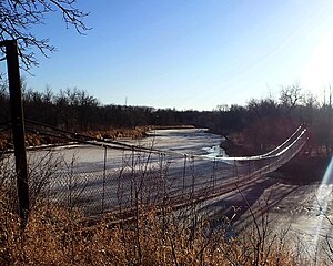
The Roseau River is a 214-mile-long (344 km) tributary of the Red River of the North, in southern Manitoba in Canada and northwestern Minnesota in the United States. Via the Red River, Lake Winnipeg and the Nelson River, it is part of the watershed of Hudson Bay. The name is from the French for reed, roseau, in turn from the Ojibwe Ga-shashagunushkokawi-sibi, "place-of-rushes river." The river flows through the Roseau River Anishinabe First Nation.

Rural Municipality of Montcalm
Rural municipality in Manitoba, Canada
Distance: Approx. 7439 meters
Latitude and longitude: 49.1775,-97.32472222
The Rural Municipality of Montcalm (French: Municipalité rurale de Montcalm) is a rural municipality (RM) in the Pembina Valley Region of Manitoba in Western Canada. As of 2021, Montcalm has a population of 1,278 people. Three Francophone towns are located in Montcalm: St.
All Saints Anglican Church (Dominion City, Manitoba)
Distance: Approx. 5864 meters
Latitude and longitude: 49.1419,-97.162
The former All Saints Anglican Church is an historic Carpenter Gothic style Anglican church building located at 48 Centennial Drive, Dominion City, in the Rural Municipality of Franklin in Manitoba, Canada. Built in 1879 as an Episcopal Methodist church with a steep pitched roof and lancet windows, it is a modest example of Carpenter Gothic church style. In 1908, it was bought by the Anglican Parish of Dominion City which moved it to its present location and expanded to include the more elaborate details typical of Carpenter Gothic style Anglican churches.
Letellier, Manitoba
Distance: Approx. 4608 meters
Latitude and longitude: 49.13694444,-97.30555556
Letellier is a small Francophone community in the Rural Municipality of Montcalm, Manitoba, Canada. It is located at the junction of Highway 75 and Provincial Road 201, approximately 15 kilometres north of the Pembina–Emerson Border Crossing.

Municipality of Emerson-Franklin
Rural municipality in Manitoba, Canada
Distance: Approx. 6591 meters
Latitude and longitude: 49.142,-97.152
The Municipality of Emerson – Franklin is a rural municipality (RM) in the Canadian province of Manitoba.
Weather in this IP's area
overcast clouds
12 Celsius
11 Celsius
12 Celsius
12 Celsius
1009 hPa
64 %
1009 hPa
981 hPa
10000 meters
5.05 m/s
9.99 m/s
182 degree
100 %
07:30:19
16:55:28