67.214.82.16 - IP Lookup: Free IP Address Lookup, Postal Code Lookup, IP Location Lookup, IP ASN, Public IP
Country:
Region:
City:
Location:
Time Zone:
Postal Code:
IP information under different IP Channel
ip-api
Country
Region
City
ASN
Time Zone
ISP
Blacklist
Proxy
Latitude
Longitude
Postal
Route
Luminati
Country
Region
tx
City
dallas
ASN
Time Zone
America/Chicago
ISP
US-TELEPACIFIC
Latitude
Longitude
Postal
IPinfo
Country
Region
City
ASN
Time Zone
ISP
Blacklist
Proxy
Latitude
Longitude
Postal
Route
IP2Location
67.214.82.16Country
Region
texas
City
dallas
Time Zone
America/Chicago
ISP
Language
User-Agent
Latitude
Longitude
Postal
db-ip
Country
Region
City
ASN
Time Zone
ISP
Blacklist
Proxy
Latitude
Longitude
Postal
Route
ipdata
Country
Region
City
ASN
Time Zone
ISP
Blacklist
Proxy
Latitude
Longitude
Postal
Route
Popular places and events near this IP address

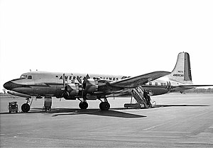
American Airlines Flight 157
1949 aviation accident
Distance: Approx. 2732 meters
Latitude and longitude: 32.84805556,-96.85111111
American Airlines Flight 157, a Douglas DC-6, departed on November 29, 1949, from New York City bound for Mexico City with 46 passengers and crew. After one engine failed in mid-flight, a series of critical mistakes by the flight crew caused the pilot to lose control of the plane during the final approach to a routine stopover at Love Field in Dallas, Texas. The airliner slid off the runway and struck a parked airplane, a hangar, and a flight school before crashing into a business across from the airport.
Bachman Lake
Artificial lake in Northwest Dallas, Texas
Distance: Approx. 1608 meters
Latitude and longitude: 32.84888889,-96.87111111
Bachman Lake is a small freshwater lake located in the Bachman Lake community of northwest Dallas, Texas (USA). It covers 205 acres (0.83 km2) and lies on the northwest boundary of Dallas Love Field in the airport's landing path and the western boundary of the upscale Bluffview neighborhood. At the Western end of the lake, DART provides transit service at Bachman Station, including light rail service via the Green Line and Orange Line.

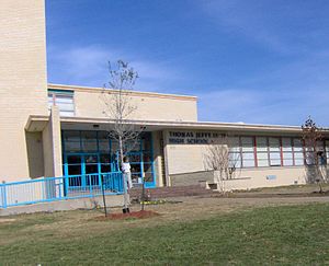
Thomas Jefferson High School (Dallas)
Public high school in Dallas, Texas, United States
Distance: Approx. 3331 meters
Latitude and longitude: 32.8806,-96.8453
Thomas Jefferson High School, also known as TJ High School, is a public high school in Northwest Dallas, Texas (USA) that serves grades 9-12. The school is part of the Dallas Independent School District (DISD) and is classified as a 5A school by the UIL. The school is named after the third President of the United States, Thomas Jefferson. It is adjacent to Walnut Hill International Leadership Academy, a Pre-K-8 DISD school.

American Airlines Flight 910
1952 mid-air collision
Distance: Approx. 2732 meters
Latitude and longitude: 32.84805556,-96.85111111
American Airlines Flight 910, a four-engine Douglas DC-6 propliner, collided in mid-air with a single engine Temco Swift on final approach to Dallas Love Field on June 28, 1952, over Dallas, Texas. The DC-6 was carrying 55 passengers and 5 crew members from San Francisco, California. The DC-6 landed with no injuries to any of its 60 occupants, while both occupants of the two-person Swift died when their aircraft impacted the ground.
Zero Gravity Amusement Park
Former amusement park in Dallas, Texas
Distance: Approx. 3496 meters
Latitude and longitude: 32.885,-96.901
Zero Gravity Thrill Amusement Park was an amusement park in Dallas, Texas, with rides themed around freefall and simulated flying. Owned by Amusement Management International, Zero Gravity was in operation from 1992 until 2021.
Bachman station
DART light rail station in Dallas, Texas
Distance: Approx. 1050 meters
Latitude and longitude: 32.854044,-96.877338
Bachman station is a Dallas Area Rapid Transit station in Dallas, Texas. It serves DART's Green Line and Orange Line. The station opened as part of the Green Line's expansion in December 2010.
Walnut Hill/Denton station
DART light rail station in Dallas, Texas
Distance: Approx. 2235 meters
Latitude and longitude: 32.881504,-96.883752
Walnut Hill/Denton station is a DART station in Dallas, Texas. It is located in Northwest Dallas and serves DART's Green Line. The station opened as part of the Green Line's expansion in December 2010.

Burbank station (DART)
DART light rail station in Dallas, Texas
Distance: Approx. 2549 meters
Latitude and longitude: 32.842689,-96.861854
Burbank station is a DART light rail station located near Dallas Love Field airport for service on the Green Line and Orange Line. The station opened as part of the Green Line's expansion in December 2010, and serves the headquarters for Southwest Airlines and an adjacent residential neighborhood. This station was originally proposed to serve the airport terminal directly with an underground station (much like Cityplace/Uptown station), but a 2004 study showed that costs would be well beyond acceptable levels and jeopardize a federal grant.
Parker University
College
Distance: Approx. 2557 meters
Latitude and longitude: 32.879639,-96.893174
Parker University is a private university focused on healthcare and located in Dallas, Texas. The university operates a second chiropractic clinic in Irving, Texas, the site of its first campus. It is accredited by the Southern Association of Colleges and Schools, the Council on Chiropractic Education, and the Commission of Massage Therapy Accreditation.

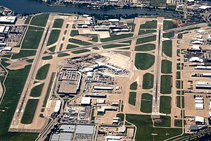
Dallas Love Field
Municipal airport in Dallas, Texas, United States
Distance: Approx. 2750 meters
Latitude and longitude: 32.84722222,-96.85166667
Dallas Love Field (IATA: DAL, ICAO: KDAL, FAA LID: DAL) is a city-owned public airport in the neighborhood of Love Field, 6 miles (9.7 km; 5.2 nmi) northwest of downtown Dallas, Texas. It was Dallas' main airport until 1974 when Dallas Fort Worth International Airport (DFW) opened. Love Field covers an area of 1,300 acres (530 ha) at an elevation of 487 feet (148 m) above mean sea level and has two runways.

Gas Monkey Bar N' Grill
American restaurant and live music bar in Dallas, Texas
Distance: Approx. 2064 meters
Latitude and longitude: 32.8608,-96.8961
Gas Monkey Bar N' Grill was an American restaurant and live music bar in Dallas, Texas started by entrepreneur Richard Rawlings, who is also the star of Discovery Channel reality television show Fast N' Loud.

Gas Monkey Live
Music venue in Dallas, Texas, 2014–2020
Distance: Approx. 1867 meters
Latitude and longitude: 32.8577,-96.8931
Gas Monkey Live was an American music venue in Dallas, Texas, owned by Richard Rawlings, star of American television program Fast N' Loud and owner of both Gas Monkey Garage and Gas Monkey Bar N' Grill.
Weather in this IP's area
light intensity drizzle
11 Celsius
11 Celsius
11 Celsius
12 Celsius
1017 hPa
95 %
1017 hPa
1001 hPa
6437 meters
3.09 m/s
330 degree
100 %


